• Happy Collect Rocks Day! 🪨🥌💎

Marshall Lake loop- NW Ontario (July 2024)

The tent has mesh to keep the bugs out but they were thick enough that I got a ton of bugs in when I was throwing in my gear and (especially) before I got zipped up when I got in. I burned the mosquito coil figuring that maybe it would kill everything but me(?).

Sorry, I haven't had much experience with mosquito / black fly abatement. Until this trip, I'd run into very few that would actually eat me.
 
I didn’t find mosquito coil to be overly effective but it helped and, after about an hour and a half of swatting anything that landed on me, I had the bugs tamed enough that I could sleep.

why do you burn mosquito coil in the tent?

I burned the mosquito coil figuring that maybe it would kill everything but me(?).

The mosquito is our unofficial national bird.

Very fitting, timely and relevant posts for World Mosquito Day!

Enjoyable writing and pix, Steve. I'm vicarious-ing.
 
Standard procedure up here to burn a bit of pic in the tent after you are in for the night. About five minutes worth will kill or disable the mosquitos that follow you in. If you are an old fella, or possess a two hour bladder, a handy bottle that can absolutely not be confused with a drinking bottle will keep you in the tent all night, avoiding any secondary incursions.
 
Some interesting comparisons;

Large flat rock campsite Gamma passed but I used in 2013, at daybreak I was awakened to something large walking in the river, I ran out in my skivvies and witnessed the biggest moose (# 7 on this trip) I have ever seen. He swam across the river and when he exited his butt had to be close to 3’ (91.44 centimeters). Later in the trip an outfitter visited my campsite, he asked if I saw any moose, I told him just a couple of cows, “dam wolves” he said.

2024
1724242426889.png
2013
DSC02129_Original.jpeg

Summit Lake, one end feeds the artic watershed, the other end heads towards the Great Lakes ,
Gammas vist,
IMG_4885.png
2015 with (l-r) Memaquay, Christine, Mr and Mrs Odyssey, Karin and myself,
DSC01075_Original.jpeg

Solo in 2013,
DSC02085_Original.jpeg

Gamma exiting Summit Lake,

IMG_4884.png
Boney for us.
DSC01092_Original.jpeg
Solo,
1724245615700.jpeg
Camping at the falls, 2015 with the crew,
DSC01113_Original.jpeg

2024 with Gamma,
IMG_4883.png
2013 Robin solo,
DSC02114_Original.jpeg
 
Last edited:
Great trip report. I enjoyed reading about this adventure and the details that you shared. Quick question....were there any small flying flesh eaters....😂
 
Day 4

The bugs weren’t any better in the morning than they were the night before as I made breakfast quickly and skipped coffee again to minimize blood loss.

I was back on the water shortly after 7am and the morning didn’t get much better.

In addition to making my own canoe, I’d made four wooden paddles of various blade shapes & wood species to try out on this trip.

IMG_20240622_132915099_HDR.jpg

I’d found that I preferred the beavertail blades over the others and, fortunately, I had two of them; one made from Sassafras and one from Catalpa. (the Catalpa is beside the plastic blade in the accompanying picture and the Sassafras is in the center)

I was worried that I’d cut the Sassafras a bit thin as it was super flexible but it was the lightest of the four so I was trying to use it sparingly in order to have it for the massive open water crossing of Ara lake at the end.

If it was going to break, I wanted to get as much use as possible at the most critical time.

My primary paddle, therefore was the Catalpa beavertail and I was really enjoying it. It moved more water than the Cherry ottertail and fit my hands better than the Aspen whitewater bladed paddle did.

DSCN2558.JPG

When I arrived at the second portage of the day, the maps had prepared me for a steep bank to exit the river and it wasn’t too bad throwing the packs up the hill at the portage landing.

There was also a large(ish) tree across the trail at the top of the hill... Nothing that would make it really difficult to get across but it was positioned in a way that it looked easier to pull the canoe up the bank and over the tree in one pull than to do each obstacle individually.

With the packs unloaded between the top of the bank & the tree, I grabbed the stern painter and, reminiscent of the steeper portages on the Steel River, I yanked the canoe out of the water and up the bank.

DSCN2559.JPG

As the canoe left the water, I realized the error of not removing everything from the canoe as the Catalpa beavertail slid the length of the boat, glanced off the bow float tank & landed in the water right at the head of the rapid.

I didn’t really even have time to get a picture before it was descending the rapid without me.

The portage ended in a terrible bughole of a backwater and I loaded as quickly as possible and escaped again to the sun and the open water.

I paddled upstream and fished the end of the rapid for awhile then went searching downstream to see if the Catalpa paddle had, somehow, beaten me through but I could find neither a fish nor my paddle that morning.

In the end, I had to conclude that I wasn’t a very good fisherman and that the paddle was, indeed, gone.

DSCN2560.JPG

From there it was another long, flat water paddle past some nice, mature Birch forest, more Trumpeter Swans and lots of wild rice & ducks.

DSCN2573.JPGDSCN2575.JPG

Around 10:30 I saw another sign of civilization in the form of a bridge. I thought about stopping and taking a break to walk around a bit (there was a nice landing and what appeared to be a boat ramp) but the map looked like there was another at the edge of Sedgman Lake Provincial Nature Reserve so I paddled on.

DSCN2583.JPG
DSCN2584.JPG

Like the trip my son & I took down the Conemaugh River at home, the debris piled high on the bridge piers told that the Spring snow melt was capable of much higher water levels than I was experiencing.

What I thought was really impressive in this place was that the surrounding area was much flatter than at home and the only explanation that I could come up with was that the roadbed itself acted as a dam to channel the flood water through the narrow bridge opening.

DSCN2586.JPG

For the record, there is only one bridge. It is where the Ogoki road crosses the Kap river and the road forms the Western boundary of the 58 square km (22 square mile) Sedgman Lake Provincial Nature Reserve.

This area is open to canoeing, wildlife viewing and sport fishing but hunting, trapping and harvesting wild rice is forbidden (except, perhaps, First Nations Tribes with treaty rights)

According to the management statement, camping within the reserve is discouraged and there are no established campsites within its boundaries.

My maps showed otherwise and there was a campsite listed near the Eastern edge of the reserve.

IMG_20240719_123024624.jpg

I arrived there around noon and it’s a really nice site. A gently sloping rock landing, a nice fire pit and several really nice tent pads had me, once more, wishing that I’d done this loop in August or early September.

As it was, there was some relief to be had from bugs on the sunny, breezy rock landing but anything back in the shade was teeming with tiny, thirsty and relentless flying vampires.

I made a quick lunch on the landing, filtered some water and checked the weather on the inReach. It said that rain was expected between 2 & 6 and I thought briefly about staying put but, with an open tarp unlikely to keep the bugs at bay, the idea of being cooped up in the tent all afternoon was enough to convince me to paddle on.

IMG_20240719_123019036_HDR.jpg
DSCN2604.JPGDSCN2606.JPGDSCN2607.JPG

The clouds started rolling in and the wind was picking up but it didn’t really seem to be overtly threatening rain as I paddled on looking for moose and other wildlife (shouldn’t they be concentrated in the preserve?... Maybe that's only during hunting season...)

DSCN2618.JPG
DSCN2621.JPG

The maps showed another campsite in the next open lake area and, although it would require a few km of paddling away from the route, I had all day (or at least as long as the rain held off) and I decided to check it out as well.

The esker upon which this site was located made a really nice windbreak when paddling to and from the site but, with lots of open water in front of the site, paddling around the point to access the beach landing might have been dicey with any more wind.

DSCN2638.JPG
The site itself was nice but there was a bit more garbage there than most of the other sites I’d visited. The landing was a huge, sandy beach, there was lots of room for tents and the breeze across the site provided a wonderful break from the bugs.

It’s obviously used more heavily than some of the others I’d visited but even this site didn’t look like it had seen any recent use.

DSCN2630.JPGDSCN2635.JPGDSCN2636.JPG
DSCN2639.JPG

By 3:30 the clouds were starting to thicken as I continued on down the Kap river and past the home of what I can only assume to be a very patriotic beaver. It still seemed like the storm might pass me to the North.

DSCN2649.JPG
DSCN2651.JPG

By 4:30 the thunder was starting to rumble pretty hard and I was pretty sure the storm was not going to miss me.

The maps seemed to show a campsite on the beach to my left and I paddled past looking carefully but didn’t see any evidence of it.

DSCN2654.JPG

The maps also showed another campsite at the far end of the lake.

I was just about resigned to the thought of sprinting the length of the 3 km (1.8 mi) lake trying to beat the rain when I thought I saw an unusual rock pile on a small island.

DSCN2657.JPG

I beached the boat to investigate, found a really nice campsite and had just enough time to get the tent set up when the storm broke in a pretty impressive downpour.

It rained hard for almost 2 hours while I secured boat and paddles, gathered firewood, filtered water, explored my island home and took some pictures (quite a few with raindrops on the lens).

It finally stopped around 7:30 and I made supper, enjoyed a cup of brandy by the fire and watched the sun set behind the camp. I tried to wait until the very end to get the rosy hues but, in the end, the bugs won and I watched the sun fade from within the tent.

DSCN2670.JPGIMG_20240719_195655443_HDR.jpgIMG_20240719_205234998_HDR.jpgIMG_20240807_200701050.jpg
 

Attachments

  • DSCN2586.JPG
    DSCN2586.JPG
    166.2 KB · Views: 2
Robin, Some of the differences are remarkable. I was prepared for the shrubbery around the trapper's cabin to be much higher but I'm very thankful that the water level was higher for me coming out of Summit Lake. The 2015 picture is beyond "boulder garden" but it looks like you made out a little better in 2013.

Sadly, still no bull moose for me (but I'm not done seeing cows).
 
Nice to see the old sites again! Interesting, I didn't realize hunting wasn't permitted in Sedgeman, me and about 10 000 moose hunters from Southern Ontario have somehow managed to violate that rule successfully since the Park's inception.

The Esker Hilton looked good compared to usual, someone must have cleaned it up. Here's what I found right on the beach the last time I was there:
nP0ZWdd.jpg

I think that patriotic beaver gets around, that flag was at the Hilton ten years ago.
B8Q6mVz.jpg

I have lots of good memories from the Esker Hilton. This is from 2010.


This one from 2004


Really enjoying the report, bringing back lots of memories!
 
OK, I just want to know who the clown was that packed the toilet into "the Hilton". (not gonna lie, part of me has nothing but respect for the fool) :) (PS: there was some other trash at that site but no sense risking losing a star over it by posting the pics.)

I can easily see that "the Hilton" would be a favorite for the school trips. Great site overall but tons of room!

I really liked that the beaver was so patriotic... seems, somehow, fitting... I'll have to try & remember a fresh flag if I do the loop again but I might need some time to forget some of the (especially upcoming) portages before I consider that. (avoiding the bugs is easier- just don't go in mid-July... I'm not kidding- just don't.)

Anyway... on with the story...


Day 5

I slept better that night than I had since I’d started and even slept in a little, re-inflating the air mattress again in the morning and remaining bug-free in the tent until the call of nature forced me into the open air where I became breakfast for the hungry hordes.

DSCN2714.JPG

Rather than spray myself with Deet, I packed quickly, once more skipped breakfast (at the rate I was eating, I had enough food to stay out a month or more) and escaped again to the sun and the open water.

DSCN2719.JPG

At that point, I was really glad that I hadn’t tried to outrun the rain the previous evening.

What I hadn’t noticed when I was considering it was that the map scale had changed and the area represented by each map was now 4-5 times larger than it had been all trip.

I would have had no chance at all of making it.

DSCN2747.JPG

About an hour of paddling brought me to the campsite and, as I looked around, I was glad that I’d stopped where I did.

This one was nice. It had some good tent pads, a nice firepit area and some good views from the landing but it was tucked back completely in the trees so the views weren’t as open from in camp.

As with most of the campsites, this one did not show signs of recent or heavy usage.

Unlike the others, this one had a bow hanging from a nail in one of the trees and I had to wonder how much time someone had spent carving it and how long it had hung there.

DSCN2738.JPGDSCN2739.JPGDSCN2740.JPGDSCN2746.JPG

The next 2 ½ hours was more flat water paddling as the river weaved its way past marshy areas and some sparsely forested ones. There weren’t very many great places to get out and I found it a little surprising that the campsites I’d found weren’t used more heavily.

To be fair, it did seem to be the height of bug season so maybe they saw more use in the late Summer and Fall but it seemed that there were literally miles of river that could be accessed from the Ogoki road bridge and all of it was deep enough to use an outboard if one didn’t want to paddle.

DSCN2763.JPGDSCN2769.JPG

One advantage of paddling, of course, was that I saw more wildlife as the next moose would not have been seen at all with any more noise than I was making. As it was, it exited the river quickly and I barely had enough time to get a picture.

Still no horns… I was starting to feel like I was hunting whitetails at home.

DSCN2761.JPG

Around One O’clock, I left the Kap river and paddled South through a slight narrows and into Stewart Lake. As I entered, I saw a red steel roof and a well-used, pretty battered canoe on my right.

I paddled closer to investigate and found a large wooden dock, several row boats up on the bank and a new looking cabin.

As the dock was mostly out of the water & all boats were well up on shore, it appeared that no one was around (or had been in awhile) and, needing to stretch my legs a little any way, I decided to, once more, be nebby and look around.

DSCN2780.JPGDSCN2784.JPGDSCN2785.JPGDSCN2795.JPG

As I approached the cabin, I noticed a “Private Property” sign but, instead of the usual “KEEP OUT” message, I was pleasantly surprised by the more congenial tone.

I’m not even sure the front door was capable of being locked (at least from the outside) but I tried it, it was unlocked and, although I did not go in, it certainly looked like it had all the comforts of home and was built for four season use.

DSCN2788.JPGDSCN2786.JPGDSCN2787.JPG

Soon after leaving the cabin site, I arrived at the next campsite shown on the maps. There are two shown at the Northern end of the lake and this was on the Western shore.

Like all the others, this one was extremely “buggy” in the wooded areas and I had to wonder what all those bugs eat when there are no unfortunate canoe trippers making questionable life choices.

There was a nice breeze across the rocky landing though so I started some water boiling to rehydrate lunch while I donated blood in order to photograph the site.

DSCN2803.JPG

There was a pretty good hike uphill from the landing to the campsite and the site itself was very nice. Someone had built firewood storage, there were several nice tent pads and the biggest White Birch I’d ever seen.

If I were to stay overnight, I’m not sure I’d choose to camp here instead of avail myself of the apparent hospitality of the cabin but I’ve certainly camped in worse conditions (just two days prior, in fact).

DSCN2799.JPGDSCN2800.JPGDSCN2801.JPG

With lunch over, I debated paddling over to the site on the Eastern shore but decided that would include backtracking into a headwind and donating more blood so I decided against it and continued on Southwest across the expanse of Stewart Lake.

Besides, I reasoned, the inReach showed that I’d left camp 5 hours ago and, based on the map (and depending upon the next portage), I might have another 4-5 hours to go before reaching the point campsite that I was aiming for on Stone Lake.

DSCN2808.JPG

I noticed that, away from the Kap river, the shorelines had begun to get more rocky and the large marshy areas were more rare. I enjoyed the change of scenery as well as the increased opportunities to go ashore and walk around to stretch my legs.

DSCN2811.JPGDSCN2818.JPG

The South end of Stewart narrowed a little and there were, again, large areas of wild rice. I saw some metal on the shoreline to my left but it didn’t appear to be much (maybe a hunting blind) and the shoreline was steep and overgrown so I didn’t bother to investigate.

A couple of kilometers later the waterway narrowed even more and I started upstream toward Stone Lake.

Once again, the flow was indiscernible, the river was shallow and I suspect the moose hunting might be good.

I passed an old hunting stand, scared a bunch of ducks and then came across a huge cow moose belly-deep in her lunch.

Unlike the morning moose, she posed long enough for a nice picture, then high-tailed it for the bush and, in doing so, provided a couple of nice action shots.

DSCN2833.JPGDSCN2835.JPG

I also saw another Dragonfly and I wondered why I wasn’t seeing more of them. With all the mosquitoes, it seemed that Dragonflies could feast to absolute gluttony… I had to wonder if most had done exactly that and were now to fat to fly… (alone in the woods for awhile, you start thinking about all kinds of weird stuff, I guess)

I was torn away from musing about the health and welfare of insects when, a little further upstream, I came across a newer hunting blind that was easily accessed from the water so I stopped to check it out and see what the field of fire looked like.

It felt great to be out of the hot sun even if it meant more blood loss and I was glad that I checked it out.

Honestly, even if the owner doesn’t get a moose from that stand, I’d think the view from the blind would make for a very pleasant day in the woods.

DSCN2839.JPGDSCN2840.JPGDSCN2841.JPGDSCN2844.JPG
 
(It seems that my picture-heavy reports finally ran afoul of the site's limits and I'm not allowed more than 30 pics in a post.

No worries: I'll just post twice today) :)

Day 5 (part 2)

Less than 10 minutes later, I arrived at the next portage.

I caught & released a huge Northern Pike below the riffles and unloaded on the rocky portage landing. (the fish was too much for one person to eat and I was already carrying enough food to feed an army).

DSCN2850.JPG

Although the portage trail was easy to follow and moose, obviously, use it, I was not a fan of this portage. Besides the omnipresent bugs, the trail was very swampy in places and the Alder growing low across the trail made it difficult to see where I was putting my feet.

Besides that, the day was very hot and I was sweating enough by the end that, if bugs detect prey via thermal signatures, I was shining like a beacon and probably drawing bugs all the way from Montreal.

I found a cached boat at the end of the portage so I dumped my gear upon it, sprayed myself liberally with Deet and sat in the shade for awhile before returning for the canoe.

DSCN2852.JPGDSCN2853.JPG

The rest of the way to Stone Lake was uneventful but pretty and it took me about 45 minutes to reach the headwaters of the river where I got my first look at just how big the lakes were becoming on this route.

DSCN2857.JPG

As I entered, I noticed a fishing outpost camp to my left with lots of overturned boats in the yard. I suspected that it was a bit further away than it looked and I was staring out at miles of open water so I didn’t bother to paddle over but, instead, took advantage of the fact that the lake was almost perfectly still.

DSCN2863.JPG
DSCN2871.JPG

It took about an hour to paddle the 4 km (2 ½ miles) to the campsite I was aiming for.

This one had a huge stone landing, lots of room in the woods for tents, a great view of the lake, a ton of eater-sized Northern Pike in the cove adjacent to the landing and, most surprisingly, the bugs weren’t bad at all.

DSCN2875.JPGIMG_20240720_182238397.jpg

I was still really worried about the long, open-water crossing awaiting me on Ara Lake so, after supper, I messaged Mem to see if he could give me a wind forecast and to ask what the South shore was like.

He’d previously told me (in no uncertain terms) that Ara was not to be taken lightly and that, if I reached it when the wind was down, I’d best get across it ASAP.

Looking at the maps, it seemed that the shortest crossing was straight across from the cove I would portage into.

I was thinking that, if the wind was up, I’d sneak along the Northern shore to the campsite across from the Ara-Meta channel and try again the next day but, if winds were favorable, I’d get across right away and stay on the Southern shore to the channel and worry about camping options later.

He promptly messaged back that I should have very favorable winds (5-10 km/hr) from the NW and that he’s crossed as I’d proposed before and the South shore was fine.

With what seemed to be a solid game plan in mind, I send out the “all OK” message and turned in for the night.

IMG_20240720_191810209_HDR.jpgIMG_20240720_190723596_HDR.jpgDSCN2862.JPG
IMG_20240807_200731369.jpg
 
Last edited:
I had to wonder what all those bugs eat when there are no unfortunate canoe trippers making questionable life choices.

I've wondered the same thing for decades. There just doesn't seem to be enough animal biomass around to feed blood to the gazillions of female mosquitoes and black flies.

Unlike the morning moose, she posed long enough for a nice picture, then high-tailed it for the bush and, in doing so, provided a couple of nice action shots.

The moose splashing picture is superb.

It seems that my picture-heavy reports finally ran afoul of the site's limits and I'm not allowed more than 30 pics in a post.

Yes, that's the current picture limit in a message (post). There is also a 15,000 character limit on text in a message.
 
Great instalment! A couple of points of interest - I think the cabin was recently sold, I knew the fella that owned it previously, they were pretty liberal with other people using it, I stayed there once in very bad weather. Looks like they have been doing quite a bit of improvements on it.

That site you checked out on Stewart is also known as a "bug hole", it is mostly used by moose hunters in October.

The moose blind you checked out is new as well, probably has something to do with the cabin.

On Stone, the point you stayed on was the pike point, the other point was the walleye point. I'll clutter your report now with a few pics.

Here is the result of an hour of fishing at the walleye side of the Stone Lake campsite, 2010.

That's actually me and my chum fishing from the walleye side on 2004
 
Great TR Gamma. Very descriptive with great photos. You either have a great memory or more likely kept a good journal.

Bugs in July are what turned me into more of a shoulder season guy.
 
There is also a 15,000 character limit on text in a message.
LOL I'm sure I've pushed that a few times also :LOL:

(spoiler: I'll, almost certainly, be posting twice again tonight)

I'll clutter your report now with a few pics.
Clutter away. I wish I'd known there were walleye that close on Stone but the info may be helpful for the next trip or for the next person through the loop.

Great TR Gamma. Very descriptive with great photos. You either have a great memory or more likely kept a good journal.

Thanks Al, I'm glad you're enjoying it. Taking all those pictures certainly helps (I downloaded about 1200 from the main camera when I got home) but, lately I've been using a voice recorder (I also have one on my phone) to take trip notes in the moment and to summarize periodically. Not only does it help with details but it's a great aid in remembering the mental state during certain parts of the trip.

I would not, however, be able to post actual transcripts of many of the portages for fear that I'd also short out the site's profanity filter.
 
Last edited:
I too am enjoying this trip report, great pictures but no selfies?
These two shots over 10 years apart, that same dead tree is in the river,

IMG_4938.png
DSC02240_Original.jpeg

In Memaquay’s picture below there’s a tree with clothes hanging in it. When I stayed there the tree was blown over, and I found a large egg shaped rock in the root ball. I pulled it out of the dirt and it had a black dot smack dead center of about 1”. I looked at it for a while, then placed the rock up in the bush on top of another rock. When I told Memaquay about that rock he said that there was probably a whole bunch of Indians looking back at me from within the rock. Gave me the Willie’s! I bet that rock is still there back in the bush.
IMG_4944.png

IMG_4939.png
1724455495304.jpeg

I concur, one cast from out front of the point on the right and I had my super, clear cool water walleye,

DSC02245_Original.jpeg
 
...one cast from out front of the point on the right and I had my super, clear cool water walleye
Ugh! (I settled for Pike)

Oh, and I rarely take selfies. I prefer to be behind the camera and it rarely occurs to me to turn it around.

Day 6

IMG_20240721_061305737_HDR.jpg

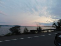
Sunrise from the point was spectacular and I lingered just a bit that morning to be certain that the fog wouldn’t build as it had last Fall on Lake Santoy. I enjoyed a leisurely breakfast (including coffee!) and started paddling around 8am.

DSCN2915.JPG

I paddled South along the shore and, as I neared the point where the shoreline turned West, I found 2 more cabins in fairly close proximity to one another. One seemed significantly newer than the other but both seemed to share the same landing.

DSCN2921.JPGDSCN2926.JPG

I didn’t stop to investigate either but, instead, turned South and made my first open water crossing of the day.

DSCN2929.JPG

In another questionable decision, I deliberately chose to hit the Southern shore to the West of where I thought the portage should be figuring that I wouldn’t have to paddle back & forth if I was sure I was due West of it. If I’d been thinking at all, I would have made certain that I hit the shore to the East of the portage so as to have the sun at my back.

Instead, I found myself paddling into the sun, looking for signs of the portage against the glare off the water.

The Southern shore was lined with a thick wild rice patch and I cruised along the edge looking for some sign of the portage. This one was well marked with both styles of portage signs.

DSCN2930.JPG
DSCN2933.JPG

The landing itself was a muddy mess and I went to some trouble to throw the stern painter across the mud and then, in a display of gymnastics that was nearly worthy of Olympic Pewter, I climbed through some of the brush surrounding the landing in order to avoid the mud.

(sadly, there is no photographic evidence of my agility during the mud pit avoidance exercise so you’ll have to take my word for it)

IMG_20240721_085103126_HDR.jpg

Once more, with hindsight being 20/20, I could have saved myself the effort and just waded in from the deep water edge of the wild rice.

I wasn’t 100 yards into the 1.6 km (1 mile) portage when I was, once again, knee deep in the swampy trail.

The rest of the portage didn’t get any better and it was simply a brutal, hot, bug-infested mess that made me, for the first time ever, happy to see a massive lake. There were two places where I had to clear (thankfully, small) blow downs and my trip notes indicate that, if I didn’t need the canoe to cross Ara, I was tempted to just leave it and hike back to the truck.

DSCN2538.JPG
DSCN2942.JPG

As it was, I think I dragged the canoe through more of the portage than I carried it, I wound up wading the landing at Ara anyway (but that helped wash off the mud) and I think I sprayed myself with more Deet than I ever had in my life.

On the plus side, there were blueberries everywhere and I even found Indian Pipes which, like Emily Dickenson, I think are one the coolest wildflowers ever.

DSCN2954.JPG
DSCN2946.JPG

Ara Lake, with over 12,012 acres (48.6 sq km or almost 19 sq mi) of water is a massive lake and the bay that I portaged into was nearly as large as Stewart Lake had been the day before.

Seemingly in testament to the size of this behemoth, I was greeted near the launch by a Pelican. I’m not sure how large the ocean needs to be to support Pelican life but, already intimidated by the fact that I could scarcely see that there were trees on the far side of the lake, its presence was not helping.

DSCN2982.JPG
DSCN2966.JPG

I paddled along the Western shore of the bay until I reached the main lake and, as per mem’s forecast, there was barely any wind. Initially, I set a course to go straight across but, as I paddled further from shore, I started to get more comfortable that Ara Lake wasn’t going to suddenly explode and swamp the canoe and I modified my course to pass the Eastern end of the point before me.

DSCN2984.JPG

It turned out to be a 2 km (1.25 mi) open water crossing and I then chose a point on the South shore that was about 1.5 km (1 mi) away and started toward it. I wasn’t terribly far into that paddle when I saw the first people I’d seen in a week: 2 boats full of fishermen working their way along the South shore in approximately the place that I was aiming for.

So as to not interfere with their fishing, because I was still enjoying my solitude and because the lake seemed content to remain like glass, I altered course to what would become the longest open water crossing of my life at 6km (3.75 miles).

The lake was actually calm enough that I could clearly see my wake for quite a ways behind me.

DSCN2997.JPG
(camera's got a great zoom BTW)

DSCN2995.JPG

I saw a fishing camp on the North shore but, checking it with the camera’s zoom lens, it didn’t appear that anyone was currently using it.

DSCN2999.JPG

A little over an hour later, I, again, reached land and spotted a nice little esker beach where I pulled the canoe ashore to stretch my legs and filter some more water.

I rested there for awhile as I watched the small fishing boats motor past, their smiling occupants seemingly oblivious to my presence.

IMG_20240721_141245213.jpg
DSCN3018.JPG

After about an hour of lounging on the beach, I paddled around the point and into the Ara-Meta channel where I found a much larger fishing camp and saw a couple of boats coming and going from it.

DSCN3021.JPG
DSCN3027.JPG

I was about ½ way through the channel between Ara and Meta lakes when I heard a fishing boat approaching from the rear. As it drew closer, it reduced power substantially and I thought “that’s nice of them to not toss me around in their wake” but didn’t turn to look.

Soon, as the boat drew nearer, the pilot shut off the engine and I heard a man’s voice say “So… do you know (Memaquay)?”

DSCN3042.JPG

The speaker was John Wiersema and he and his wife Cheryl were returning home from fishing on Ara. For them, it truly was returning home as they own Meta Lake Lodge and, therefore, live on Meta lake all summer.

They seemed genuinely thrilled that I’d started at Marshall and done the loop and we chatted awhile about various topics before Cheryl asked where I was staying that night.

I said the maps showed a site at the South end of the lake, she affirmed that it was a nice, grassy area and then John suggested I turn left at the end of the channel & stay at the outpost camp that they have there as it was currently empty.

He asked Cheryl if the door was open and, when the answer was negative, said that I was welcome to camp in the yard, there was good fishing off the dock, a picnic table, an outhouse and a firepit.

When I said that I wasn’t a fan of huge lakes and wanted to get somewhat close to the portage in case the weather was worse tomorrow, he said that I was welcome to camp out in the yard of their lodge also as it was mowed which helped to keep the bugs at a minimum.

I thanked them for all the info, told them I’d say “hi” to mem for them and they were on their way again.

DSCN3046.JPG
DSCN3047.JPG

I reached Meta lake around 4pm and turned left at the end of the channel as I figured that, especially with permission, I really should check out John & Cheryl’s outpost camp.

DSCN3050.JPG

About a half hour later, I tied up to the dock and looked around. It looked like an awesome little fishing camp with most of the comforts of home (plus a fish cleaning shed). Needing to stretch my legs any way, I walked all around the area, snooped in the windows and tried a few casts off the dock.

In the end, I decided that I was unlikely to find a better day to paddle big water than what I had so I’d paddle on and stay at the site at the South end of the lake just in case the weather turned sour.

DSCN3051.JPG
DSCN3055.JPG
DSCN3054.JPG
DSCN3052.JPG
 
Day 6 (continued)

At 8,050 acres, Meta lake is also big water although it lacks the large, open water areas that make Ara so troublesome and it has quite a few islands that make it seem smaller and would allow someone to get behind them if the wind were severe.

None of that, however, makes the paddling distance shorter and, from the dock of the outpost camp to the South inlet where the camp was marked on the map was 6.5 km (4 miles)

DSCN3057.JPG
DSCN3076.JPG

I looked around the grassy area South of the inlet where the campsite was marked but, to be honest, I didn’t look very hard. As I neared the high grass, the bugs began to thicken and, as I stepped ashore, the ground seemed marshy.

I paddled along the Southern shoreline looking for something better while thinking that John & Cheryl had offered yard space, if I don’t find anything by the time I reach the point, I’d take them up on it.

DSCN3064.JPG

I poked my nose into the Cedars a couple of places and there are some good possibilities along the shore (nice, level areas that weren’t wet or rocky) if one wanted to take the time to clear out some blowdown to make room.

As it was, I wasn’t terribly motivated to do so and, upon reaching the Eastern tip of the point, I dug the Aspen paddle deep and was soon tying up to the dock.

DSCN3082.JPG

John & Cheryl seemed genuinely pleased to see me again and it was obvious that they’d told all their guests that they’d run into me on the water. It seemed that nearly everyone checked out the strip canoe that I was paddling as I hauled it and my gear onto the dock.

As I was trying to figure out where I could camp and be out of the way, John suggested that Cheryl just put me in cabin #4 as it was currently empty.

I was thus outfitted with the most luxurious accommodations I am likely to ever find in a backcountry canoe trip, complete w/ hot & cold running water, electricity 24/7 and a flush toilet.

DSCN3087.JPGDSCN3091.JPGDSCN3092.JPGDSCN3096.JPG

I’d barely started to settle in when the cook came by, asked if I was hungry and offered some leftover lasagna.

Honestly, I was worried about how the guests would react to me dropping in but everyone I talked to (and they all seemed to drop by at some point) were welcoming and eager to swap stories. I sat at the picnic table sipping brandy and talking to a retired RAF pilot, a father and son from Texas and some folks from Michigan.

Cheryl stopped by just before dark and we talked a bit more when she told me that she’d met her husband while paddling the loop with memaquay and 20 teen-aged school kids. She said that dragging the canoe most of the portage from Stone lake was probably standard operating procedure that she hadn’t been paddling this year as she’d messed up her back.

In all, I found them all to be wonderful people and the experience reinforced the idea that, although I go to the woods to get away from everything and everyone, sometimes the people that you meet are the best part of the story.

DSCN3100.JPGDSCN3089.JPGDSCN3083.JPGIMG_20240807_200757471.jpg
 

Attachments

  • DSCN2086.JPG
    DSCN2086.JPG
    52.6 KB · Views: 3
Last edited:
Back
Top