-
Happy Boxing Day! 🎁📦💰
You are using an out of date browser. It may not display this or other websites correctly.
You should upgrade or use an alternative browser.
You should upgrade or use an alternative browser.
Mapping, tracking and tripping vicariously the Marshall Loop, Ontario
- Thread starter Gamma1214
- Start date
Just took my first look. What do the red flag waypoints mean? Are they where he camps for the night?
I’m not sure what they mean, one is the start of the trip and I believe he did camp there, the second flag is at his first portage. There is a symbol where he camped the second night on Grip Lake, looks like a backwards E, not sure what it’s called.Just took my first look. What do the red flag waypoints mean? Are they where he camps for the night?
I’m not sure what they mean, one is the start of the trip and I believe he did camp there, the second flag is at his first portage. There is a symbol where he camped the second night on Grip Lake, looks like a backwards E, not sure what it’s called.
If you are referring to this symbol:
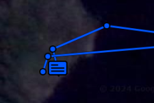
Then that is a preprogrammed message he sent out last night. Clicking on it (or any other point) will give you some more details:

If you click on one of his more recent points, you'll see he's going about 3 mph right now.
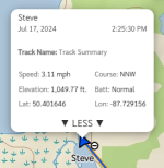
The red flag means he marked and stored his location on his InReach. The waypoint also updates to the Mapshare webpage, which we can see.Just took my first look. What do the red flag waypoints mean? Are they where he camps for the night?
He's a lucky guy to be doing this route, especially with higher water levels.
I don't always get the same message when I click on the symbols. but it's clear he is camping at places where he sends his OK messages. Before that it's the day before, and after that it's the next day.
He seems to be pushing for certain daily targets and arriving late, as opposed to paddling leisurely for exploration as he suggested he might. What time does it get dark up there?
He seems to be pushing for certain daily targets and arriving late, as opposed to paddling leisurely for exploration as he suggested he might. What time does it get dark up there?
What time does it get dark up there?
Sunset today about 9:50 Eastern, depending on your activities you might not need a headlamp until 10:30. Maybe even later because Moonset is after midnight tonight and it's a full moon on Saturday all night, moonset just a few minutes before sunrise.
Oh wow. Just discovered that scrolling/zooming in on the map changes from map to satellite. Love that.
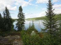
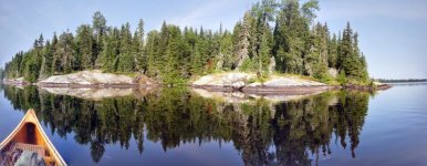
Also, thank you gentlemen for the trip photos, they compliment the route in real time perfectly, making me wish I were there.
Also, thank you gentlemen for the trip photos, they compliment the route in real time perfectly, making me wish I were there.
Oh wow. Just discovered that scrolling/zooming in on the map changes from map to satellite. Love that.
Also, thank you gentlemen for the trip photos, they compliment the route in real time perfectly, making me wish I were there.
You can use the layers button (upper left) to switch from Topo (2 versions) or Satellite without the need to zoom in.

Also, the default view is for the current active track, to see all the tracks click the button in the upper right

- Joined
- Jan 7, 2016
- Messages
- 960
- Reaction score
- 1,879
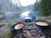
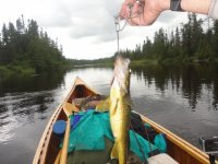
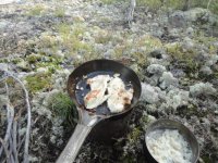
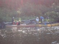
I am enjoying going canoe tripping vicariously, never thought I would. Photos of the places he is at or passing add another dimension. I can almost smell the campfire smoke and taste that breakfast, poured myself a cup of coffee, gorged myself on fillets of pickerel (aka walleye or in Scandinavia, pike perch). Even had a little visit with Mr. & Mrs.Odyssey (first picture of them that I can recall). I even helped with portage (carried stuff from the refrigerator back to my big soft chair).
Looks like he (Gamma 1214 aka Steve) took a little side trip before portaging and camping last night.
Thanks Memaquay, Robin and Steve for letting me ride along in the duffer seat.
Looks like he (Gamma 1214 aka Steve) took a little side trip before portaging and camping last night.
Thanks Memaquay, Robin and Steve for letting me ride along in the duffer seat.
- Joined
- Jan 7, 2016
- Messages
- 960
- Reaction score
- 1,879
Any Speckled Trout in those streams that he is traveling on or passing by?
No specs on the loop, but there are specs close by.
Similar threads
- Replies
- 41
- Views
- 4K
- Replies
- 54
- Views
- 3K
- Replies
- 17
- Views
- 3K
- Replies
- 161
- Views
- 12K


