• Happy Premiere of Tchaikovsky's "The Nutcracker" (1892)! 🩰🥥🧚

Whitefish & Lynx Lakes, NWT: 2022

To paraphrase the opening line from Charles Dickens’ novel, A Tale of Two Cities, Today was the worst of times. Today was the best of times.

I'm a few days behind, as usual. But I'm hoping the trip ends with a paraphrase akin to the last line.
 
PaddlingPitt said:
To paraphrase the opening line from Charles Dickens’ novel, A Tale of Two Cities, Today was the worst of times. Today was the best of times.


I'm a few days behind, as usual. But I'm hoping the trip ends with a paraphrase akin to the last line.
That could have been a good ending to the story, Glenn. Perhaps starting with “The last three and a half days were…...”
 
Monday, July 18. Rain all night, which thankfully stopped in the morning. Sill three km from our pickup spot. It was a frustrating afternoon yesterday with the GPS. We hope the GPS fares better today. We left without breakfast, expecting to get there soon—only three km to go, after all. Should be there in less than an hour.

Well, the GPS did not perform better today. We spent another frustrating afternoon paddling round and round. First we were getting closer. Then we were getting farther away. The most amusing part of the day was when an Arctic Tern dove at Kathleen’s head when we stopped on a rocky island to take a GPS reading. At least I thought it was amusing. And Kathleen likely also found it amusing, as she has told the story many times back in Preeceville. We had probably entered the tern’s nesting site, as according to alllaboutbirds.org, “If humans enter the breeding colony they often dive towards them, peck their heads, and defecate on them.” Yikes! That was close. Could have been a lot worse than a simple peck on the back of her head.

I eventually decided to rely mostly on my mangled map rather than the GPS. Two difficulties existed, however. First, the map was tattered, with some sections completely missing. Second, we were at the far eastern edge of the map, so all features immediately east of us were unavailable. “I’m pretty sure I know where we are, Kathleen. I’ll use map and compass until we get close. Then I’ll turn on the GPS for confirmation.”

There was no response from Kathleen.

Anyway, onward we went. As we approached the beach that I assumed to be our destination, I turned on the GPS. We paddled forward. Closer. Closer. Closer. We continued to paddle forward. Farther away. Farther away. Farther away.

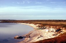
We landed on the beach. I then wandered left down the shore with the GPS, which indicated that I was getting farther away from our destination. I then walked right, down the shore. Again the GPS indicated that I was getting farther from our destination. I then walked inland. Again the GPS indicated that I was getting farther from our destination. dang the GPS. I’m pretty certain we had reached the same beach where we began our Thelon River trip in 1993. The same beach where we would be picked up by Ahmic Air tomorrow.

We began to set up camp a little after three o’clock, and were in the tent a few minutes later snacking on cheese & crackers. At four o’clock I called Stephen, who said the plane would come for us at noon tomorrow, depending on the weather. He suggested that I call in the morning at ten to confirm. I gave him our coordinates, according to the dang GPS: 62º 20.9’ N, 105º 59.4’ W. Once we’re back in Preeceville, I need to find out if a GPS loses its accuracy over time. Ours is an older model—a Garmin 12 channel etrex made in 2000.

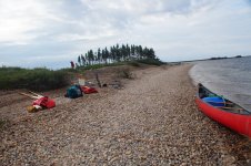
We leisurely dined on a spaghetti supper, while relaxing in our chairs on the beach. Only the enchanting yodelling of nearby loons broke the perfect tranquility. This was why we came.

To the tent for brandy, and then a well-deserved and restful sleep. Tomorrow we fly back to Yellowknife. We were both feeling quite strong, despite all the struggles of the last two days. As always, we had toughened up on the trip. Even so, for the first time, we were truly looking forward to the end of a canoe trip.

DSC01456.JPG
It Had Rained All Night, But Cleared Early Morning, July 18.

DSC01454.JPG
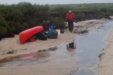
Preparing To Leave Morning Camp, July 18


DSC01458.JPG
Still Getting Farther Away. dang That GPS.


DSC01461.JPG
Same Beach In 2022 Where We Began Our 1993 Thelon River Trip?

DSC01464.JPG
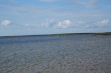
Nearby Loons Yodelling. Perfect Tranquillity.


Thelon019 resized.jpg
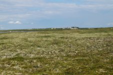
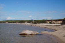
Back in Preeceville, I viewed this image of our beach at the beginning of our Thelon River trip in 1993. Note the large boulder in the water, bottom left. Also note the smaller boulder to the immediate right of the larger boulder. Then compare that to the second image above, taken in 2022, that shows a large boulder, centre bottom, with a smaller boulder to the immediate right. Although the angles and lighting are different, I think these are the same two boulders in both images. The curve of the beach, and the height of the tundra ridge are also similar in both images. I believe these attributes confirm that we were indeed on the same beach in both 1993 and 2022.
 
I'm caught up and I know I could look this up, but just in case some other ignoramus reads this thread, what is a tent ring?

I do know what an inuksuk is and thought I knew what a waterfall is.
 
Glenn. I have copied this from a website.

In the past four years over one hundred indigenous sites have been found due to our explorations of western King William Island. Almost all of these sites consist of one or more tent rings; some sites having as many as ten tent rings. The rings represent where individuals, families or more than one family, had located their tents for varied lengths of time. The stone rings represent where the edges of the tent skin walls were weighted down with rocks. Some tent rings have two circles of stones usually with a well defined ring inside another ring of fewer rocks. The outside stones likely anchored sinew which helped stabilize the tent walls in strong winds.
 
Last edited:
Tuesday, July 19. Windy and overcast at 5:30 a.m.

We were only 0.1 minutes south and 0.6 minutes east of the destination coordinates I entered yesterday, and yet the GPS indicated that we were 511 metres (559 yards) away. I wondered how much latitude distance there is in 0.1 minutes. (Note: I checked back in Preeceville, and 0.1 minutes equals a latitude distance of 185 metres (609 feet). So 0.1 minutes is not all that close.)

I then asked the GPS to “GOTO” our current location, and it said we were already there. That’s not too surprising, as the GPS should know its own current location. I’m still confused, though, about why it could not lead us to the desired coordinates yesterday. A similar situation occurred when we arrived at the Lynx Tundra Lodge on July 13. Using coordinates given to me by the lodge’s owner, the GPS indicated that we were still 641 metres (701 yards) away from the lodge. Why would that be? I remained perplexed.

Wind continued to assault our position at 7:00 a.m. Kathleen and I were reluctant to get out of the tent, which shook, shuttered, flapped and billowed. Even though it stood firm, I was worried. How much could the tent take? I lay awake restlessly in my sleeping bag. Too difficult to nap or rest comfortably with all that noise. Kathleen and I plan to check into the Chateau Nova Hotel in Yellowknife tonight. We enjoyed staying there when we came off the East Arm of Great Slave Lake in 2017. At least we hoped to check in tonight. The wind continued at 9:00 a.m.

The wind persisted at 10:30 a.m when I called Stephen, and gave him our coordinates reported by the satellite phone: 62º 20.54’ N, 105º 59.26’ W. Perhaps the satellite phone readings are more accurate than my GPS. Stephen said, “The weather reports in Yellowknife are bad. Flights are being cancelled. What’s the ceiling like out there Michael? We need 300 feet.”

“I think the ceiling is much more than 300 feet, Stephen. Visibility is quite good, I think.”

“That’s great to hear. The plane has left, and should be there around one o’clock.”

Kathleen and I took down the tent, and packed up all our gear. We then snacked on gorp.

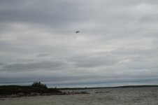
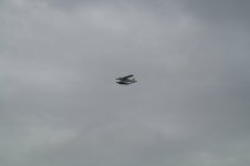
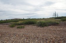
The float plane appeared at 2:00 p.m. To me it seemed more like a rescue plane than a pickup plane. We were more than ready to get to Yellowknife. The plane dipped toward the water, but then rose again and flew off to the south. Minutes later it returned, dipped toward the water, but then rose again and flew off to the east. The plane repeated this process for the next twenty minutes or so, when it buzzed us low overhead, and flew off to the south. Minutes later we could no longer hear the engine.

Where could the plane be? Why didn’t it even try to land? We cocked our ears to the south, but could hear only wind. Five minutes later I called Stephen.

“The plane flew away, Stephen. It doesn’t seem to be coming back.”

“There were too many rocks, and it was too rough to land where you are. But he has landed 2.3 miles (3.7 km) away, at 62º 19.58.’ N, 106º 03.1981’ W, at a bearing of 243 degrees. He says he’ll wait for you if you want to paddle down there. It’s an island with an esker and lots of sand.”

“We can’t paddle in this Stephen. Way too rough for the canoe.”

“OK. We’ll try again on Friday.”

“What day is it today, Stephen?” (Note: I knew it was July 19, but I didn’t actually know the day of the week.)

“Tuesday.”

“Three days? That’s a long time from now, Stephen.”

“I’m all booked up between now and then. But I want you to go down there for the Friday pickup.”

“OK, Stephen. We gotta go now. It’s starting to rain heavily. We gotta get the tent set up.”

I then turned to Kathleen and said, “I don’t want to put the tent back up on the ridge. I’m worried about it holding up against this wind. We should put the tent on the beach, where we have a little more protection.”

“But it’s wet on the beach.”

“It’s a little bit drier over there, right up against the bank.”

“OK.”

But we didn’t get the tent set up before being absolutely drenched by a sudden downpour. This was bad. We crawled into the tent just before lightning cracked menacingly close above our heads. We both jumped, as best one can jump from a sitting position. Kathleen began to cry softly.

Lightning and thunder rolled across the Barren Grounds for the next few hours. At 5:30 p.m. we heard the float plane returning. It buzzed the tent low overhead and flew away to the west, likely returning to Yellowknife. Water started flowing through the front vestibule, and under the front portions of the tent floor. “I’m sorry Kathleen. We should have camped up on the tundra as you suggested. But I didn’t like the wind up there.”

We needed some good news, so we called Donna, in Preeceville, at 6:45 p.m. “How is Shadow doing?”

“He’s doing great. He’s relaxing on the living room couch right now.”

That news about Shadow cheered us up quite a bit. I studied my mangled topographic map, and concluded that the island we should paddle to for Friday’s pickup was shaped like an open wishbone. I called Stephen at 6:55, who confirmed that we should head for the “wishbone” island. Rain continued to batter our beach.

At 8:10, Kathleen poured the last of our brandy. Unrelenting rain still pounded our beleaguered position.

At 10:20, Kathleen began patting the tent floor. “Michael, it’s like we’re on a water bed. Look. There’s water all under the tent!” We jumped out to see that a river was literally flowing under our tent. Must be from all the water coming off the tundra ridge. We quickly unpegged the tent, and dragged it, with all its contents, back up onto the tundra ridge. It was reassuring to know that the tent didn’t leak. I was still concerned, though, about how it would fare against constant, strong winds. The downpour continued unabated throughout the night. I envied those warm, dry, snug people at the Chateau Nova Hotel in Yellowknife.
DSC01467.JPG
The Float Plane Appeared At 2:00 p.m.
DSC01469.JPG
The Float Plane Flew Away At 2:20 p.m.
 
It feels hypocritical to like a chapter describing a severely unlikeable situation, but Michael and Kathleen, you know what I mean.
 
The good news is that we know you lived. Almost positive of that. At least we've never yet had a dead person write a trip report that I know of.

The bad news is that you have to spend three more days in this place that . . . well . . . sounds a bit different from the desiderata in the OP, if I may be permitted some selective quotations therefrom:

". . . nearly constant daylight and the spectacular scenery and isolation of the Barren Grounds. This is what we seek. . . . We might just find a few spots that we like, and set up base camps."

"We planned this to be a leisurely, slow-paced, northern canoe trip . . . . Just an average of 10 km (six miles) per day. Easy peasy. As an added bit of comfort, we also pre-booked two nights at the Lynx Tundra Lodge . . . . Maybe the coffee would be available on a non-stop basis."

After the luxury of the LTL, you now have three days to base camp, with an extremely leisurely remaining paddle of less than a mile a day, at least according to a mangled map and an Alice in Wonderland GPS. For some reason, I'm getting the impression that the next three days will include something more baleful than spectacular scenery and easy peasy paddling.
 
I've heard that swearing can be attributed to a poor vocabulary, and that might be true, but all I can say after reading that is, "Holy Shtt!"

Alan
 
Last edited by a moderator:
This report is starting to make the collected works of Dostoevsky look like inspirational readings!

Just kidd'n.

The part that made me the saddest was running out of hooch with three days of lollygagging ahead of you.
 
From Robbie Burns (To a Mouse) :

"But Mousie, thou art no thy-lane,
In proving foresight may be vain:
The best laid schemes o’ Mice an’ Men
Gang aft agley,
An’ lea’e us nought but grief an’ pain,
For promis’d joy!"

And an English translation:

"But Michael, you are not alone,
In proving foresight may be vain:
The best-laid schemes of mice and men
Go oft awry,
And leave us nothing but grief and pain,
For promised joy!

And foreshadowing of more grief and pain - I look forward to the next installments.
Interesting malfunction of your GPS - any explanation?
 
Interesting malfunction of your GPS - any explanation?
Thanks for the poem, Ralph. I did start a thread titled GPS Advice in the Navigation and Communication Forum. Lots of good responses. No one directly suggested, though, that perhaps I just didn’t know what I was doing. This was the first time I had ever tried to navigate with a GPS. Previously I had always used map and compass.

Is that your subtle form of foreshadowing? Lol.
You are perceptive, mem. As they say, “It ain’t over until some large person sings.”
 
Last edited:
Wednesday, July 20. The rain stopped at 6:00 a.m., but the wind and waves remained too strong to paddle.

We forced ourselves out of the tent, and headed to the windswept beach for a bannock breakfast just before 8:00 a.m. Kathleen always prepares a dry bannock mix at home for each day of our canoe trips. She places each mix in a plastic baggy, and usually freezes any leftover bannock mixes for the next trip.

I always cook the bannock. I first open the baggy, and pour in just the right amount of water. I then close the baggy and knead the bannock to reach optimum consistency. If necessary, I add more water, and continue kneading. I then bite off a bottom corner of the baggy, and squeeze the bannock mix into the buttered skillet. This works virtually always perfectly.

Not this time, though. For some reason the baggy had already been punctured by two small holes. As I poured the water in, it just poured out through the holes. I tried to hold the baggy, holes side up, so that I could knead without losing too much water. It appeared to be going reasonably well. I bit off a bottom corner of the baggy, and attempted to squeeze the bannock mix into the skillet. But the bannock mix was partially dry, partially wet. It did not squeeze into the skillet. Rather it just fell out in bits and fragments. Sort of like my mangled 1:250,000 topographic map. A depressing start to the morning.

This was the second bannock baggy with holes on our trip. This had never happened before. Perhaps they had been baggies frozen from previous trips. Maybe the freezing had weakened the baggies structurally. They might have been in the freezer since 2019, at the end of our Yukon River trip. Or perhaps they had just been damaged somehow on this trip. I did have more bannock mixes for breakfast, so perhaps the ruined bannock was no big deal. It’s just a bannock, after all. We had more bannocks. But I like things to work as planned. I don’t condone baggy bannocks falling out in bits and fragments.

Wind and waves continued strong throughout breakfast. We returned to the tent to seek respite from the truly horrible morning.

Respite did not find us, however. The wind intensified throughout the morning. The windward wall of the tent began bowing inward, at times nearly reaching the tent floor. Now I was worried that a tent pole might snap. At noon, Kathleen and I kneeled in front of the inward-bowing tent wall and pushed back against the strong gusts. We gotta prevent those tent poles from snapping. If we lost the tent, we would indeed be in serious trouble. There would be no way to keep warm and dry. Hypothermia would be a genuine possibility.

What would we do if the tent snapped and blew away? We couldn’t call Stephen, whose pilot didn’t land yesterday in wind much less severe than the swirling maelstrom that now surrounded our tiny bit of nylon shelter. Could I call for helicopter rescue? Could a helicopter land in these windy, low-visibility conditions. I hoped not to find out.

At 2:30 p.m. the wind grew even more menacing, and the tent wall bowed even farther inward. We continued to push back. At four o’clock, we still pushed back against the wind.

At 6:30 p.m., Kathleen scrambled down to the beach to get two bags of gorp for our supper. Assuming the tent holds, our plan is to hope for calmer weather, get a good night’s rest, and leave early in the morning. Not much of an actual plan, I know, but hope is all we got.

The wind began to die, just a bit, around 9:30 p.m. For the past hour, Kathleen had been sitting in her ground chair with her head pressed up against the windward-facing tent wall. A light rain returned, perhaps indicating a change in atmospheric conditions. “I think the wind is slackening a bit, Michael. I’m going to bed.”


DSC01472.JPG
A River On the Beach—Morning Of July 20

DSC01471.JPG
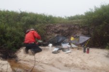
Preparing A Bannock Breakfast— Morning Of July 20

DSC01474.JPG
Hoping For Calmer Weather Tomorrow
 
Wow! The foreshadowing of wind and the Wanderer 4 is becoming real. Hopefully the tent holds up. Were your guy lines slipping or were pegs pulling out or is the high profile of the Wanderer 4 just too much for the combination of high winds and little shelter on the barrens?
Your situation on the beach looks very miserable, uncomfortable and tenuous. You are doing well to cope.
 
Back
Top