• Happy Patent for First Computer Mouse (1970)! 🖥️🖱️🐁

Whitefish & Lynx Lakes, NWT: 2022

It is 5:28 AM as I read your report, but it was 6:30 yesterday when I did the same.
-or-
At 5:28 AM your report kicks like a bass drum, better than java for waking me up.

I'm not a gear freak, but I noticed the bottom of your chairs, with the platform style base. My original helinox chairs have both lost their feet, and the legs punch through on anything but a rock surface, causing some spectacular wipe-outs, especially after a couple of glasses of wine (red, from a box).

I'm gonna look for your style of chair. That is all this morning, thanks for the 5:30 AM canoe fix.

edited to say I found the chair, Black Friday sale at Canadian company Atmosphere, ordered two, Christmas presents for Irene and I.

Canoetripping.net does it again, parting me from my money like waves from the bow!
 
Last edited:
I'm gonna look for your style of chair. That is all this morning, thanks for the 5:30 AM canoe fix.

edited to say I found the chair, Black Friday sale at Canadian company Atmosphere, ordered two, Christmas presents for Irene and
Mem,

Kathleen bought these chairs for Christmas quite a few years ago now. I have no idea what style she purchased. We had some friends over for a gathering in August, and he brought two Helinox ground chairs. They were a smidge larger, and didn’t have the platform feet. Just poky feet. He knows gear, and said he had the Helinox 1, while we had the Helinox 0. Ours would be difficult for some people to get up from. No problem for us so far. But we’re small people. We even use our chairs in the tent, without any damage. Do you know what model you purchased?
 
An update, mem. Guy who knew gear didn’t know gear as well as he thought. I googled the Helinox 0, and it just has those rubber ball feet. Kathleen is up now, and she says that she ordered the Helinox Ground Chair. I googled that, and it has the platform feet.
 
re: Camp chair diversion. My own chair update. We bought a pair of light weight Helinox type Amazon knockoffs for $10 each. Crazy prices for pretty decent chairs. (Since then, the price has climbed to $40) However, on the first cycle day tour I accidentally left one chair leg bottom stopper behind. Went back several times to look for it in the long grass without success. So now I've installed plastic practice golf balls. Still not ideal but works. These chairs have been somewhat comfortable cycle touring and canoe tripping the past few years but will likely be replaced. When I saw your chairs Michael I thought "That's what I need!!!" Or a cheap Amazon knockoff.
All this chair leg kerfuffle has me leaning back towards a simpler stadium seat answer. Legless when I'm legless?
 
Last edited:
Yes, it's the Helinox Ground chair I ordered, when I saw your picture of them sitting on the sand, I knew right away I had to have them. If I set mine up on sand I would be arse over tea kettle in less than a half a glass of wine.
 
Thought I would post tonight so that mem has something to read with his morning coffee.

Thursday, July 7. Up at 4:30 a.m. Tea and bannock for breakfast. We packed up and headed south down Gordon’s Esker for our first full day of canoeing.

Kathleen and I paddled mostly without talking, just enjoying the scenery and silence. We drifted by a herd of seven muskoxen, who stared intently as we passed by.

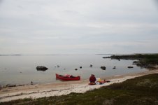
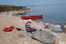
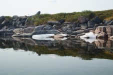
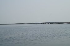
We stopped for Top Ramen soup for lunch on a gravel beach. Despite the warmth, pockets of ice remained along the shoreline. While enjoying my soup, I studied the 1,250,000 topographic map. “You know, Kathleen, something just doesn’t seem quite right.”

“What do you mean.?”

“I don’t know. Things just don’t seem quite right.”

Back on the water, Kathleen suddenly asked, “Do you know where we are?”

“Not really. Let’s go to shore and take a GPS reading.”

“There’s a good beach over there, Michael. Let’s go over there to take a reading.”

Kathleen hopped out of the canoe, walked a few steps uphill, and declared, “It’s home.”

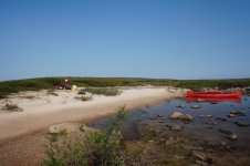
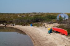
It was indeed home for the night. Our ideal camp. Easy access from the water, a sandy beach, and a low tundra ridge for the tent. We much prefer not to pitch our tent on sand, which eagerly races into the tent at all opportunities.

We snacked on gorp and then set up camp. I was having a tough time lifting the canoe packs. I normally sit down next to the pack, with my back against the padded straps. I then reach my arms into the straps, stand up, and stride out comfortably and confidently. Only three years ago on our Yukon River trip, I easily stood up, and somewhat nonchalantly carried the packs uphill. Today I could barely stand up, and then fell while trying to get up onto the low tundra ridge. I am definitely old. This is definitely the last canoe trip.

It was 40 degrees C (104 degrees F) inside the tent when we crawled in to take a rest. An hour later is was only 28 degrees C (82 degrees F). Quite tolerable, but still on the warm side.

Before our supper of Thai noodles and Christmas cake for dessert, I spread out the topographic map, and activated the GPS. “Kathleen, we’re not as far along as I thought. I don’t know how that can be. We’re about two km (one mile) away from where I thought we were. I have never been so far off.”

I have always navigated with just compass and map, and have never relied on a GPS. I brought our GPS on this trip because we had to be at a specific location for our float plane pickup on July 19. Otherwise I needed to provide our coordinates of where we actually were on July 19.

“I’ve always trusted you Michael. What’s the problem?”

“The problem is that I don’t have my watch. So I didn’t know how long we’d been paddling.”

(Note: I haven’t worn a watch for 15-20 years. But on canoe trips I always wear an inexpensive sport watch. With calm lake conditions, we generally paddle approximately five km (three miles) per hour. After one hour we’ve covered about five km. I keep the topographic map in a map case secured directly in front of me on the spray deck. Easy to compare the surrounding landscape with the features on the topographic map. A compass reading or two quickly confirms our location. But my sport watch wasn’t working when I pulled it out of the drawer in my nightstand. Screw it, I said to myself. I don’t really need a watch. Turns out though, that I really did need my watch. I don’t really navigate with just compass and map. I navigate with compass, map, and watch. You might be wondering how I sometimes refer to the time when I don’t have a watch. Pretty easy. When I want to know the time, I activate the GPS. It knows the time. But I didn’t keep in on continuously, and failed to regularly note staring and stopping intervals throughout the day.)
The GPS indicated that we made about 25 km (15 miles) today—five km (three miles) more than our goal. We set up camp at 62º 38’ N, 106º 52’ W. I thoroughly enjoyed today’s paddle—calm conditions—just drifting along in absolute stillness and isolation. The lake belonged to us, seven muskoxen, and a few lake trout that periodically surfaced next to the canoe.

In the tent for the night, I noticed our two green cups in Kathleen’s corner of the tent. These are not our tea cups. No. These green cups are for two ounces of brandy. I would like some brandy, but we ration ourselves on canoe trips. This was only our third night. Normally too soon for brandy. And, I didn’t see the one-litre fuel bottle of brandy over in Kathleen’s corner of the tent. She probably brought the green cups into the tent by mistake. I didn’t want to say anything, as Kathleen would probably get up to get the brandy. I didn’t want her to go to all that trouble. Kathleen started rummaging around in her corner of the tent, and held up the one-litre fuel bottle of brandy.

“Would you like some brandy, Michael.”

“Yes, please.”

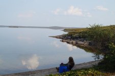
I savoured my nightcap, and then fell asleep listening to soft waves lapping against our sandy beach. Sweet lullaby of Whitefish Lake.

DSC01351.JPG
Morning Tea Break

DSC01354.JPG
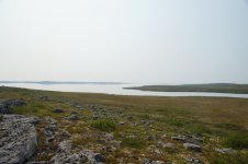
This Doesn’t Seem Right.

DSC01355.JPG
Ice, Despite the Warmth

DSC01357.JPG
Pockets of Ice Along the Shore

DSC01362.JPG
Our Ideal Camp

DSC01359.JPG
End of a Thoroughly Enjoyable Paddling Day
 
Last edited:
Thought I would post tonight so that mem has something to read with his morning coffee.
Geeze, that's the nicest thing anyone has done for me in a while. Thanks so much!

My first coffee was actually consumed at 5:00AM as I wrote up a test on the life cycle of plants and the mysteries of photosynthesis, so your latest instalment was consumed, along with my second coffee, around 7:00 AM.

I can tell you that if I was using 1:250000 maps, I would be lost every time. Even with my bi-fuch-als on, I can't make out enough detail. 1:50's or less for me.

Thanks again for the Monday morning "pick-me-up"!
 
Hi Michael,
I asked about your canoe and tent and then I didn't respond, sorry! Thank you for responding. I got lost in following your story and I have the attention span of a gnat. When I saw your picture of your tent, I thought it was the Wanderer 4 but wanted to confirm. I have one (and a Wanderer 2) and I think it is a great tent for canoe tripping for two people for variety of reasons but I always wondered how it would be out in the winds on the barrens. Obviously it is fine. Did you have to do any modifications to the tent to withstand the wind?
Another example of MEC having a great product and then discontinuing it.
I have to agree with Memaquay - I don't think I could navigate on 1:250 000 maps. Your ability to do so sure cuts down on the number of maps you need to take.
 
Friday, July 8. Another beautiful, calm morning. No bugs. I had gone to the tent early last night to escape the hordes of mosquitos, although Kathleen stayed out to enjoy the stillness. But why were there no bugs this morning? It hadn’t been cold overnight. Certainly not cold enough to initiate a widespread bug die-off. Nevertheless, floating, dead mosquitos covered the lake’s surface. Why would that be? All we could think of is that perhaps mosquitos viewed a smooth lake surface like birds view glass windows. This didn’t really make any sense to us, and seems totally preposterous as I write these words. It’s all we could think of, though.

(Note: After returning home, I read that mosquitos die when temperatures fall below 50 degrees F (10 degrees C). I don’t know how far the temperature dipped on July 7, but it didn’t seem any colder than usual for the past few days.)

We hope to reach one of our favourite campsites, at the Lynx Creek Esker, in two more paddling days. We would need to negotiate the rapid between Whitefish and Lynx Lakes. As part of our preparation for this trip, and as a supplement to my 1:250,000 topographic map, I had downloaded 1:50,000 topographic maps. I printed them out, and then cut them down to size. In addition to these hardcopies, I also copied these maps to my iPad so that I could enlarge them while studying them in the tent at night. A copy of my 1991 book Franklin, Oops, Mud & Cupcake: Canoeing the Coppermine, Seal, Anderson and Snowdrift Rivers of Northern Canada also resided on my iPad.

All I remember about the rapid between Whitefish and Lynx Lake is that it was not difficult. To confirm, I opened my book to read what I had written about the rapid coming up from Lynx Lake in 2001.

“A little less than 2 km (1 mile) from the rapid, we encountered current and paddled hard, ferrying from inside bend to inside bend, slowly making our way upstream. In a few minutes, we approached the rapid itself, which was nothing more than a shallow, wide, Class I riffle with strong current. Too strong to paddle against. While Kathleen walked along the shore, taking pictures, I dragged the loaded boat about 150 m around the inside bend in knee-deep water. Little more than a jaunt.”

Seems quite doable. Even easy. But you never know. Rapids can change in 21 years.

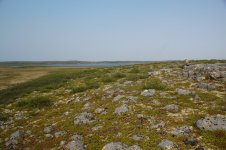
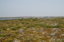
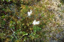
Before lunch, we set out on a tundra hike, where we renewed our friendships with some of our favourite Barren Grounds plants: crowberry, cotton grass, dwarf birch, and the fragrant northern labrador tea.

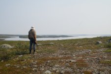
DSC01363.JPGWe sat on the ridge for a couple of hours. So vast and seemingly empty, yet so full of life. Insects, mostly ants, scurrying about in all directions. Every square metre bustling with activity.

DSC01365.JPG
Contemplation

DSC01366.JPG
View To Esker

DSC01369.JPG
Toward Yesterday’s Route

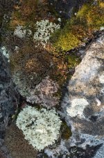
DSC01372.JPG
Rock Community

DSC01374.JPG
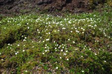
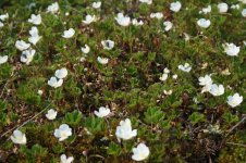
Carpet Of Cloudberries

DSC01375.JPG
Cloudberry Flowers

Back to our camp for lunch of cheese and crackers, with dried pineapple rings and figs. Very hot at 33 degrees C (91degrees F), so we moved to a small patch of shade against the rocks at the edge of our beach. We sat still. The shallows beneath our feet brimmed with life. Small fish swimming casually. Tiny water bugs darting along the bottom. Common Loons calling in the distance. The Barrens are empty only of human life.

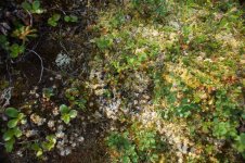
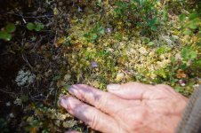
Kathleen walked along the beach searching for debris-free drinking water, and found a diminutive butterwort (Pinquicula villosa). The plant’s yellowish, green, sticky leaves trap small insects, which are then broken down by enzymes secreted by the plant, and the nutrients are absorbed into the leaf surface. In her book Barren Land Beauties: Showy Plants of the Arctic Coast (1991), Page Burt wrote

“It’s quite a thrill to discover these mini plants, and this points up the importance of looking closely all around you. We often hike over the vast expanse of the tundra world with our attention fixed on the distance, on a caribou, a soaring hawk, or a mineral outcropping. Take time to look closely and you will discover another world in a jewel-like puddle on a tundra slope—a world of minute plants, of mosquito larvae, and wolf spiders bearing the precious burdens of their egg sacks.”

We had been following Page Burt’s excellent advice for most of the day.

DSC01376.JPG
Lunch In The Shade

DSC01381.JPG
Kathleen Discovered Purple Flowers Of Butterwort.

DSC01380.JPG
Diminutive Butterwort

DSC01383.JPG
Flowering Northern Labrador Tea

DSC01385.JPG
Camp In The Afternoon

Leaving the tent after our afternoon rest, Kathleen saw a Golden Eagle. During our supper of smokies, a Long-tailed Jaeger flew close by, seemingly to inspect the two human intruders.

A gentle wind produced waves this afternoon. In the tent at 6:15 p.m., hoping for calm paddling conditions in the morning. Kathleen’s recurring back problems plagued her for much of the day. She retrieved a Robaxacet from the first aid kit, which usually helps.

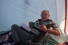
I took my green cup into the tent. Kathleen and her green cup were still in our kitchen area on the beach. I didn’t ask her if she were taking her green cup to the tent. If not, there would be no brandy for me. Best just to sit still, observe and hope. Kathleen picked up her green cup, stepped into the tent and sat down in her ground chair to read. A few minutes later she asked, “Would you like some brandy?”

“Yes, please.”

DSC01386.JPG
Brandy Nightcap

In the middle of the night, we heard a sound we have never heard before on the Barren Grounds. Sort of like a calf bawling for its mother, or a cow calling out to her calf. Could it be a muskox? Is there a duck that makes that kind of sound? Heard it every few seconds for about 30 minutes.
 
Last edited:
That Brandy nightcap picture of you made my morning, I LOL'd, as the kids say. You look like a little kid with some forbidden goodies.

I was showing my students a variety of carnivorous plants last week, I shall have to include the diminutive butterwort if I teach the course again, I think they came away with the idea that the majority of the plants were huge, monster like man eating things.

Looking forward to your trip through the rapids, I sense some foreshadowing there as well.
 
Al,

I will eventually reveal the answer, in about five more tripping days.

Mem,

We used to take two cameras. One for Kathleen. One for me. Got a lot of images that way. Now, only Kathleen has a camera. I never say, ”Take a picture, Kathleen.” So, no picture of the rapid. I am writing this, so I guess we survived.
 
Saturday, July 9. We crawled out of the tent at 5:00 a.m. A beautiful calm morning. A red sky, however, dominated the horizon. And, as you know, that means potential trouble, as in red sky in morning, sailors take warning. That suggests that canoeists should also take warning from a red sky in the morning.

This adage, in fact, has a scientific/meteorological basis. In the mid latitudes, storms commonly travel from west to east, pushed along by the jet stream. A rising sun in advance of an approaching weather system illuminates the approaching mid- and high-level clouds to create a red sky in the morning. Some sources say that the mid latitudes occur from about 30 to 60 degrees north or south of the equator. Kathleen and I are camped north of 60 degrees, so are not technically in the mid-latitudes. Other sources say that the mid latitudes in the northern hemisphere occur between approximately 23 and 66 degrees north of the equator, which places us within the threat of red sky in morning, canoeists take warning. We shall see. If the current calm conditions hold, we might reach the Lynx Creek esker today, only about 35 km (22 miles) away.

We put on the water in a stiff breeze. Not too bad, but worrisome. An hour later we went ashore to rest, as the wind had intensified. We were close to where Whitefish Lake narrowed a bit, where we might benefit from a shorter fetch.

Thirty minutes later we faced strong headwinds, accompanied by large, rolling waves. We tried to round a point to seek shelter in a small bay, but were pushed up against shoreline boulders. We hopped out and tied the canoe, stern first, onto a small tree. The canoe crashed heavily against the boulders, but seemed secure. So we scrambled up the bank, and sat on the leeward side of a large rock, just like Samual Hearne reported on his overland trip to the Coppermine River in 1770-1771, as presented in Farley Mowat’s book Tundra:

“On the 3rd of July the weather was again bad, but we made shift to walk ten or eleven miles, until we were obligated to put up because of not being able to see, due to the drifting snow. By putting up, no more is to be understood than we got to leeward of a great stone, or into the crevices of rocks, where we smoked our pipes or went to sleep until the weather permitted us to proceed.”

Compared to Hearne’s conditions, our situation was much better. We had nothing to complain about. After about an hour we snacked on gorp, and discussed our options, which weren’t welcoming at all. If the wind stopped by 1:00 p.m. we could still reach the Lynx Creek esker today. This option looked extremely unlikely, so we decided to search for a place to camp. All nearby potential sites were either hummocks, bogs, or pure rock. Kathleen and I couldn’t have landed at a more miserable location. We had to push on.

Back at the canoe we struggled to pull/push it to the slightly more sheltered cove. Rollers repeatedly pushed the canoe back up against and onto the boulders. We were making no progress. Kathleen slipped and tumbled into the cold water three times, badly bruising her legs on the rocks. I was breathing heavily from the struggle, but didn’t suffer a stroke. Quite reassuring for an old man with high blood pressure. But then again, that’s why I’ve been taking blood pressure medications for many years, now.

We finally reached the cove, beached the canoe, and walked over to the next cove to assess camping. We found a nice, flat piece of tundra. We hurried back to the canoe, and paddled with difficulty around the point into our somewhat sheltered cove with acceptable camping.
Working quickly we got the tent and fly up mere seconds before a deluge overwhelmed our site. Thirty minutes later, the rain seemed to stop, which allowed us to bring our Therm-a-Rests and sleeping bags into the tent, again mere seconds before a second deluge assaulted us. We crawled into our sleeping bags to warm up, and to doze.

We should have taken pictures of our current predicament, as a picture is worth a whole lot of words, a thousand, they say. But we didn’t. And I don’t want to compose a thousand words to substitute for the missing picture. But contemplate these nine words: Low, bleak tundra. Crashing waves. Dark sky. Pouring rain. We were enjoying a true Barren Grounds experience. Just what we came for.

We were camped at 62º 35’ N, 106º 54’ W. Still about 25 km (15 miles) to the Lynx Creek esker, and 35 km (22 miles) to the Lynx Tundra Lodge, where we have reservations for July 13 and 14. We need calm weather.

At 6:30 p.m. we somewhat enjoyed a quick supper of spicy chicken noodle soup, with cheese and crackers. Blue sky began poking through the greyness above a finally calm Whitefish Lake. People often ask us if we work out before embarking on these physically demanding trips. I’ve always said there’s plenty of time to toughen up on the trip itself. This seems to be happening, even at our age. I’m not nearly as tired now as I was a couple of days ago, despite our most difficult day so far.

(No pictures today.)

Sunday, July 10. Kathleen stepped outside the tent at 3:00 a.m. “There’s a dense fog on the eastern shore, Michael. It’s not really raining. Just a slight drizzle, and the lake is calm. We might be able to paddle today.” Moments later, the slight drizzle became actual rain, driven by a crisp wind. I could hear waves lapping onto the shore. The wind increased, and the lapping on-shore waves became louder. Not exactly crashing, but more than lapping. More like running onto shore.

I stepped outside at 6:15 a.m. Medium sized waves on the lake. Back in the tent I reported that we could paddle in this, but probably wouldn’t want to make the upcoming open crossing of approximately 1.0 km (0.5 miles). “Then we shouldn’t go,” Kathleen said. She was right, of course. We were content in the tent, and were approximately on schedule. No reason to push ourselves in uncomfortable paddling conditions. We can just enjoy our company in the tent. Kathleen noted that canoe trips teach patience and humility. In our city lives we sometimes believe we are in control of events. Out here, on the Barren Grounds, circumstances are definitely beyond our control.

Around 7:15 a.m. I could no longer hear waves lapping up onto the beach. I peered outside. Calm, with just a slight wind. We might be able to paddle soon.

At 9:00 a.m. Kathleen got up out of necessity, and heated up our tea from last night. “Still drizzling, Michael, but the sun is poking through the clouds.” The rain returned in earnest before Kathleen crawled back into the tent.

For lunch we prepared Raman-style noddle soup, with salami, figs and dried pineapple rings. Finally, at 2:30 p.m. the sky finally appeared to be clearing, with very little wind. “I think this is more than just a brief break in the storm. I think we should go.”

“I agree.”

We quickly broke camp, loaded the canoe, and headed out onto Whitefish Lake. We both felt so good to be paddling and making progress. After about two hours we stopped to take a GPS reading. Again, we were not nearly as far as I thought. What is wrong with me? I’ve never had this much trouble navigating. Well, for one thing, as you remember, I didn’t have a watch, so didn’t know how long we had been paddling. I was only guessing that we had been paddling about two hours. And for a second thing, I hadn’t been taking compass readings. Why take compass readings when I already believed I knew where we were? Kind of foolish attitude on my part, though. The compass hangs around my neck—takes only a few seconds to get the compass reading. Three seconds later my compass confirmed our position.

At 6:00 p.m. stopped for gorp and a GPS reading. Bingo! Exactly where I thought we were. “No need for my compass now, Kathleen. We just need to follow the shore, and then turn right into the narrows leading to the river that takes us to Lynx Lake.”

Again, all this embarrassing hubris coming out of my mouth. Compass readings require only a few seconds. I’ve always taken many compass readings on our canoe trips. It’s neither difficult nor inconvenient. Take the dang compass readings!

I should mention that Kathleen and I have spent a lot of time pushing and pulling our canoe off of and through boulders while rounding points and landing on beaches. Barren Ground lakes are generally shallow near shore, with many boulders guarding access to the beach. I should have been recording how many times we had already hung up on boulders. I should have been tallying how many times we had to jump out in thigh-deep water to yank the canoe free. The total is many. Too many.

“Kathleen, I’m heading out a little way offshore to avoid grounding out on boulders.”

“But I thought you said that we we need to follow the shore to turn into the narrows. Now you’re not on the shore, Michael.”

“But I can see the shore.”

“Don’t you think we should actually snug up against the shore?”

“No need to do that. We’ll be able to see the narrows from here.”

A few minutes later we entered what I truly believed to be the narrows leading to the river that would take us to Lynx Lake. “This doesn’t seem right to me, Michael. I think this is just a side bay. I don’t see an outlet down there.”

“I’m a little worried too. But I think I see current down there. Do you see current?”

“I think so. I’m sorry to have doubted you.”

Twenty minutes later we reached the bottom of a side bay. We were not in the narrows. There was no river that would carry us to Lynx Lake. A GPS reading confirmed that we had passed by the right turn into the narrows. My compass would have immediately established that our current direction was obviously wrong—that I had taken us into a side bay, and not the narrows leading to Lynx Lake.

These two events elicited a lot of discussion between Kathleen and me. The conversation went something like this.

“I’ve always been happy to trust your excellent navigational skills to get us where we’re going, Michael.”

“And, Kathleen, I’ve always appreciated your unwavering confidence in my judgement.” (Note: I placed quotes around the two previous statements, even though they might not represent exactly what we said.) This was undoubtedly the worst navigational day of my life. Just take the dang compass readings.

Anyway, we paddled back out of the side bay, and over to the shore. A few minutes later, we saw a channel curving to the right. The entrance to the narrows had been obscured by the land falling away when we paddled by 40 minutes ago. I took the dang compass reading. Yes. This was it.

We soon found ourselves in the narrows, heading toward the rapid between Whitefish and Lynx Lakes. We descended the shallow river slowly, bumping and grinding over rocks. We soon hung up on a boulder, and I jumped out to pull us free. We headed to the outside bend, seeking deeper water. We heard the rapid before seeing whitewater up ahead. We eddied out on river left to scout. An obvious trail existed through a dense clump of spruce. Other adventurers had passed this way. We walked down the trail and studied the rapid. No problem. Only a shallow riffle.

“All we gotta do is head down the middle and keep the canoe aligned with the current.”

“Yeah, the main problem is to make sure we don’t ground out or broach on a boulder.”

Back in the canoe, we shoved off toward the rapid. Probably less than a minute later, the excitement was all over. Or so we thought. Up ahead another stretch of whitewater posed a potential challenge.

“Do you want to get out and scout?”

“No. It’s not as much as what we have already run. Let’s just go.”

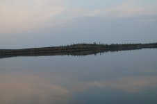
A little after 9:00 p.m, we reached the southern end of Whitefish Lake, where we drifted slowly in absolute calm and silence, like canoeing on a mirror. We paddled through the gap, and turned west, looking for our 2001 Lynx Creek esker camp. After about 15 minutes Kathleen said, “We should have been there by now Michael. We must have gone by. Let’s head back. I think I already saw the esker. I should have said something.”

So we turned abound and paddled all the way back, to the first beach west of the gap. “I think this might be it, Michael.”

We landed on shore to investigate what was truly a horrible site with a brackish pond, probably filled with vicious, frenzied mosquitos. “I don’t think this is it, Kathleen.”

“I don’t think it is either. What do we want to do?”

“Well, I don’t want to stay here. Do you like this spot, Kathleen?”

“No.”

“Neither do I. In fact I hate it. Let’s head back and look for our favourite camp—our Lynx Creek esker camp. That’s why we came. It’s on the itinerary. We gotta stay there.” (Note: I was certain that we hadn’t paddled far enough up Lynx Creek. There’s no way we would have not recognized its truly beautiful esker campsite. Based on my recent navigational failures, however, I thought it best to say nothing.)

We headed back west, and found our camp just around the bend where we had turned around. We beached and set up camp, harassed continually by the worst horde of mosquitoes so far on the trip. Into the tent for our nightly sip of brandy, and then into our sleeping bags.

During the paddle the western horizon glowed red, perhaps good news. You know that old adage red sky at night, sailor’s (and canoeists) delight. Several sources indicate that if the sun is setting as a weather system exits, and high pressure is building, then the departing clouds would be illuminated. This creates a red sky at night with fair weather to follow.

Kathleen and I both woke up in the middle of the night. “It’s cold!”

“Very cold.”

We both put our fleece jackets back on. Kathleen even pulled her overbag onto her sleeping bag. I finally warmed up, wondering what the temperature was—too tired, though to get the thermometer out of the map case. The cold temperature indicated that the heavens had cleared. The red sky at night had indeed accurately predicted a coming high pressure system.
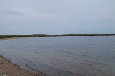
DSC01390.JPG
Clearing Sky and Calming Waves At 2:30 p.m.
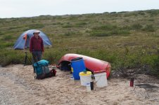
DSC01388.JPG
Time To Pack Up And Go

DSC01394.JPG
Exactly Where I Thought We Were At 6:00 p.m.
DSC01396.JPG
Calm And Silent At The Southern End Of Whitefish Lake, 9:20 p.m.
 
As always, a great read - thanks.
Your reluctance to use your compass as you usually did in the past reminds me of me, for whatever reason, not wanting to do simple things that have been successful in the past. For example,
deciding that it will be OK to not tie the canoe up when stopping for a break or,
deciding that it will be OK to not turn the canoe over and tie it to a tree for the night - preferably both ends or,
not using most or all of the guy lines on the tent in case the weather turns bad or,
not securing the tarp to be able to withstand a sudden deterioration in the weather,
etc., etc., etc.
I KNOW that it is better to do the things that ensure success rather than getting up in the middle of the night to deal with a crisis that could have been avoided yet ...
Is it laziness? Is it playing the odds? or ???
Anyway, a great story well told.
 
Indeed, I wonder the same, I often find myself doing similar things on trips now, and just hoping for the best. Probably the effects of Chem Trails. Just kidd'n.

Love the pictures of the calm water, we are in the middle of a snow storm at the moment, the views do the heart good.
 
I can't count how many times I've said to myself. "I'll probably regret this later" and still not performed what's a simple task. I think it's just my little way of being a rebel and living dangerously. It sure can add excitement at times.

Alan
 
Back
Top