• Happy Founding of The Wilderness Society (1935)! 🏔️🏜️🌲

Photo of the day

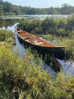
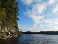
I did some exploring the other day. There was a trail leading to a lake on one of my hunting paths, so I decided to check it out. Started out in weeds, but opened up into a large, rock lined beauty, with a nice beach at the south end. Poked around in the bush until I found evidence of humans, looked like someone had a walleye camp there, old filleting shelf and one of those big wire traps they used to use to keep fish alive in the lake. Anyway, I suspect it is my new "secret" lake, hope to get back next week with a fishing rod.
Kbz0CmA.jpg

0yoLV1H.jpg
 
The blackfly season this year is horrific
Nothing works and the flies are getting smaller so they fit in tiny holes
Its been cool and rainy and ideal conditions for the blackfly
We almost ran into a caribou today
No pic but I will try tomorrow
The bou was walking the road!
 
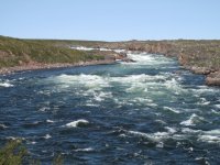
Goonstroke, is Ripogenous Stream the same waterway that Google Earth labels as Duck Brook at the west end of Harrington Lake? I see a semi-circular rapid mid-way between Harrington and Rip Lake that perhaps matches your image.
 
Goonstroke, is Ripogenous Stream the same waterway that Google Earth labels as Duck Brook at the west end of Harrington Lake? I see a semi-circular rapid mid-way between Harrington and Rip Lake that perhaps matches your image.
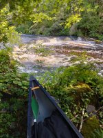
Yes, exactly. Unlike some rapids that hide in the shade that one looks as prominent on the satellite as on the ground, (45.929641, -69.227255). I portaged that one and ran everything else. It was an up and then down trip so I had seen everything on the way up.

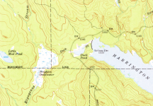
Ripogenus Stream comes into Brighton Deadwater from the north, where Duck Brook joins it from Harrington. When I was there Duck Brook was bringing more water than upper Rip Stream, but I don't know if that's typical or if it was just a big release from the Harrington dam. Here's a snip from the 1954 topo (not for driving as the roads have moved):
1692578600484.png

Back in the day there was also a portage trail from the deadwater to Little Mud Pond and then Mud Pond. That area's been cut over pretty hard so it's probably beyond my bushwhack pain threshold. Mud Brook comes out on Chesuncook opposite Sandy Point campsite.
 
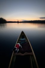
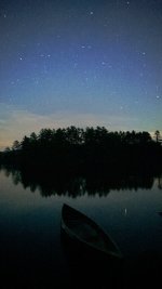
Grafton Pond, Grafton, New Hampshire, last night.

One of my dogs (the calmer one) relaxing on her bed in my Northstar Northwind 16:

IMG_4344.jpeg

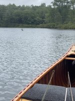
There are seven loons on the pond right now. A chorus of six of them:


Looking back out on the pond from the launch at the end of the paddle:

IMG_4355.jpeg
 
Back
Top