Really enjoying the great trip reports from folks being posted so far. We're getting hit with the white stuff today and most people are staying at home. So thought I'd add another report from warmer days...this one from August 2010. Might be useful for southern Ontario folks looking a short loop. Southwest of Gravenhurst is some Crown Land, part of the Severn River Conservation Reserve. The main access lake for this loop, Nine Mile Lake, is heavily dotted with cottages but the other finger lakes in the region allow for some pretty decent camping. After securing a vehicle at the public boat launch, one heads southward to the mouth of the Gibson River which begins a meandering flow through wetland marshes. At this point one loses sight of any other folks and I would spend the next 4 days with only an occasional bushplane flying to the nearby fly-in fish camp on the adjacent lake system to disrupt the serenity. I'm not much of an ultralighter, so brought along a lot of luxury foods and gear. Portages are very short (longest = 650m) so a double carry wasn't a waste of time. Plus I'm never in a rush on these sort of trips.
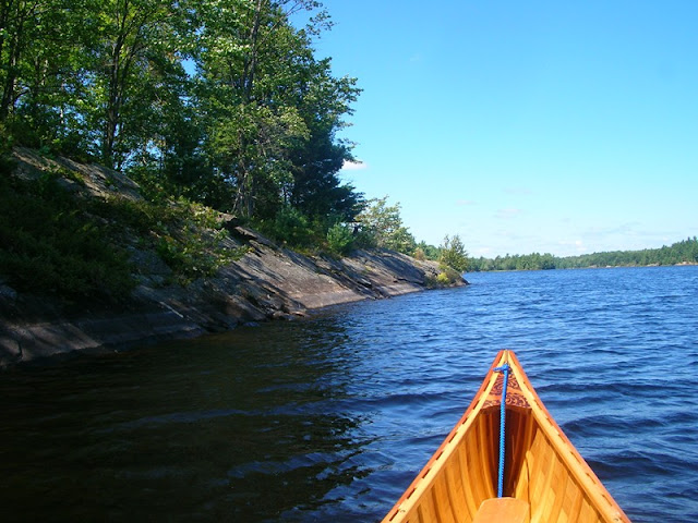
Start of the Gibson

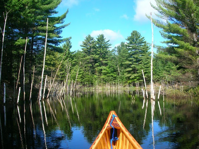
Marshy banks

In some places the river narrows to just a width of canoe only to open up again. Water levels were typically low this late in the season, but thanks to the efforts of many beavers, the majority is the river is certainly accessible by canoe with some minor lift-overs and 3 short portages of 75 meters or less. It was over this marshy territory that I spotted a pair of provincially significant Red Shouldered Hawks with their nervous "Kee-Ahh" shrieks. Very cool.
Narrow Section

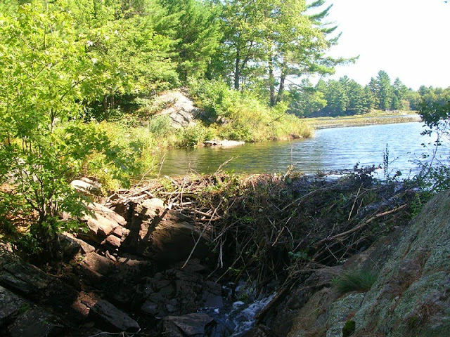
Beaver dam holding back a pond
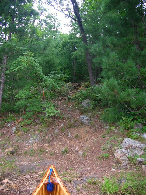
Made it though some of the portage sections with plenty of blown down trees and overgrown trail heads meaning not too many folks come down through this route. After this point, the river empties into a series of long, narrow lakes that loop back in a generally northwest direction. The lakes tend to have sloping granite shores making landing a bit of a tricky affair.
Start of mini portage
Somewhere in there is a trail
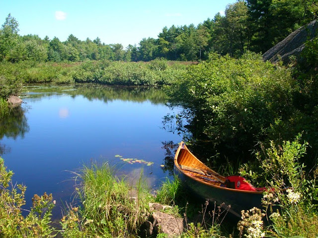
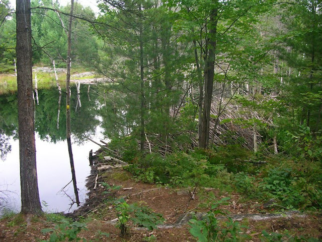
End of River Section
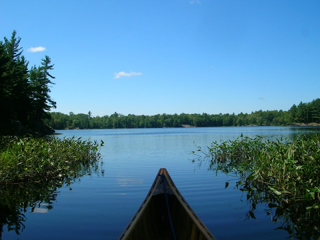
Lake Paddling
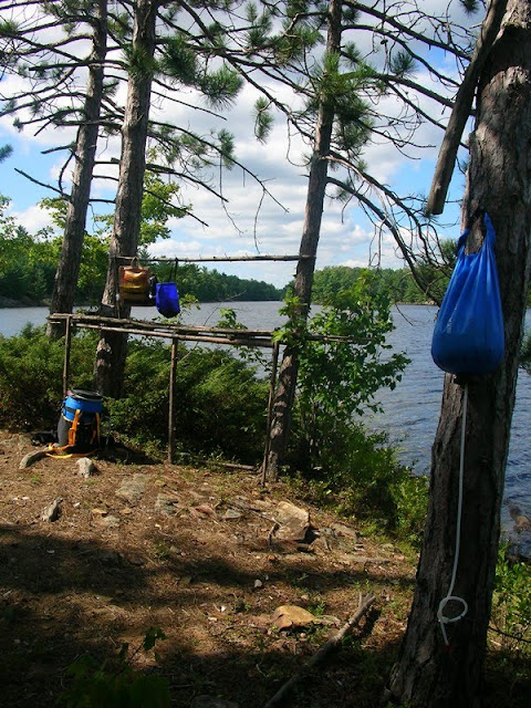
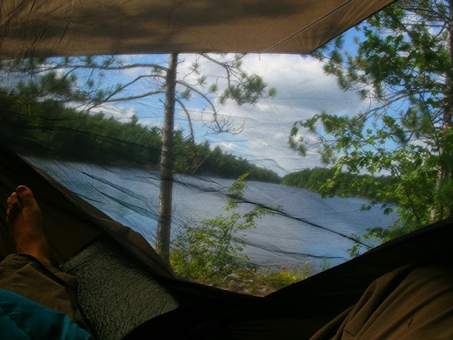
Managed to find a very clean site on a small peninsula on Woodland Lake that gave a fantastic 3-sided view of the water. This site has been frequented by other folks who've rigged up bush kitchen table and decent firepit so the site has an established feel but at least it was spotless on arrival. Set up my Hennessy Hammock shelter in a protected area away from the kitchen. Nice night sleeping to the sounds of a nesting Whip-poor-will and the haunting "Who-cooks-for-you, who-cooks-for-you-all" hooting of a Barred Owl
Camp Kitchen;
The Sleeping Quarters

View from the hammock
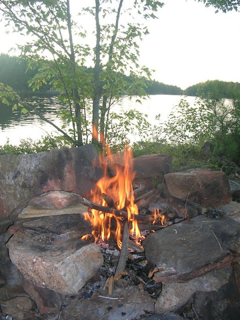
Nice fire that night
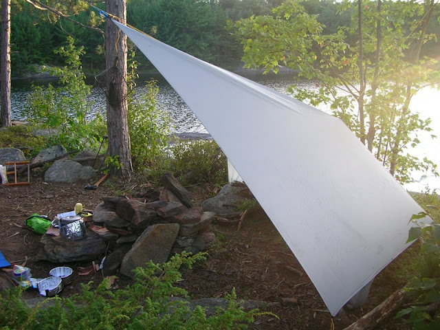
Spent the next day huddled in camp as rain moved in. Stayed totally dry in the hammock with its strange asymmetrical rainfly design. Once the steady rainfall relented in the late afternoon, the winds changed and started blowing icy cold from the north. To get any cooking done, I set up a tarp windblock behind the firepit so rigged up a modified Diamond fly with a high peak but low profile. This worked to use the cooking stove that evening. Got down to 7 degrees Celsius that night but seemed chillier with the relentless wind.
Rigged Tarp against wind
Thankfully the sun came out the next day, but the winds still blew from the north (my direction of travel). To get to the next series of lakes in the loop involved a short wading through a boulder infested channel and another more significant uphill portage that follows a pathetically flowing waterfall.
Start of uphill portage
Packed up for the climb

Reaching the top of the climb, I realized why the waterfall flow was so minimal. The largest beaver dam I've ever come across had flooded the forest floor and created a mini lake. It was eerie paddling through the stand of flooded birch that followed...
Huge dam - curves to right of photo
Shot of the dam closeup

Birch tree stand
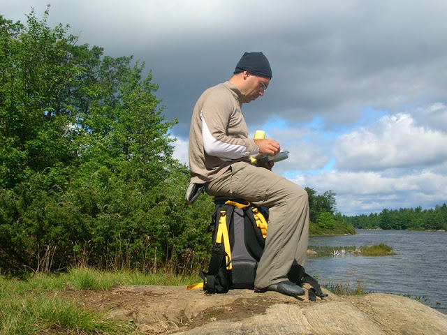
Sure enough I spotted 2 beavers busy at work although they slapped their tails and fled underwater to safety before I could turn the camera one. Oh well. The next lake had some wonderful rock formations and much evidence of more wildlife. Headwinds certainly made getting to shore for camp a pleasure. Managed to find a small sheltered site. Of course, sheltered also means the bugs come out ferociously so dinner had to be eaten on the windy point with a cap and wool sweater to beat the flies and the chilly north breeze.
"Stone beach" shoreline

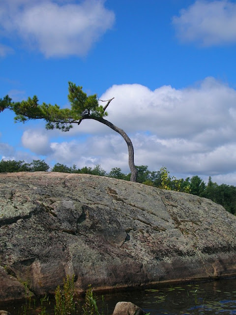
Consistent prevailing winds shaped this pine
Dinner on the point
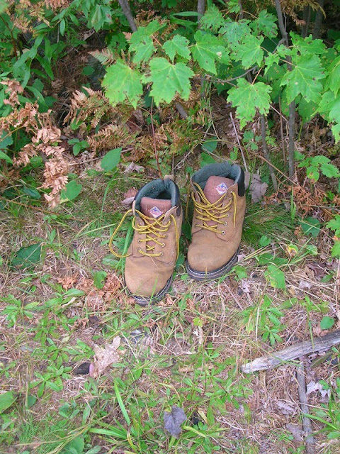
The next day involved the longest portage of the trip - a mild 650 meters or so through some uneven terrain that also serves as a snowmobile trail in the winter. While lugging the gear for the first carry, I came across a pair of boots, then a single sock, then another, and then a pair of pants! This weird bush strip-tease had me convinced that the only human I'd encounter on my trip was some sort of frolicking nudist perv catching unwary canoeists at the end of the portage...very grateful that my solo trip remained a solo trip when no one came out of the bushes to reclaim their clothing.
Boots, 1st Sock, 2nd Sock spotted...

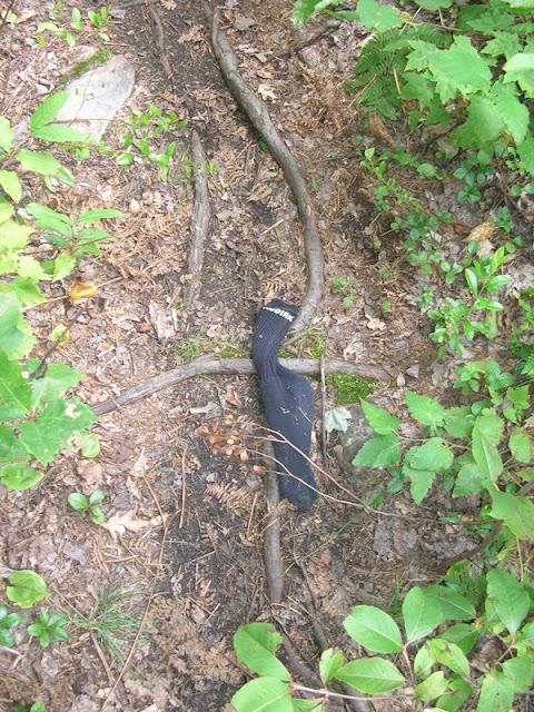
and then this...
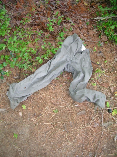
Who loses their pants in the bush?
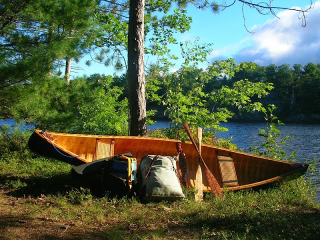
On the last leg of the trip, the sun came out and warmed the remainder of the day nicely. Here's the gear and canoe at the end of the final portage before the uneventful paddle back to the public launch.
I'm experimenting with the Gmap4 website: Clicking here should open a new window with a top map and the track route for anyone interested...
Start of the Gibson
Marshy banks
In some places the river narrows to just a width of canoe only to open up again. Water levels were typically low this late in the season, but thanks to the efforts of many beavers, the majority is the river is certainly accessible by canoe with some minor lift-overs and 3 short portages of 75 meters or less. It was over this marshy territory that I spotted a pair of provincially significant Red Shouldered Hawks with their nervous "Kee-Ahh" shrieks. Very cool.
Narrow Section
Beaver dam holding back a pond
Made it though some of the portage sections with plenty of blown down trees and overgrown trail heads meaning not too many folks come down through this route. After this point, the river empties into a series of long, narrow lakes that loop back in a generally northwest direction. The lakes tend to have sloping granite shores making landing a bit of a tricky affair.
Start of mini portage
Somewhere in there is a trail
End of River Section
Lake Paddling
Managed to find a very clean site on a small peninsula on Woodland Lake that gave a fantastic 3-sided view of the water. This site has been frequented by other folks who've rigged up bush kitchen table and decent firepit so the site has an established feel but at least it was spotless on arrival. Set up my Hennessy Hammock shelter in a protected area away from the kitchen. Nice night sleeping to the sounds of a nesting Whip-poor-will and the haunting "Who-cooks-for-you, who-cooks-for-you-all" hooting of a Barred Owl
Camp Kitchen;
The Sleeping Quarters
View from the hammock
Nice fire that night
Spent the next day huddled in camp as rain moved in. Stayed totally dry in the hammock with its strange asymmetrical rainfly design. Once the steady rainfall relented in the late afternoon, the winds changed and started blowing icy cold from the north. To get any cooking done, I set up a tarp windblock behind the firepit so rigged up a modified Diamond fly with a high peak but low profile. This worked to use the cooking stove that evening. Got down to 7 degrees Celsius that night but seemed chillier with the relentless wind.
Rigged Tarp against wind
Thankfully the sun came out the next day, but the winds still blew from the north (my direction of travel). To get to the next series of lakes in the loop involved a short wading through a boulder infested channel and another more significant uphill portage that follows a pathetically flowing waterfall.
Start of uphill portage
Packed up for the climb
Reaching the top of the climb, I realized why the waterfall flow was so minimal. The largest beaver dam I've ever come across had flooded the forest floor and created a mini lake. It was eerie paddling through the stand of flooded birch that followed...
Huge dam - curves to right of photo
Shot of the dam closeup
Birch tree stand
Sure enough I spotted 2 beavers busy at work although they slapped their tails and fled underwater to safety before I could turn the camera one. Oh well. The next lake had some wonderful rock formations and much evidence of more wildlife. Headwinds certainly made getting to shore for camp a pleasure. Managed to find a small sheltered site. Of course, sheltered also means the bugs come out ferociously so dinner had to be eaten on the windy point with a cap and wool sweater to beat the flies and the chilly north breeze.
"Stone beach" shoreline
Consistent prevailing winds shaped this pine
Dinner on the point
The next day involved the longest portage of the trip - a mild 650 meters or so through some uneven terrain that also serves as a snowmobile trail in the winter. While lugging the gear for the first carry, I came across a pair of boots, then a single sock, then another, and then a pair of pants! This weird bush strip-tease had me convinced that the only human I'd encounter on my trip was some sort of frolicking nudist perv catching unwary canoeists at the end of the portage...very grateful that my solo trip remained a solo trip when no one came out of the bushes to reclaim their clothing.
Boots, 1st Sock, 2nd Sock spotted...
and then this...
Who loses their pants in the bush?
On the last leg of the trip, the sun came out and warmed the remainder of the day nicely. Here's the gear and canoe at the end of the final portage before the uneventful paddle back to the public launch.
I'm experimenting with the Gmap4 website: Clicking here should open a new window with a top map and the track route for anyone interested...