Day 4
Waking up the next morning on Lows, we found blue skies, and calm seas.
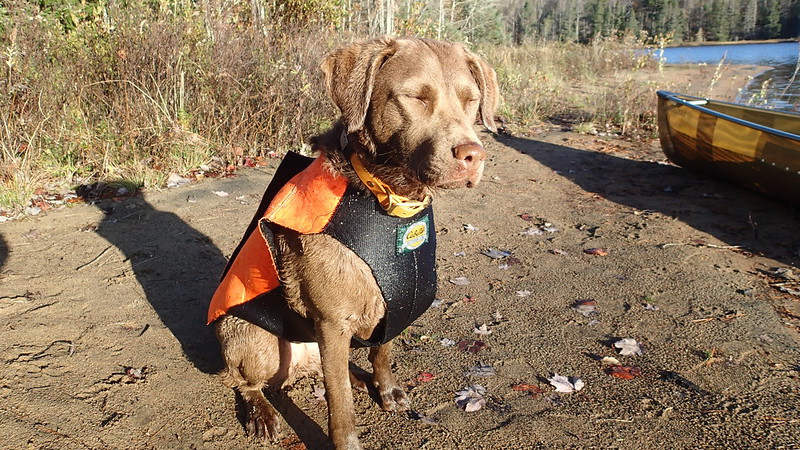
Cricket enjoys a little sunshine before leaving site 20 and heading to Bog River:
 PA200104
 by
Barry Rains, on Flickr
Are next destination was uncertain. Our first goal for the day was to get to Hitchen's Pond, just past the upper dam. So we struck out. The sun was blazing and of course right in front of us. Not only was it getting warmer than I care for, I was struggling to see. Still, it was nice to have some sun shining upon us. So we paddled and crossed another infamous bog on the Bog River and made it to Lows upper dam without incident.
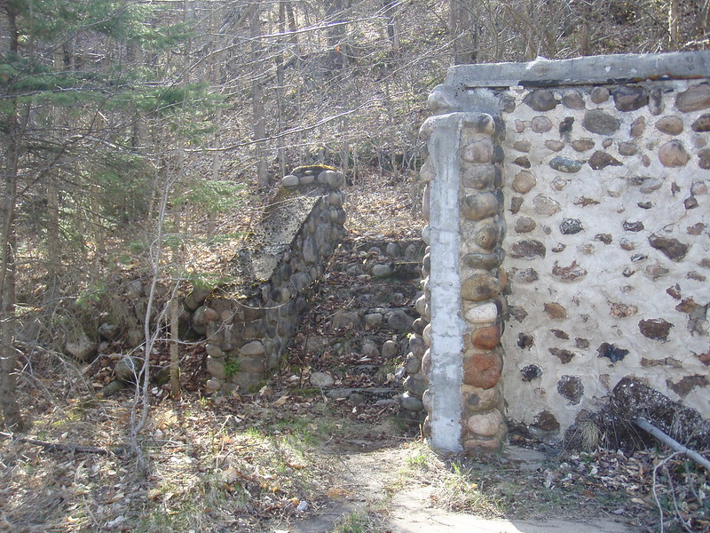
There's a short carry around the upper dam and then you carry past some old ruins and a kiosk with a lot of information about the site and business man AA Lows. Some good reading. These pics are from a previous trip:
 P5050210
 by
Barry Rains, on Flickr
 P5050208
 by
Barry Rains, on Flickr
In Spring, there are a lot of flowers that still bloom among the ruins from a time when this was a bustling place. It was still before noon on Hitchens Pond and I knew that there were only a couple of sites left before I hit Lows Lower dam. This is where most people end their trip, but I was to continue past the lower dam and there are no designated sites again until reaching Round Lake. As I did on my 2013 trip, I made the decision to go for it. We reached the Lower dam and made the carry across the breast of the dam and down to the river. This is a beautiful river with some class 2 rapids and some carries. The water turned out to be plenty for paddling except the rapids. I scraped the hell out of the canoe on the first class 2 rapid and realized that I may not be able to run portions of the river without causing serious issues to the light weight hull. In 2013 there was more water and I was able to run the river in my wood canvas prospector.
(
Edit 10-25-2021 - added additional description and some photos of the river)
The river is, in my opinion the prettiest part of the trip. But I'm partial to rivers.
 PA200114
 by
Barry Rains, on Flickr
 P5060230
 by
Barry Rains, on Flickr
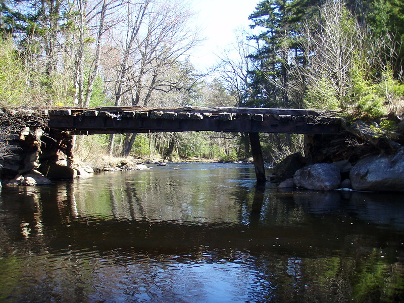
The first carry is around split rock falls and the second is around Pa's Falls. Both are marked now, they weren't back in 2013. At Pa's falls there is an old bridge that takes you across the river and is an old jeep road that takes you from Pa's falls on Bog river, all the way past the confluence of Bog river and Bog Stream. Taking this would be about the same amount of carrying as I would have if I kept heading down river from Pa's falls, but I recalled that it was rough terrain with no markings. In Spring 2013, there was plenty of water and I ran all the rapids to the confluence. But I was concerned there might not be enough water this time. After a quick lunch, I decided I would cross the river and try to make the carry as quick as possible. I was double carrying on this trip. It was a smooth carry and took about 30 minutes each trip. The trail is clearly marked on the paddler's map. So now my gear was on Bog Stream above the confluence with Bog River and there are limited sections that can be paddled. My best guess is maybe 300-400 yards total at best and intermittent. The trail that I had traversed crosses the river via a ratty old bridge and roughly parallels the stream. I decided to forego the repeated in/out of carrying the flat sections and try to make Round Lake by dark using the trail and carry that ascends along the river right bank.
The bridge I crossed at Pa's Falls to carry over to Bog Stream:
 P5060239
 by
Barry Rains, on Flickr
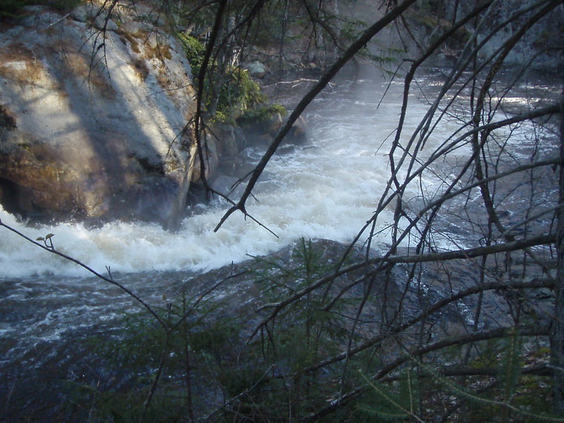
Drop along Bog Stream Carry to Round Lake
 P5070255
 by
Barry Rains, on Flickr
This turned out to be a never ending slog that kept me from reaching a site on Round lake until after dark. I even had to jettison the canoe along the carry so that I could make it to Round Lake and some semblance of a camp site. There really is no place to set a camp along the white water section of the carry. It is a rough trail of rock and roots, single track width and hemmed in by thick, rolling woods on one side and the river on the other. The carry, same as it did back in 2013 gave me a thorough lashing. As the darkness overcame me on Round Lake and all but my canoe had made it, i was dead tired and my feet were blistered. I went straight to the lake to fill my gravity filter and then made a hasty set up of our tent. While the water bottles were filling and Cricket finally got supper, I removed my portage shoes and gazed at the blisters. I figured a good night's sleep and fresh dry socks would allow me to get my canoe at first light to finish the trip.
Day 5
The next morning Cricket and I broke camp, moved all the gear to the lakeside, and set out for the canoe. I felt way better then the previous night, but my feet were still tender. I grabbed the canoe and we headed back. As we reached the gear and loaded up the canoe for the final paddle across Round Lake and into Little Tupper Lake, the skies opened up and ice cold rain came down. It continued to rain for the duration of our paddle back to the truck. I didn't take pictures of this carry, but I think I can get some from another trip and will add them later.
Copper, my previous dog was the same age when she did her first ADK trip from Long to Tupper via the Raquette river. I swore I wouldn't take here again but she turned out to be an exceptional tripping dog who did many trips some up to 13 days. I think that given that and the progress she made from Lows to the end of the trip, she will turn out to be a great tripping dog in her own right.
Cricket finally succumbs to the total sum of what she accomplished over 5 days as we near the LTL headquarters in the rain.
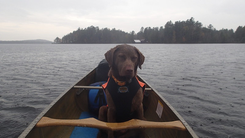 PA210117
 by
Barry Rains, on Flickr
I will try to append some of my passages with some map details and any other photos I find. But it's time to get back to work and it may take a little time. But I will answer any questions the best I can.
Cheers,
Barry
PA200104 by Barry Rains, on Flickr
P5050210 by Barry Rains, on Flickr
P5050208 by Barry Rains, on Flickr
PA200114 by Barry Rains, on Flickr
P5060230 by Barry Rains, on Flickr
P5060239 by Barry Rains, on Flickr
P5070255 by Barry Rains, on Flickr
PA210117 by Barry Rains, on Flickr
