I just got back from a 5 day fall canoe trip that started 10/17 and ended on 10/21. I paddled the Whitney Wilderness Area loop from the Little Tupper Lake headquarters, traveling clockwise on the map and returning to the headquarters to complete the loop. Little Tupper Lake, Rock Pond, Hardigan Pond, Little Salmon Lake, Lilly Pad Pond, Shingle Shanty Brook, Lake Lila, Harrington Brook, Clear Pond, Bog Lake, Lows Lake, Bog River, Hitchen's Pond, continuing past Lows Lower dam on the Bog river, Bog Stream, Round Lake, and finishing at Little Tupper Lake.
The weather was chilly and wet generally, but I did get some sun on day 4. I also missed the Fall colors by about a week according to my Brother, who spent the previous week at Lake Placid with his wife RV camping and bike riding. I traveled with my 14 mo. old chessie Cricket who has never done a multi day trip and this was only her 5th time in the canoe. The last time I did this loop in its entirety was 2013 with a much more experienced 6 y.o chessie dog. Like much of the ADK's and North woods I've experienced, the terrain is hilly, wet, uneven terrain with intermittent wetlands (bogs), and the woods are thick with young pines. The water was cold and tannin stained.
Day 1
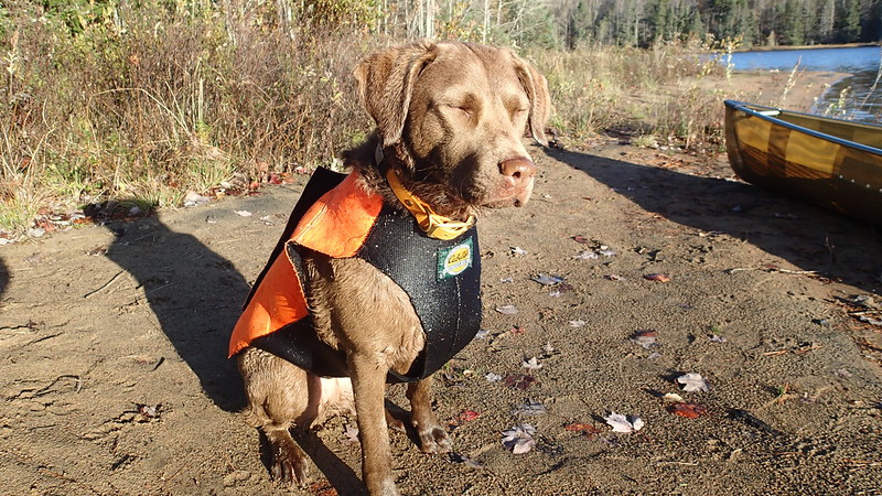
Due to my work requirements I had to alter the start time and left my home at about 1AM Sunday and was at the put-in at L Tupper Lake at 11 AM. The day prior I had taken Cricket on a fairly hard 8 mile hike in the mountains of PA in an attempt to curb her energy, but she slept most of the way North and at the put-in, was a powder keg of energy.
 PA170003 by Barry Rains, on Flickr
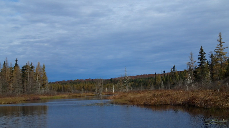
Cricket is about 68 lbs and 20 lbs. less than my previous chessie Copper. The canoe is a Bell Northstar and you can see I took the front seat out. This was the intended spot for Cricket, and is where Copper would be when traveling by canoe. As soon as we shoved off, it was apparent that this wasn't going to work trim wise and so for the rest of the trip, our gear, consisting of one portage pack and one 30L food barrel would reside all the way up front. Cricket was able to move between the kneeling thwart and forward thwarts. Cricket, as it turns out, probably wasn't quite ready for this trip. She wouldn't stop trying to get out of boat and so I had to be on my guard and was quite vocal with her. It didn't take long to realize that she needed to swim for a while. LTL is a fair size lake and she's a strong swimmer but it made me nervous as we crossed the first bay. She chugged along though and I kept looking back to offer words of encouragement. Looking at the map, I saw that there was a hiking trail that ran along the lake only a couple hundred feet from the shoreline so I decided that I would collect the dog back in the boat and head to the shore line and hop on the trail. It was safer and maybe it would burn off enough energy for her to relax. The trail was a nice trail and was also gave us the first of two bear sightings. On our way back to the canoe, I was throwing fetch sticks in the woods when Cricket let out an uncharacteristic growl and took off. I quickly saw that it was a bear that had wondered onto the trail in front of us. I called for Cricket who immediately came back. The bear continued to high tail it up the path in the direction we were traveling. I didn't get too many pics on Little Tupper Lake because I was managing the puppy.
A lot of the trees were stripped bare, but there were flashes of color all around to contrast with the pines:
 PA170006 by Barry Rains, on Flickr
Part of the trail not far from where we saw the bear:
 PA170009 by Barry Rains, on Flickr
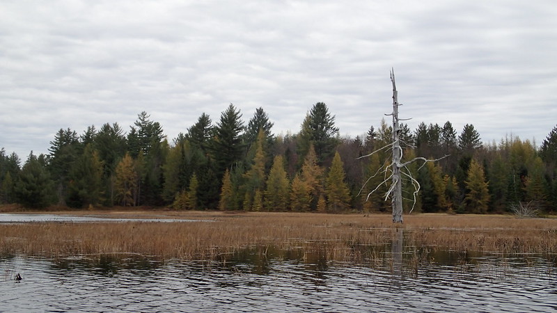
We stopped at about where site 12 would be and found that it had been shutdown for regeneration:
 PA170013 by Barry Rains, on Flickr
Back in the canoe and heading for the Rock Pond Carry. The weather was rather dreary and the rain came in fits and starts:
 PA170016 by Barry Rains, on Flickr
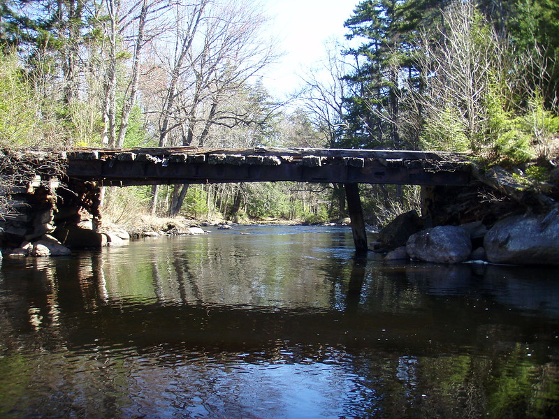
Getting back into the canoe, the hike did not help Cricket's demeanor. My goal was to get to Rock Pond for the first night and after more swimming and one short carry at the outlet, we were at Rock Pond. It had begun to rain as we reached site 30. The site sits up above the lake a bit and has a decent tent pad in a clearing just below the area where the fire ring is situated. I set up our CCS tarp near the fire ring so we had a place to eat and get dry. I set the tent on the pad down below. I was tired by the time it got dark from driving all night and ready for bed. Cricket was dry enough to be in the tent so we turned in. I had brought an MSR Hubba Hubba 2 man tent that I had never used....in fact it still had the tags on it from when I bought it several years ago. I did a dry run set up a couple days before the trip and the seam tape was suspect. I decided to bring my Big Agnes UL 2 person tent, but at the last second I decided to bring the MSR. Son of a b*tch if I didn't wake up during a windy rain squall to find that the fly was leaking and my down quilt was getting wet. So I quickly got out of my sleeping clothes and put on damp paddling clothes and my head lamp and went outside. For some reason I also threw in my cuben fiber tarp into the kit at the last second. I figured at 8 ounces it would be a good idea. I quickly deployed that tarp over the tent and after another round of changing clothes slept great through the rest of the night.
Day 2 (edit: 10-25-2021 - Section from Rock Pond to Hardigan Pond was accidentally deleted from the original post)
Having woke energized since I started day 1 immediately following a long drive overnight, I was expecting the worst and hoping for the best in regards to the next carry from Rock Pond to Hardigan Pond. I have previously spoken of this carry and the waist deep mud that kicked off the first 75-100 yards of the carry. I found the sign for the carry on the other side of the pond and was pleasantly surprised to see that there was no mud. Instead there was a moss covered single track through a stand of young pines and picking up an old jeep trail. The middle section was dominated by three or so major beaver dams before changing back to a nice even Jeep trail. Eventually the carry leaves the Jeep trail fir another single track leading to the Hardigan Pond put in.
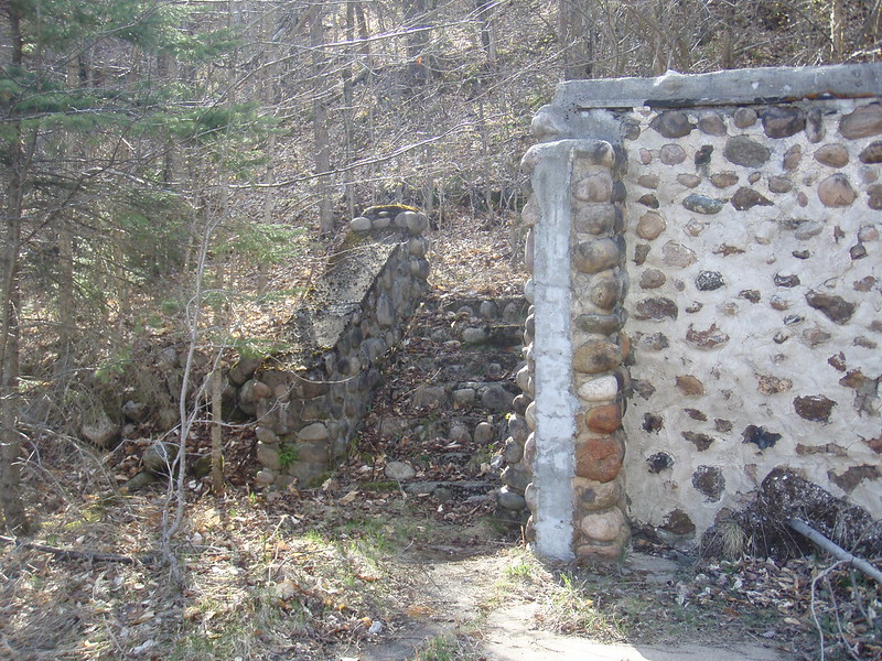
In 2013 the carry began with a river of mud:
 P5030057 by Barry Rains, on Flickr
The trail follows the edge of several large beaver dams and is wet:
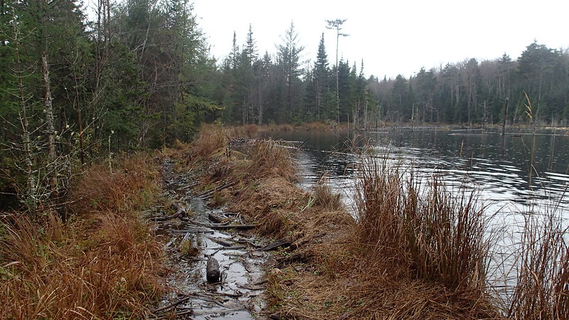 PA180053 by Barry Rains, on Flickr
 PA180049 by Barry Rains, on Flickr
 PA180048 by Barry Rains, on Flickr
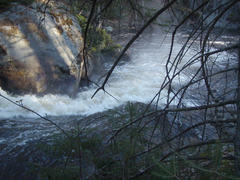
One dam had a major blowout that needs to be traversed and is about 6' deep.
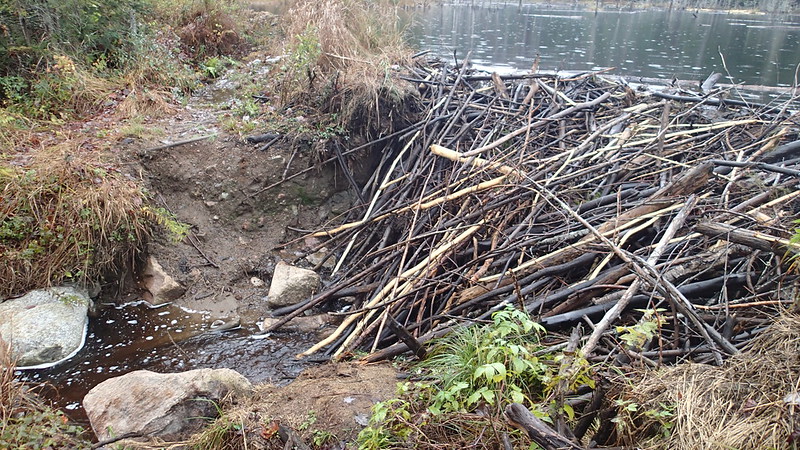 PA180052 by Barry Rains, on Flickr
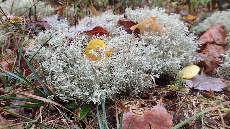
Some flora along the carry:
 PA180055 by Barry Rains, on Flickr
 PA180056 by Barry Rains, on Flickr
 PA180032 by Barry Rains, on Flickr
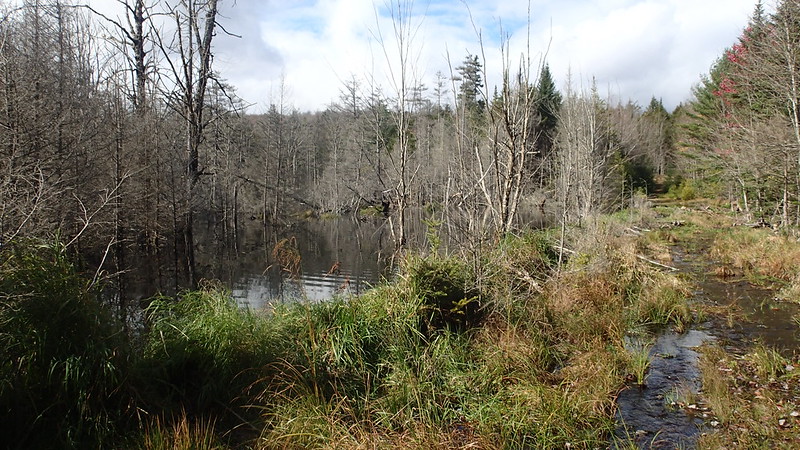
Heading out in the rain on Hardigan Pond, the next destination was LITTLE Salmon Lake. Not to be confused with Salmon Lake which is on private property. I made a little error here. First, there is no carry shown on my map. My memory from my 2013 trip is that I was able to paddle and pole generally from the Hardigan pond outlet through a marsh to LITTLE Salmon Lake. But on this trip, I saw a sign for a carry. Maybe someone can confirm, but I believe that it is marked Salmon Lake carry and not LITTLE Salmon Lake. Why would there be a carry marked to a lake on private lands I thought? I moved to the outlet and commenced what turned out to be a fairly epic drag through a choked water way that traversed a huge wetland. Half way through (about 35 minutes), I was soaked, dazed, and maybe even lost! The map told me to keep going but I wasn't confident and really didn't want to turn around. I grabbed the map, dug out my compass, and a granola bar and tried to steady myself on the floating bog mass that seemed to sink every time I shifted my weight. Looking out all I saw was more of the same marsh and out in the distance some mountain peaks. Once orientated, I trusted my tools and set out onward. After about 10 more minutes, the outlet began to open up and I got Cricket and myself back in the canoe and headed for the Lilly Pad Pond Carry. I happened to look back after we were back in the canoe and damnit if I didn't see a carry sign at the wood line. So keep this in mind if your'e heading out on this. While dragging through, I thought how dumb it was not to create a carry so that people didn't tear up the wetland habitat and apparently they did. BUT....they should add the word LITTLE to the sign to be correct, or maybe I misread. The next person through should confirm and report back.
Follow the outlet the map said, it would be fun they said:
 PA180059 by Barry Rains, on Flickr
Dragging the outlet through a bog:
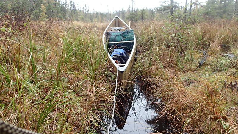 PA180058 by Barry Rains, on Flickr
 PA180057 by Barry Rains, on Flickr
 PA180060 by Barry Rains, on Flickr
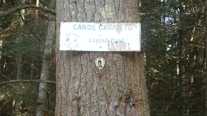
The bog opens up and were paddling to the Lilly Pond Carry. Cricket is looking at the sign and thinking, "Dude, can't you read the sign!":
 PA180062 by Barry Rains, on Flickr
 PA180065 by Barry Rains, on Flickr
My goal for day two was Lake Lila. So I needed to get to Lilly Pad Pond via the next carry, paddle to the Single Shanty Brook carry, and make my way up Shingle Shanty Brook to Lake Lila. A note here: in Spring 2013, there was still litigation as to whether the entire Shingle Shanty Brook should be considered navigable with right of way for public access. I think at the time I was following the legal process on ADKforum which one can go back to to read the detailed reports of the court battle. When I was there my best understanding was that I could access this lower part legally, and in fact there were no 'no trespassing' signs because the courts had ordered them taken down. So that's what I did. The landowner's eventually won out, and now you need to use the long established carry that bypassed the private portions of the brook. The carry, in my opinion is preferable to the never ending sinuous winding of the brook itself.. It constantly turns back on itself and after a while becomes almost obnoxious.
2013 access from Lilly Pad pond on the private section of Shingle Shanty Brook:
 P5040119 by Barry Rains, on Flickr
2013 access from Lilly Pad pond on the private section of Shingle Shanty Brook:
 P5040121 by Barry Rains, on Flickr
The weather was chilly and wet generally, but I did get some sun on day 4. I also missed the Fall colors by about a week according to my Brother, who spent the previous week at Lake Placid with his wife RV camping and bike riding. I traveled with my 14 mo. old chessie Cricket who has never done a multi day trip and this was only her 5th time in the canoe. The last time I did this loop in its entirety was 2013 with a much more experienced 6 y.o chessie dog. Like much of the ADK's and North woods I've experienced, the terrain is hilly, wet, uneven terrain with intermittent wetlands (bogs), and the woods are thick with young pines. The water was cold and tannin stained.
Day 1
Due to my work requirements I had to alter the start time and left my home at about 1AM Sunday and was at the put-in at L Tupper Lake at 11 AM. The day prior I had taken Cricket on a fairly hard 8 mile hike in the mountains of PA in an attempt to curb her energy, but she slept most of the way North and at the put-in, was a powder keg of energy.
PA170003 by Barry Rains, on FlickrCricket is about 68 lbs and 20 lbs. less than my previous chessie Copper. The canoe is a Bell Northstar and you can see I took the front seat out. This was the intended spot for Cricket, and is where Copper would be when traveling by canoe. As soon as we shoved off, it was apparent that this wasn't going to work trim wise and so for the rest of the trip, our gear, consisting of one portage pack and one 30L food barrel would reside all the way up front. Cricket was able to move between the kneeling thwart and forward thwarts. Cricket, as it turns out, probably wasn't quite ready for this trip. She wouldn't stop trying to get out of boat and so I had to be on my guard and was quite vocal with her. It didn't take long to realize that she needed to swim for a while. LTL is a fair size lake and she's a strong swimmer but it made me nervous as we crossed the first bay. She chugged along though and I kept looking back to offer words of encouragement. Looking at the map, I saw that there was a hiking trail that ran along the lake only a couple hundred feet from the shoreline so I decided that I would collect the dog back in the boat and head to the shore line and hop on the trail. It was safer and maybe it would burn off enough energy for her to relax. The trail was a nice trail and was also gave us the first of two bear sightings. On our way back to the canoe, I was throwing fetch sticks in the woods when Cricket let out an uncharacteristic growl and took off. I quickly saw that it was a bear that had wondered onto the trail in front of us. I called for Cricket who immediately came back. The bear continued to high tail it up the path in the direction we were traveling. I didn't get too many pics on Little Tupper Lake because I was managing the puppy.
A lot of the trees were stripped bare, but there were flashes of color all around to contrast with the pines:
PA170006 by Barry Rains, on FlickrPart of the trail not far from where we saw the bear:
PA170009 by Barry Rains, on FlickrWe stopped at about where site 12 would be and found that it had been shutdown for regeneration:
PA170013 by Barry Rains, on FlickrBack in the canoe and heading for the Rock Pond Carry. The weather was rather dreary and the rain came in fits and starts:
PA170016 by Barry Rains, on FlickrGetting back into the canoe, the hike did not help Cricket's demeanor. My goal was to get to Rock Pond for the first night and after more swimming and one short carry at the outlet, we were at Rock Pond. It had begun to rain as we reached site 30. The site sits up above the lake a bit and has a decent tent pad in a clearing just below the area where the fire ring is situated. I set up our CCS tarp near the fire ring so we had a place to eat and get dry. I set the tent on the pad down below. I was tired by the time it got dark from driving all night and ready for bed. Cricket was dry enough to be in the tent so we turned in. I had brought an MSR Hubba Hubba 2 man tent that I had never used....in fact it still had the tags on it from when I bought it several years ago. I did a dry run set up a couple days before the trip and the seam tape was suspect. I decided to bring my Big Agnes UL 2 person tent, but at the last second I decided to bring the MSR. Son of a b*tch if I didn't wake up during a windy rain squall to find that the fly was leaking and my down quilt was getting wet. So I quickly got out of my sleeping clothes and put on damp paddling clothes and my head lamp and went outside. For some reason I also threw in my cuben fiber tarp into the kit at the last second. I figured at 8 ounces it would be a good idea. I quickly deployed that tarp over the tent and after another round of changing clothes slept great through the rest of the night.
Day 2 (edit: 10-25-2021 - Section from Rock Pond to Hardigan Pond was accidentally deleted from the original post)
Having woke energized since I started day 1 immediately following a long drive overnight, I was expecting the worst and hoping for the best in regards to the next carry from Rock Pond to Hardigan Pond. I have previously spoken of this carry and the waist deep mud that kicked off the first 75-100 yards of the carry. I found the sign for the carry on the other side of the pond and was pleasantly surprised to see that there was no mud. Instead there was a moss covered single track through a stand of young pines and picking up an old jeep trail. The middle section was dominated by three or so major beaver dams before changing back to a nice even Jeep trail. Eventually the carry leaves the Jeep trail fir another single track leading to the Hardigan Pond put in.
In 2013 the carry began with a river of mud:
P5030057 by Barry Rains, on FlickrThe trail follows the edge of several large beaver dams and is wet:
PA180053 by Barry Rains, on FlickrPA180049 by Barry Rains, on FlickrPA180048 by Barry Rains, on FlickrOne dam had a major blowout that needs to be traversed and is about 6' deep.
PA180052 by Barry Rains, on FlickrSome flora along the carry:
PA180055 by Barry Rains, on FlickrPA180056 by Barry Rains, on FlickrPA180032 by Barry Rains, on FlickrHeading out in the rain on Hardigan Pond, the next destination was LITTLE Salmon Lake. Not to be confused with Salmon Lake which is on private property. I made a little error here. First, there is no carry shown on my map. My memory from my 2013 trip is that I was able to paddle and pole generally from the Hardigan pond outlet through a marsh to LITTLE Salmon Lake. But on this trip, I saw a sign for a carry. Maybe someone can confirm, but I believe that it is marked Salmon Lake carry and not LITTLE Salmon Lake. Why would there be a carry marked to a lake on private lands I thought? I moved to the outlet and commenced what turned out to be a fairly epic drag through a choked water way that traversed a huge wetland. Half way through (about 35 minutes), I was soaked, dazed, and maybe even lost! The map told me to keep going but I wasn't confident and really didn't want to turn around. I grabbed the map, dug out my compass, and a granola bar and tried to steady myself on the floating bog mass that seemed to sink every time I shifted my weight. Looking out all I saw was more of the same marsh and out in the distance some mountain peaks. Once orientated, I trusted my tools and set out onward. After about 10 more minutes, the outlet began to open up and I got Cricket and myself back in the canoe and headed for the Lilly Pad Pond Carry. I happened to look back after we were back in the canoe and damnit if I didn't see a carry sign at the wood line. So keep this in mind if your'e heading out on this. While dragging through, I thought how dumb it was not to create a carry so that people didn't tear up the wetland habitat and apparently they did. BUT....they should add the word LITTLE to the sign to be correct, or maybe I misread. The next person through should confirm and report back.
Follow the outlet the map said, it would be fun they said:
PA180059 by Barry Rains, on FlickrDragging the outlet through a bog:
PA180058 by Barry Rains, on FlickrPA180057 by Barry Rains, on FlickrPA180060 by Barry Rains, on FlickrThe bog opens up and were paddling to the Lilly Pond Carry. Cricket is looking at the sign and thinking, "Dude, can't you read the sign!":
PA180062 by Barry Rains, on FlickrPA180065 by Barry Rains, on FlickrMy goal for day two was Lake Lila. So I needed to get to Lilly Pad Pond via the next carry, paddle to the Single Shanty Brook carry, and make my way up Shingle Shanty Brook to Lake Lila. A note here: in Spring 2013, there was still litigation as to whether the entire Shingle Shanty Brook should be considered navigable with right of way for public access. I think at the time I was following the legal process on ADKforum which one can go back to to read the detailed reports of the court battle. When I was there my best understanding was that I could access this lower part legally, and in fact there were no 'no trespassing' signs because the courts had ordered them taken down. So that's what I did. The landowner's eventually won out, and now you need to use the long established carry that bypassed the private portions of the brook. The carry, in my opinion is preferable to the never ending sinuous winding of the brook itself.. It constantly turns back on itself and after a while becomes almost obnoxious.
2013 access from Lilly Pad pond on the private section of Shingle Shanty Brook:
P5040119 by Barry Rains, on Flickr2013 access from Lilly Pad pond on the private section of Shingle Shanty Brook:
P5040121 by Barry Rains, on Flickr
Last edited: