I'm going to post this in sections as I write it to keep it from getting too overwhelming (for both you and me). I'll post the follow ups in responses to this thread.
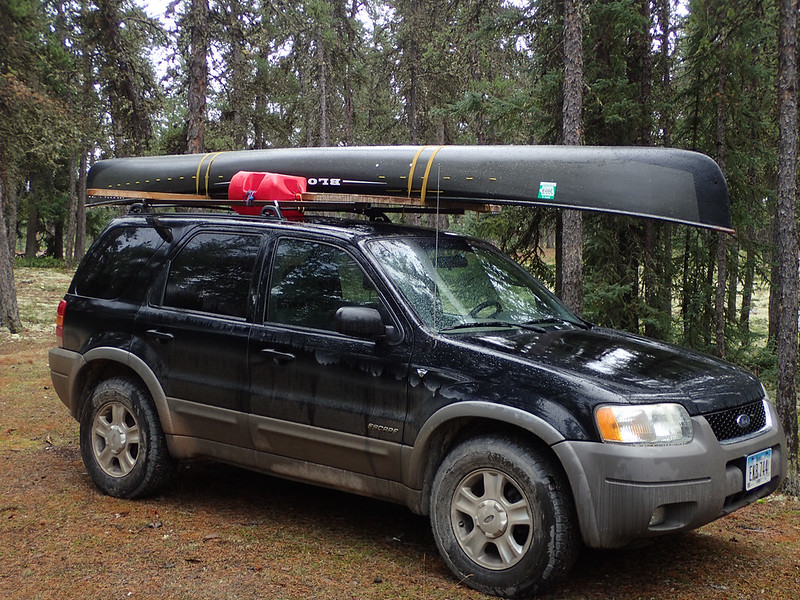
It’s a long drive from Estherville, IA to La Ronge, SK. By the time one has traveled that distance it feels like one is nearly there; only to realize that “short drive” up the gravel road to the put-in at Wollaston Lake is another 250 miles (402km). But as far as gravel roads go it’s a pretty nice drive. Speed limit is 80km/hour and that’s probably about the average speed you can expect to travel. Plenty of pot holes but most aren’t too bad and the road is plenty wide. Most of the handful of vehicles I saw were trucks hauling from the mines and they gave plenty of room.
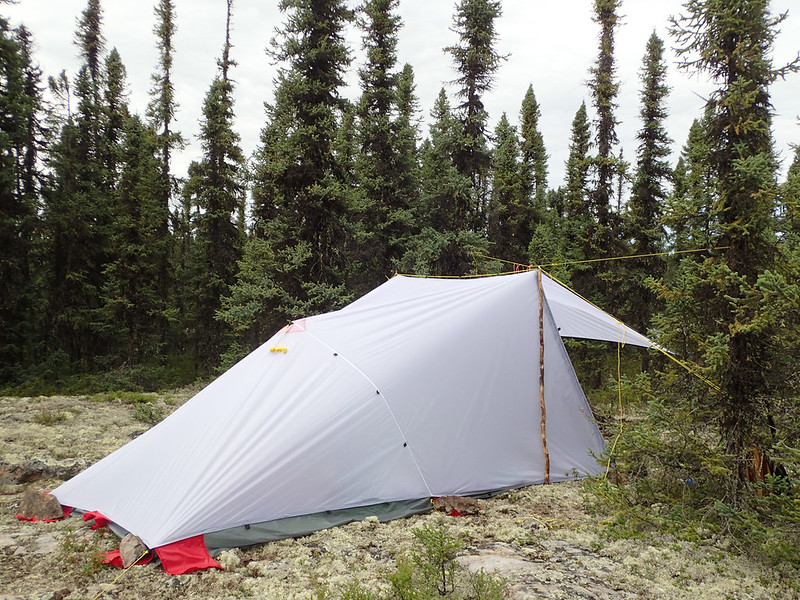
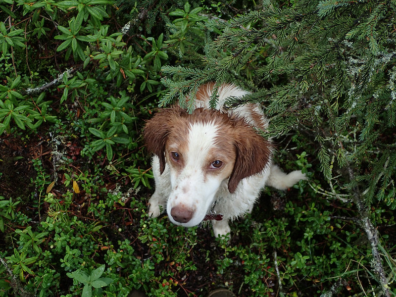
When I arrived at the put-in I found a very large campsite with around 25 different spots one could park and pitch a tent. None were in use. There were a dozen or so vehicles parked in a group. Presumably people who had either gotten a boat ride to the nearby fishing resort or across the lake to the settlement of Wollaston Lake, which has no road access. It was around 3:00 and I decided that rather than get on the water late in the day I’d get everything organized and ready for an early start in the morning. Besides, it was raining. It was August 1st and I spent the afternoon and evening wearing the heavy fleece I’d planned to leave in the vehicle for my return trip home. I decided maybe I should bring it along on the trip. That was a good decision.
 20160801_008 by Alan, on Flickr
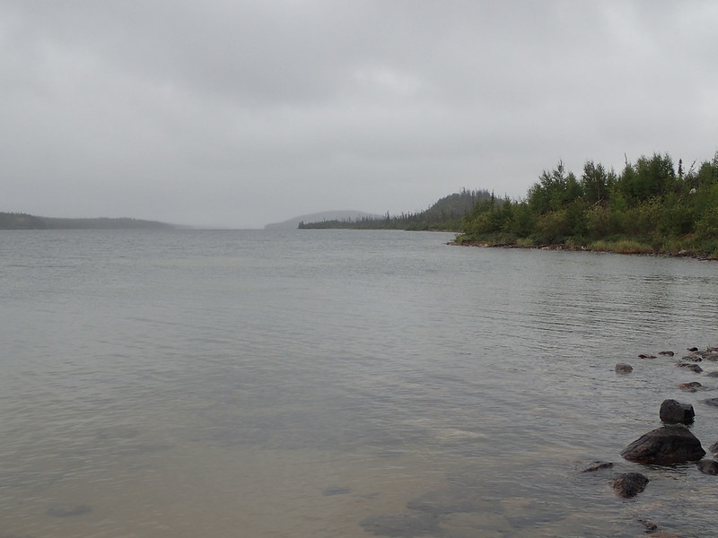
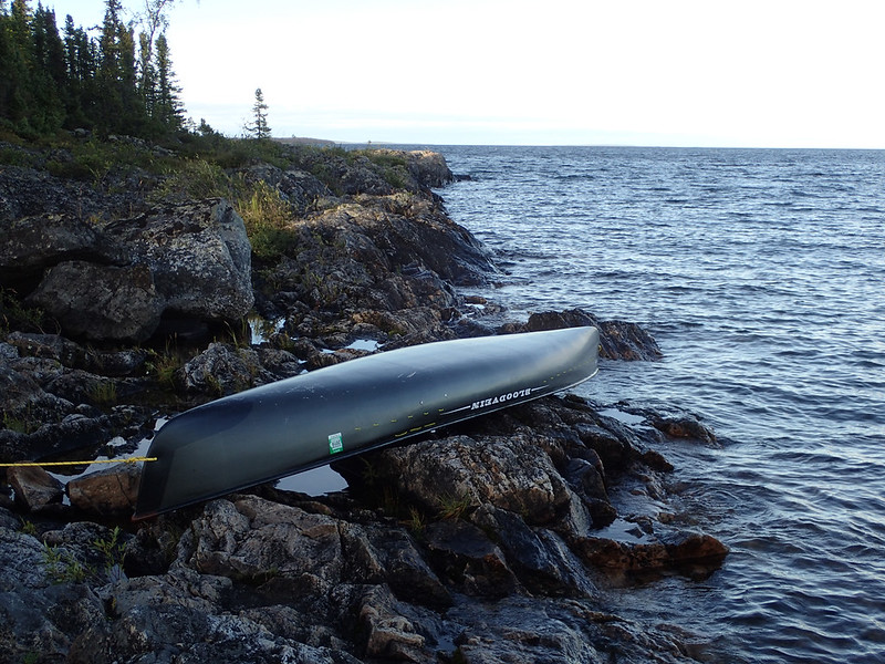
Got on on the water around 6:30am August 2nd. Took a while to calibrate my brain to the scale of the map but after that we were on our way. It sure was a strange sight to come out into a bay and realize just the bay itself was larger than a local lake I think of as being pretty big, the 2nd largest natural lake in Iowa. Once on the main lake I realized just how big it was. A myriad of islands dotted the horizon, both near and far, and between them was just a flat horizon line. I thought I’d be fine using a 1:250,000 scale map to cross Wollaston Lake, and I guess I was, but it certainly wasn’t ideal. Many islands I’d consider good sized were small enough to be omitted from the map which made locating my position sometimes difficult. It was always a guessing game trying to figure out if that island directly ahead was small enough to not be on the map or if I wasn’t where I thought I was. Some of the larger islands were 10 miles (16km) long.
 20160802_011 by Alan, on Flickr
 20160802_010 by Alan, on Flickr
 20160802_014 by Alan, on Flickr
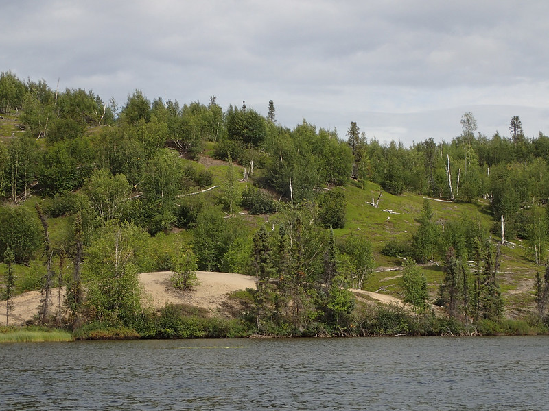
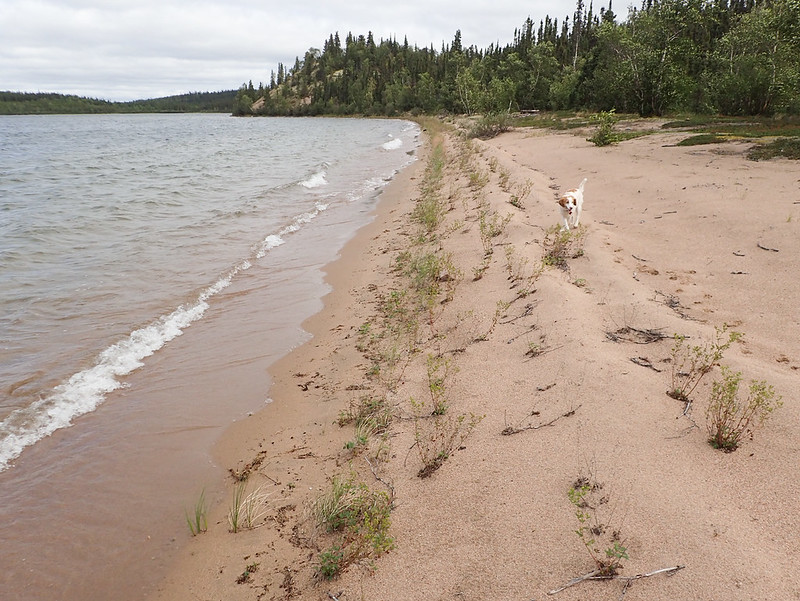
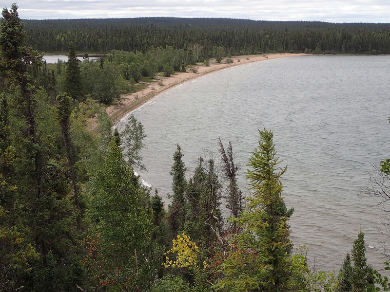
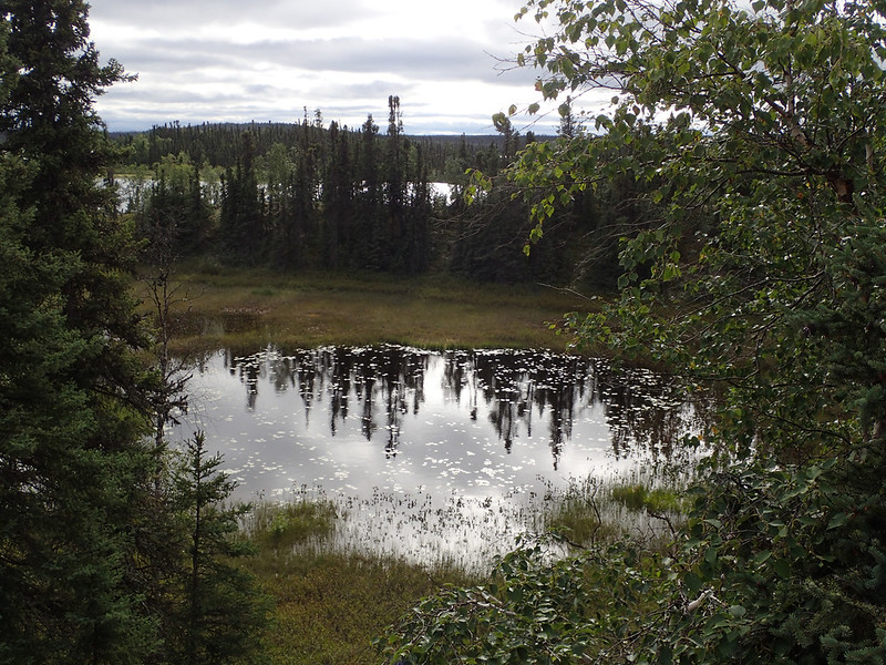
Overcast and a light west wind that wasn’t bothering me a bit since I was paddling the west shoreline. We stopped a couple times for a short break and had covered around 10 miles (16km) by noon. We were approaching Pow Bay and once there it would be time to turn across the main lake and do some island hopping with a series of 1-4 mile (1.6-6.5km) crossings. I planned to stop for lunch before starting my campaign and didn’t plan to stop moving until late in the day. Suddenly the islands I’d been watching 2 miles off shore began to dissolve into a haze and I knew rain was coming. When we turned to shore we found no good landings as shallow rocks were extending out quite a ways. It was beginning to rain harder as I rounded the point of Pow Bay and found a path through some shallow offshore rocks and an acceptable landing. We both bailed onto shore to seek out the biggest spruce tree we could find to hide behind; which wasn’t saying much as it was low and boggy with stunted trees. Nowhere to setup camp but I was hoping to wait this out for a few minutes and continue on.
 20160802_020 by Alan, on Flickr
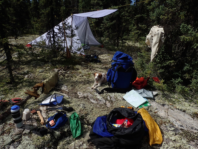
Well 1 1/2 hours later the rain hadn’t let up and suddenly the wind began to blow harder. I was now on the exposed shoreline and quickly realized if I didn’t get out of here fast I’d have a heck of a time getting away from shore through all those shallow rocks. So Sadie and I climbed back into the boat, wove our way out through the rocks, and began paddling back the way we’d come looking for a place to make camp. We made a couple landings and found nothing acceptable until we got 1 1/2 miles (2.4km) down the shore where we could round a point to get out of the wind and waves and found a protected flat spot just a little inland. We set up camp and stayed there for three days while the wind blew.
 20160803_031 by Alan, on Flickr
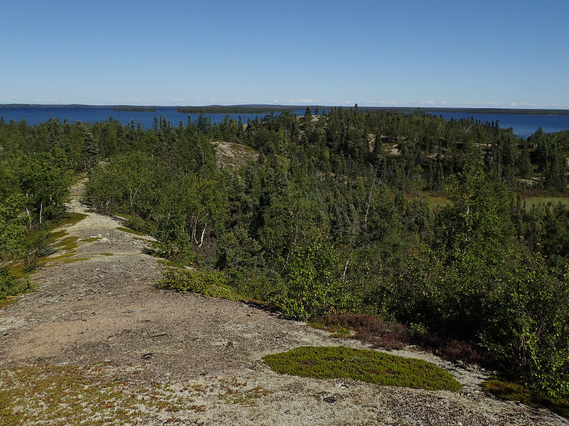
Thankfully the rain quit later that night and our camp was well protected but it certainly was a boring few days making innumerable walks out to the point to look at the wind and waves. Is it better? Is it worse? Has it changed direction? The wind was at an annoying level where it was right on the edge of being paddleable and I was constantly second guessing myself on my decision to stay put. It was hard to judge since even on my point I was somewhat protected from the mainly West wind. Then I’d see one of the fishing boats from the lodge in the distance pounding through the white caps and realize staying put was the right choice. If I could have stayed close to shore to avoid the biggest wind and waves I would have paddled but I needed to make very exposed open water crossings so I just sat tight and wondered if this is the weather on August 2nd what can I expect 1 1/2 months later at the end of the trip? Not to mention I’ll be paddling much farther north.
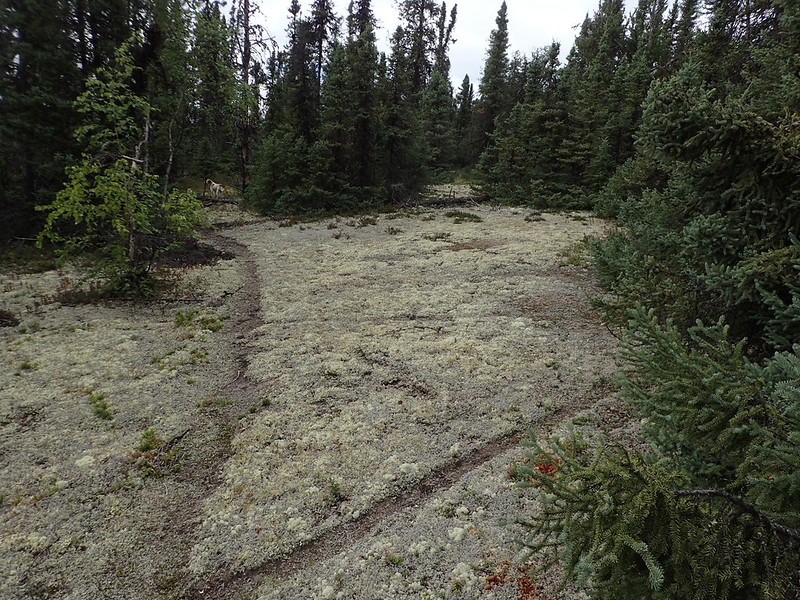
Drying out:
 20160803_021 by Alan, on Flickr
The morning of August 3rd one of the fishing boats that was heading out swung by when he saw me standing on the point. The guide said he hadn’t expected to see anyone here and wanted to be sure everything was ok. He asked me where I was heading and was surprised when I told him I was hoping to reach Nueltin Lake and then paddle back. Nice guy. That evening he stopped again on his way back to the lodge. They’d been out fishing pike and had got a 40 incher (101cm). His clients were from Pennsylvania and didn’t say much. He asked me if I wanted something to drink. I figured the options would be beer or soda, neither of which I care for, so I declined. I already had a lake full of my favorite beverage, tepid water. The wind had moved a little to the north and was blowing harder onto my point so it was difficult to talk and for him to hold boat position. He wished me well and off they went. It was nice of him to stop and offer me something to drink. I should have accepted it and choked it down in appreciation. Too bad my brain always works 30 seconds too slow in those situations. Thankfully I wouldn’t have to worry about things like that for a while because he was the last person I’d talk to for the next 41 days when I was off the water. It would be 40 days until I was even close enough to someone for a wave and once I got off Wollaston Lake, which was crawling with float planes, I only heard two float planes the rest of the entire trip; one of which was on Wollaston on my return journey.
Alan
It’s a long drive from Estherville, IA to La Ronge, SK. By the time one has traveled that distance it feels like one is nearly there; only to realize that “short drive” up the gravel road to the put-in at Wollaston Lake is another 250 miles (402km). But as far as gravel roads go it’s a pretty nice drive. Speed limit is 80km/hour and that’s probably about the average speed you can expect to travel. Plenty of pot holes but most aren’t too bad and the road is plenty wide. Most of the handful of vehicles I saw were trucks hauling from the mines and they gave plenty of room.
When I arrived at the put-in I found a very large campsite with around 25 different spots one could park and pitch a tent. None were in use. There were a dozen or so vehicles parked in a group. Presumably people who had either gotten a boat ride to the nearby fishing resort or across the lake to the settlement of Wollaston Lake, which has no road access. It was around 3:00 and I decided that rather than get on the water late in the day I’d get everything organized and ready for an early start in the morning. Besides, it was raining. It was August 1st and I spent the afternoon and evening wearing the heavy fleece I’d planned to leave in the vehicle for my return trip home. I decided maybe I should bring it along on the trip. That was a good decision.
20160801_008 by Alan, on FlickrGot on on the water around 6:30am August 2nd. Took a while to calibrate my brain to the scale of the map but after that we were on our way. It sure was a strange sight to come out into a bay and realize just the bay itself was larger than a local lake I think of as being pretty big, the 2nd largest natural lake in Iowa. Once on the main lake I realized just how big it was. A myriad of islands dotted the horizon, both near and far, and between them was just a flat horizon line. I thought I’d be fine using a 1:250,000 scale map to cross Wollaston Lake, and I guess I was, but it certainly wasn’t ideal. Many islands I’d consider good sized were small enough to be omitted from the map which made locating my position sometimes difficult. It was always a guessing game trying to figure out if that island directly ahead was small enough to not be on the map or if I wasn’t where I thought I was. Some of the larger islands were 10 miles (16km) long.
20160802_011 by Alan, on Flickr20160802_010 by Alan, on Flickr20160802_014 by Alan, on FlickrOvercast and a light west wind that wasn’t bothering me a bit since I was paddling the west shoreline. We stopped a couple times for a short break and had covered around 10 miles (16km) by noon. We were approaching Pow Bay and once there it would be time to turn across the main lake and do some island hopping with a series of 1-4 mile (1.6-6.5km) crossings. I planned to stop for lunch before starting my campaign and didn’t plan to stop moving until late in the day. Suddenly the islands I’d been watching 2 miles off shore began to dissolve into a haze and I knew rain was coming. When we turned to shore we found no good landings as shallow rocks were extending out quite a ways. It was beginning to rain harder as I rounded the point of Pow Bay and found a path through some shallow offshore rocks and an acceptable landing. We both bailed onto shore to seek out the biggest spruce tree we could find to hide behind; which wasn’t saying much as it was low and boggy with stunted trees. Nowhere to setup camp but I was hoping to wait this out for a few minutes and continue on.
20160802_020 by Alan, on FlickrWell 1 1/2 hours later the rain hadn’t let up and suddenly the wind began to blow harder. I was now on the exposed shoreline and quickly realized if I didn’t get out of here fast I’d have a heck of a time getting away from shore through all those shallow rocks. So Sadie and I climbed back into the boat, wove our way out through the rocks, and began paddling back the way we’d come looking for a place to make camp. We made a couple landings and found nothing acceptable until we got 1 1/2 miles (2.4km) down the shore where we could round a point to get out of the wind and waves and found a protected flat spot just a little inland. We set up camp and stayed there for three days while the wind blew.
20160803_031 by Alan, on FlickrThankfully the rain quit later that night and our camp was well protected but it certainly was a boring few days making innumerable walks out to the point to look at the wind and waves. Is it better? Is it worse? Has it changed direction? The wind was at an annoying level where it was right on the edge of being paddleable and I was constantly second guessing myself on my decision to stay put. It was hard to judge since even on my point I was somewhat protected from the mainly West wind. Then I’d see one of the fishing boats from the lodge in the distance pounding through the white caps and realize staying put was the right choice. If I could have stayed close to shore to avoid the biggest wind and waves I would have paddled but I needed to make very exposed open water crossings so I just sat tight and wondered if this is the weather on August 2nd what can I expect 1 1/2 months later at the end of the trip? Not to mention I’ll be paddling much farther north.
Drying out:
20160803_021 by Alan, on FlickrThe morning of August 3rd one of the fishing boats that was heading out swung by when he saw me standing on the point. The guide said he hadn’t expected to see anyone here and wanted to be sure everything was ok. He asked me where I was heading and was surprised when I told him I was hoping to reach Nueltin Lake and then paddle back. Nice guy. That evening he stopped again on his way back to the lodge. They’d been out fishing pike and had got a 40 incher (101cm). His clients were from Pennsylvania and didn’t say much. He asked me if I wanted something to drink. I figured the options would be beer or soda, neither of which I care for, so I declined. I already had a lake full of my favorite beverage, tepid water. The wind had moved a little to the north and was blowing harder onto my point so it was difficult to talk and for him to hold boat position. He wished me well and off they went. It was nice of him to stop and offer me something to drink. I should have accepted it and choked it down in appreciation. Too bad my brain always works 30 seconds too slow in those situations. Thankfully I wouldn’t have to worry about things like that for a while because he was the last person I’d talk to for the next 41 days when I was off the water. It would be 40 days until I was even close enough to someone for a wave and once I got off Wollaston Lake, which was crawling with float planes, I only heard two float planes the rest of the entire trip; one of which was on Wollaston on my return journey.
Alan