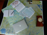
Well Jeff is now with Unlostify and I think the maps will be awesome
too bad the new owner of his old company is fleecing people
too bad the new owner of his old company is fleecing people

Here's an interesting article that discusses the pros and cons of our quickly progressing electronic world.
https://www.theguardian.com/us-news/...des-hiking-app
I love maps and compass but I could learn to love a GPS as well. Spending several hundred $$ for a device is still an impediment to me but it may be one I overcome some day.
I use MyTopo too. I like being able to create a custom map that includes parts of different quads for the areas I visit frequently.I like mytopo.com.
You get to choose the printed size and scale of your map as well as fine tuning the coverage area. So rather than buying 4 maps because the area you want is in a corner you can center that area over one single map. Really cuts down on the number of maps you need to buy.
The maps are waterproof and available rolled or folded. The 2'x3' seems to be a nice size for tripping.
I also don't quite understand how people go about printing their own full size maps. I don't want want to juggle a bunch of 8.5x11" sheets of paper.
Alan
I never use GPS. I can take a look at a map, coiupled with sat photos and just go walk or paddle a route with no trouble. It is a skill I developed over many years and see no reason to change.

Had I not trusted those maps so much, or at least glanced at a satellite map, we would have made it to our destination.
It was still a nice day.
