• Happy 1st English Child Born in Canada (Jonathan Guy, 1613)! 🍁👶🏼

West Branch Penobscot River and Chesuncook Village .. from a 1984 Yankee Magazine..

Nice story. Alexandra and Garrett were my mentors when I was in the process of getting my guide license in the early nineties. Heard many stories, around the campfires, of their time with Mick. Rocky Rips could get a bit "sporty" after the Fall draw down in combination with a dry summer. They also showed me a small axe head they picked up there during a particularly dry year that was authenticated as an early trade axe.
 
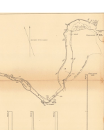
The pool level was raised at least twice (and perhaps a few more times in between). The original dam(s) were surely for holding back water to aid in the log drives. The old dam was at the foot of Chesuncook proper (before Ripogenus lake) and can be seen at extreme low water. From memory, Thoreau talks about trees killed from inundation and describes a shoreline consistent with a dam, so the original dam was i place before the mid-19th century. However, this dam was small and didn't create the lake as we know it today. (Witness the lack of Gero Island, Umbazooksis Lake, etc.on Hubbard's map above.) The current size of the lake was defined by the Ripogenus dam, completed around 1920 and converted to produce power not long after that.

I've been interested to see Rocky RIps and Pine Stream falls for years. Some of the historic travelogs mention them including Thoreau (The Maine Woods), Steele (Canoe and Camera), Stanton, and Hubbard. You also see them mentioned in many of the old guide books (e.g. Hubbard and early Bangor & Arrostook Railroad guides). You can find many on archive.org The conditions that expose Rocky Rips and Pine Stream falls have more to do with the amount of water held back by Rip Dam rather than Seboomook Dam. Though these things are often closely correlated on dry years.
I take the opportunity of re-finding this thread to bring another cool map that shows Rocky Rips clearly above the Entrance of Pine Stream. The survey for this map was done in 1905, so post dates the Chesuncook Dam, and pre-dates the Ripogenus Dam. We can see that under normal water levels even the Chesuncook Dam drowned the Pine Stream Falls, but not Rocky Rips. However, this map also includes a portage direct from below Pine Stream to Chesuncook Village would have avoided Pine Stream Falls at lower water levels and the wind around the point to the Village.

This map is part of a series down in the early 19xx by the USGS presumably to assess water power on the West Branch and the feasibility of projects like Rip Dam. You can find them several places online including https://alabamamaps.ua.edu/historicalmaps/us_states/maine/index2_1911-1915.htm
 

Attachments

  • rocky rips.png
    rocky rips.png
    498.2 KB · Views: 10
I've been interested to see Rocky RIps and Pine Stream falls for years.
Rocky Rips were thrilling to swim! Sorry I couldn't get you a photo for you, but I had my paddle in one hand and my stern painter in the other as I tried to dodge boulders and tried to keep track of where my gear was floating off to.

Great map!
 
Back
Top