We had a rare few days where our schedules synced, and we wanted to fit in an end-of-season trip. We decided on Densconeag because it's relatively close and we'd been there before so we could really maximize our time given that we only had two nights and three days.
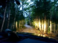
We arrived at Omaha Beach too late in the day to get on the water. The road was as we remembered it--you're on the Golden Road for a heartbeat, and then there is the turnoff and road into Omaha Beach that is rife with big holes and rocks. It had rained recently, so there were big puddles. It's not a horrible road, but I'm glad we took the truck.
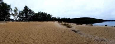
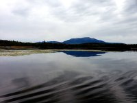
There was one other camper at Omaha Beach. We pitched our tent at the opposite end of the beach, cooked up a quick steak with onions and peppers, had a wee dram and hit the sack. We were up early to cross the West Branch of the Penobscot at Debsconeag Deadwater. It was still and within moments that amazing view of Katahdin emerged.
After crossing the Deadwater, we entered the channel that cuts behind a couple islands, where we were enthusiastically greeted by otters and then, a little bit farther along, beavers.
We paddled into the outlet stream of First Debsconeag Lake, losing our view of Katahdin and then soon entered the lake proper. We had planned to camp at the site to the right as we paddled into the lake (northeast corner of the lake behind the little peninsula), but a plume of smoke let us know it was taken. Our alternate site was the one on the left of the outlet stream, but as that beach came into view, we saw that site was taken too. That was a first for us, and we surprised for late September. Using the binos, we scoped the Lake's other site, which is at the opposite end, and it looked like it was open, so off we went. The wind picked up a bit as we crossed the lake, but it was at our back and we made good time.
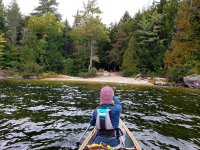
We had not chosen this site before because we know from scouting it on previous trips that it turns into a refrigerator early....but at least we'd have the morning sun, right? The temperature was cool, and the wind made it feel cooler. We got camp set-up and a fire going.
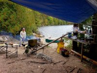
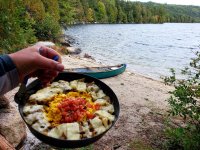
I cooked up Ring of Sunshine, and we made a plan for the day over breakfast and coffee.
We had to decide between the ice caves and the trail to the overlook, fishing or the hike to Second Debsconeag. We opted for the latter, as we had never hiked all the way through before and we'd been to the ice caves. We made the short paddle to the beginning of the trail, tied up the canoe, switched shoes, grabbed our packs and headed off.
The trail to Second Debsconeag is under a mile, and you can cut off a little more time by paddling further up the stream before starting your portage.
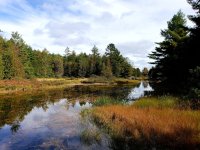
Part of the reason we wanted to walk it is because we'd like to do a trip where we portage into Second Debsconeag (and beyond!), but our recollection of the trail was that it would be a pretty miserable portage with the tripper. While parts of the trail would be smooth sailing, others would be not quite as enjoyable. Maybe we'll try it with our other canoe next summer. It was a great hike nonetheless.
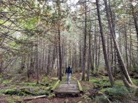
We arrived at the outlet of Second Debsconeag, where we fished for a couple hours, landing a few brookies and tons of perch.

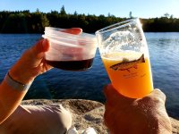
We eventually hiked back to camp, where we avoided the refrigerator for a while by hanging out for cocktails on the sunset rock on the back side of the campsite (shameless plug for the Angler's Pint www.AnglersPint.com).
Then it was onto dinner and a fire...
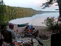
Followed by "They have an app for that"...
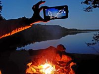
The next morning's forecast was for clear with light winds, but starting at about 4am, I could hear the wind up high cranking right along. Hmmm. The day dawned with the wind having done a 180 and pretty pervasive cloud cover. So much for that morning sun.
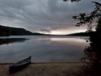
As we started breakfast, we got some sun, and the colors of the foliage were just starting to look good.
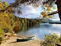
As K made pancakes and duck eggs, I started packing--too quick a trip we were both thinking.

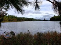
While the site at this end of the lake is still not our favorite, it does have redeeming qualities. It is very private, which is nice, and, well, this view speaks for itself, I think:
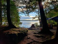
We put on the water and started our journey back across the lake.
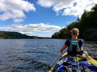
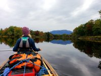
Within minutes, a stiff breeze turned into a good wind, creating some following seas that made sure I didn't stay dry in the stern. We hugged the southern shore and rocketed along with the wind at our backs. Once we entered the outlet stream, things calmed down. We decided to thread our way amongst the islands on the West Branch to avoid a pretty choppy deadwater. Paddling towards Katahdin, the scenery wasn't bad. ;-)
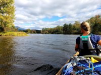
Eventually we emerged from the last little cut and made the short sprint across the West Branch and then on to Omaha Beach. It was blowing pretty good when we were packing up, and it was good to be off the water. While it was a short trip, it was, as always, well worth it and will sustain us until we can wet our paddles again!

We arrived at Omaha Beach too late in the day to get on the water. The road was as we remembered it--you're on the Golden Road for a heartbeat, and then there is the turnoff and road into Omaha Beach that is rife with big holes and rocks. It had rained recently, so there were big puddles. It's not a horrible road, but I'm glad we took the truck.

There was one other camper at Omaha Beach. We pitched our tent at the opposite end of the beach, cooked up a quick steak with onions and peppers, had a wee dram and hit the sack. We were up early to cross the West Branch of the Penobscot at Debsconeag Deadwater. It was still and within moments that amazing view of Katahdin emerged.

After crossing the Deadwater, we entered the channel that cuts behind a couple islands, where we were enthusiastically greeted by otters and then, a little bit farther along, beavers.

We paddled into the outlet stream of First Debsconeag Lake, losing our view of Katahdin and then soon entered the lake proper. We had planned to camp at the site to the right as we paddled into the lake (northeast corner of the lake behind the little peninsula), but a plume of smoke let us know it was taken. Our alternate site was the one on the left of the outlet stream, but as that beach came into view, we saw that site was taken too. That was a first for us, and we surprised for late September. Using the binos, we scoped the Lake's other site, which is at the opposite end, and it looked like it was open, so off we went. The wind picked up a bit as we crossed the lake, but it was at our back and we made good time.

We had not chosen this site before because we know from scouting it on previous trips that it turns into a refrigerator early....but at least we'd have the morning sun, right? The temperature was cool, and the wind made it feel cooler. We got camp set-up and a fire going.

I cooked up Ring of Sunshine, and we made a plan for the day over breakfast and coffee.

We had to decide between the ice caves and the trail to the overlook, fishing or the hike to Second Debsconeag. We opted for the latter, as we had never hiked all the way through before and we'd been to the ice caves. We made the short paddle to the beginning of the trail, tied up the canoe, switched shoes, grabbed our packs and headed off.

The trail to Second Debsconeag is under a mile, and you can cut off a little more time by paddling further up the stream before starting your portage.

Part of the reason we wanted to walk it is because we'd like to do a trip where we portage into Second Debsconeag (and beyond!), but our recollection of the trail was that it would be a pretty miserable portage with the tripper. While parts of the trail would be smooth sailing, others would be not quite as enjoyable. Maybe we'll try it with our other canoe next summer. It was a great hike nonetheless.

We arrived at the outlet of Second Debsconeag, where we fished for a couple hours, landing a few brookies and tons of perch.

We eventually hiked back to camp, where we avoided the refrigerator for a while by hanging out for cocktails on the sunset rock on the back side of the campsite (shameless plug for the Angler's Pint www.AnglersPint.com).

Then it was onto dinner and a fire...

Followed by "They have an app for that"...

The next morning's forecast was for clear with light winds, but starting at about 4am, I could hear the wind up high cranking right along. Hmmm. The day dawned with the wind having done a 180 and pretty pervasive cloud cover. So much for that morning sun.

As we started breakfast, we got some sun, and the colors of the foliage were just starting to look good.

As K made pancakes and duck eggs, I started packing--too quick a trip we were both thinking.

While the site at this end of the lake is still not our favorite, it does have redeeming qualities. It is very private, which is nice, and, well, this view speaks for itself, I think:

We put on the water and started our journey back across the lake.

Within minutes, a stiff breeze turned into a good wind, creating some following seas that made sure I didn't stay dry in the stern. We hugged the southern shore and rocketed along with the wind at our backs. Once we entered the outlet stream, things calmed down. We decided to thread our way amongst the islands on the West Branch to avoid a pretty choppy deadwater. Paddling towards Katahdin, the scenery wasn't bad. ;-)

Eventually we emerged from the last little cut and made the short sprint across the West Branch and then on to Omaha Beach. It was blowing pretty good when we were packing up, and it was good to be off the water. While it was a short trip, it was, as always, well worth it and will sustain us until we can wet our paddles again!
Last edited:
