For reading material, I use Amazon's Kindle app which has the same functionality and name as Amazon's e-reader. I believe the Nook and the Nook app are owned by Barnes & Noble. I also use Amazon's Audible app, which has a huge selection of audio books. I mostly play them over my car's speakers while driving long distances. I prefer to read actual, paper books, but having a nearly unlimited supply of reading material in a single, small device is undeniably advantageous when you're counting ounces and minimizing bulk. My current device has an IP68 waterproof rating, which exceeds paper by a wide margin. I am not sure if any of the dedicated e-readers out there are this waterproof.
There are many apps out there to provide maps, from detailed satellite imagery to public-domain TOPO and everything in between. Google Maps has a function where you can save maps for offline use and I make sure to do this for any area I'm paddling through. I will also take 'screen shots' or download .pdf maps from websites like PaddlePlanner.com, USGS.gov, and the forest service website, FS.USDA.gov. In the BWCA I prefer to carry Fisher brand maps but I like to take pictures of the McKenzie/Voyageur/Chrismar maps that cover the same area, especially when someone more experienced than I has annotated them. I should note that I prefer a paper map and compass, only pulling out the GPS (google maps for this) when I do not know where I am exactly (lost). Most of the time I do not actually look at the extra maps I have on the device either but they're there if I need them and weigh nothing. When I have, it's normally because a portage cannot be found and a different brand of map will show it's proper place or the trail itself can be discerned from satellite imagery.
Every smart phone on the market today is also equipped with a flashlight. They normally take quite a bit of juice and only have one power level so using it as a primary night time light source is not a good idea.
I also have a
Deeper Pro Plus wireless sonar/fishfinder. It weighs 3.52 ounces and is the size of a tennis ball. It is only the transducer itself and requires a smart phone to display the graph. The battery only lasts 6-8 hours but it can be charged with the same powerbank that keeps the GPS/Camera alive. I do not like to stare at a screen while fishing like so many others however it is very useful for finding structure or quickly figuring out what depth late summer fish are holding at iff my initial efforts are fruitless.
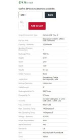
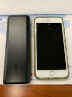
Anyway, the point I'm trying to make is this: When I go paddling, the entirety of my reading material, GPS, spare/alternate maps, camera, backup flashlight, fishfinder and extra batteries weigh 26.02 oz. and have approximately the same bulk as one mass-market paperback and a tennis ball. When in range of a tower, it also makes phone calls and puts most of the knowledge of the entire world in the palm of your hand, including this website. When tripping, however, I appreciate losing this functionality.
It is up to the owner of such a powerful device to look away and not fall under it's spell like so many of my generation have. The world will pass you by if you do.

