The school is in the process of obliterating my past, lol. Since I retired in 2019, much of my stuff from Outers and the Video program I ran has remained untouched. Renovations are forcing a lot of stuff into the garbage. The old map cases have been emptied, and I had to go through hundreds to save the ones that were still relevant. There was one in particular that I was searching for, it was a historical map I had briefly seen several years ago about a trip run by the famous Vanderbecks and Emile Cote. trapline North fans will recognize these names. Anyway, I found the map. It is over four feet long and a a couple of feet long, it looks like a direct copy on some old style onion skin paper. I've taken several shots to post here.
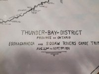
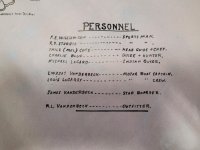
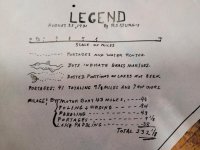
Here is an overview of the map, then i will post three closer shots of sections.

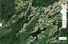
They leave from Cordingley Lake in Nakina.
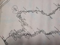
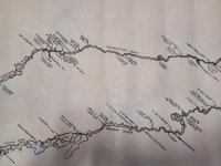
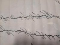
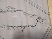
I'm assuming they went down the Esnagami "Esskagannega" and the Little Current, and then poled back up the squaw system. Lots of detail on the map, very interesting. I'm not sure if the squaw section could be replicated now, there has been a lot of cutting back there.


Here is an overview of the map, then i will post three closer shots of sections.

They leave from Cordingley Lake in Nakina.


I'm assuming they went down the Esnagami "Esskagannega" and the Little Current, and then poled back up the squaw system. Lots of detail on the map, very interesting. I'm not sure if the squaw section could be replicated now, there has been a lot of cutting back there.

