Teslin and Yukon Rivers- 13 days in a working wilderness
Part I Johnson’s Crossing to Carmacks – 6 days
We were a party of two in a rented Wenonah Cascade. 17 foot 6 inches of Royalex fat beast rented from Kanoe People in Whitehorse. We had driven cross North America and somehow” lost” two canoes in Ohio so we needed to rent for our trip( Our journey took 20,000 km over 65 days and we did not want to drag boats with us). Kanoe People shuttled us back southeast on the Alaska Highway for an hour to Johnsons Crossing for the start of our trip. We chose to paddle the Teslin River to the confluence of the Yukon at Hootalinqua rather than to paddle Lake Laberge (that decision has made us want to come back again to paddle that lovely temperamental lake). In retrospect, that decision probably was due to the fact I had read about the famous cinnamon buns available at Johnson’s Crossing. If you are a party of two, one bun will suffice. If you are a party of four one bun will suffice. If you are solo, you can just ditch all your food now. You won’t need it.
I will start with the mandatory briefing of water levels and weather. It rained almost all of July 2012. When we launched on July 27, evacuation advisories had just been posted for Marsh Lake on the Yukon River. Deep snowpack and constant July rains with warm temperatures had made water levels unseasonably high. Folks on the relatively nearby Chilkoot trail were taking twice as long to cross the pass as usual as the snow was soft and ten feet deep.
So in retrospect, we were very fortunate in that during our 13 day journey to Dawson City, there was but one whole day of rain. That was near Carmacks, where the locals insisted that there never would be a full day of rain(right!). Temperatures ranged from 5 degrees to about 20. Nothing hot, nothing excessively cold. Neoprene gloves and a good windbreaker and wool underlayers were sufficient. We thought about bringing drysuits but decided against that. We did find Chota Mukluks very useful as they did not pull off in the mud and did give our feet warmth and we could kneel in them if we wanted.
Such high water means that gravel bar camping is more difficult. Below Carmacks the usual abundance of gravel bars is reduced in high water, and where bars exist, the soil may be very soggy and boggy. We used Len Webster’s map books to locate possible campsites and corroborate our position. The books are essentially waterproof topo maps with GPS coordinates along the river with campsites indicated. Starred campsites are to be avoided. They may be lovely but suffer from a lack of downed wood and sometimes are overused. There are no supplied latrines. The author only documented campsites usable at high water, which is a nice feature. At lower water, the campsite opportunities blossom.
The Teslin starts out sluggish. We started at noonish and five hours later with no particular wind had made but twenty miles. Our campsite was up high.
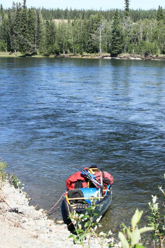
So it is naturally depressing that the thought of having to do another 480 miles in twelve days is daunting. But, really, not to worry. The current picks up.
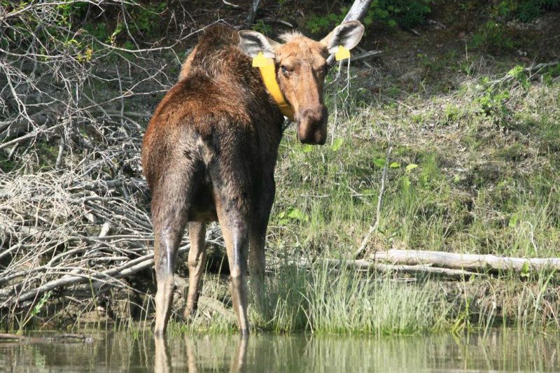
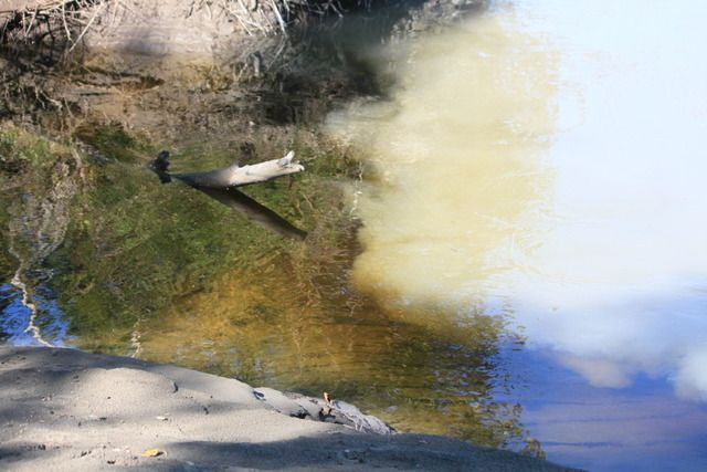
In a cove in a backwater, she waits? “What are you?” (the sight of a collared moose a two days from the last people and surrounded by wild country seems surreal)
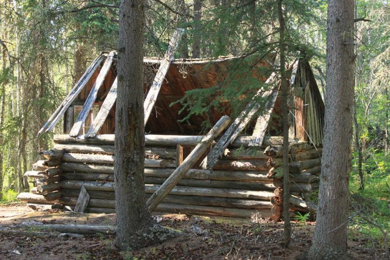
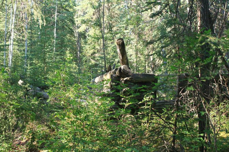
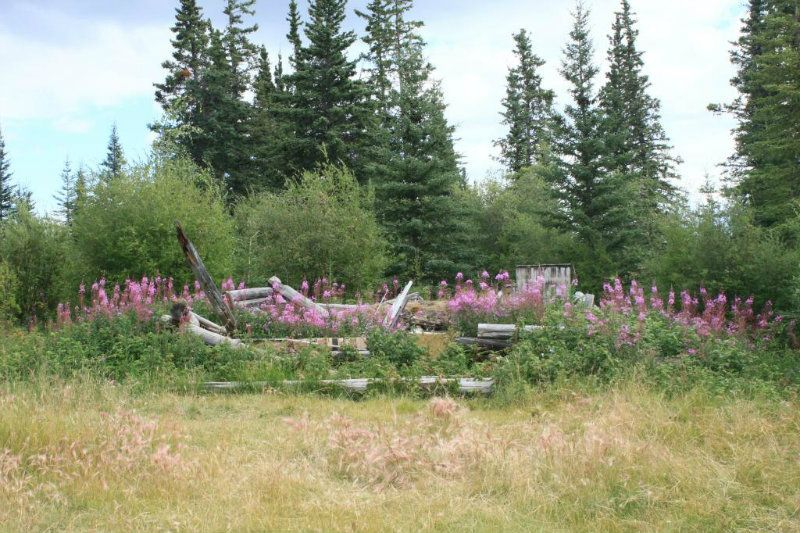
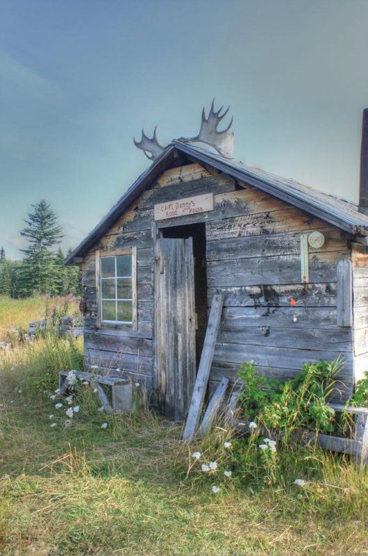
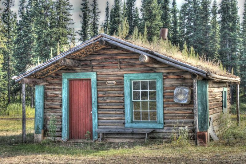
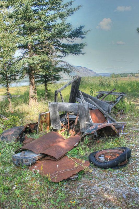
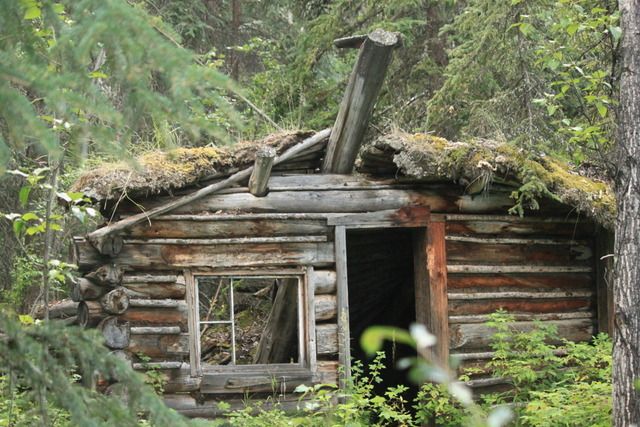
The next day we easily make Bothwells landing and the third day lands us at Morse’s Landing . Both areas have nice beaches. From historical pictures, the beaches are more substantial than what we found. Old cabins dot both sites.

Along with handmade furniture, which I appreciate in my old age.
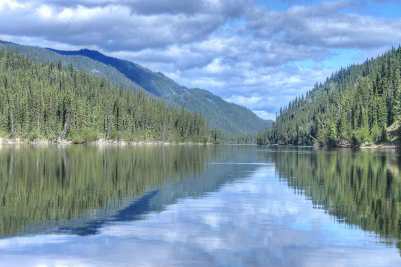
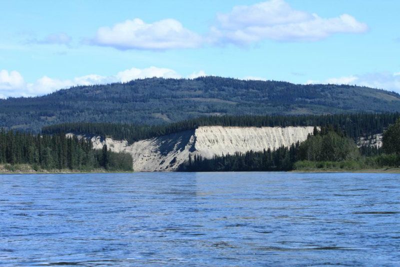
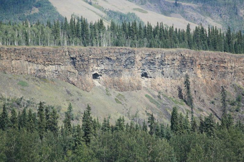
The Teslin’s main feature is high sandbanks, extending some 80 to 100 feet above the river. Pebbles are constantly making mini avalanches. Ergo the river is somewhat silty, yet at camp we were able to use a gravity filter without letting the water settle. And over 13 days the filter did not clog, nor seem to require backflushing.
After leaving Morses, we stop by a curious looking camp compound of several large canvas tents and a satellite dish. Turned out it was a fish count crew. They were tracking salmon and told us the run in 2012 was proving to be almost non-existent. We met a few Natives on the river who reported their fish wheels were coming up empty.
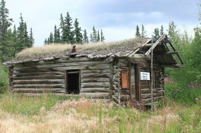
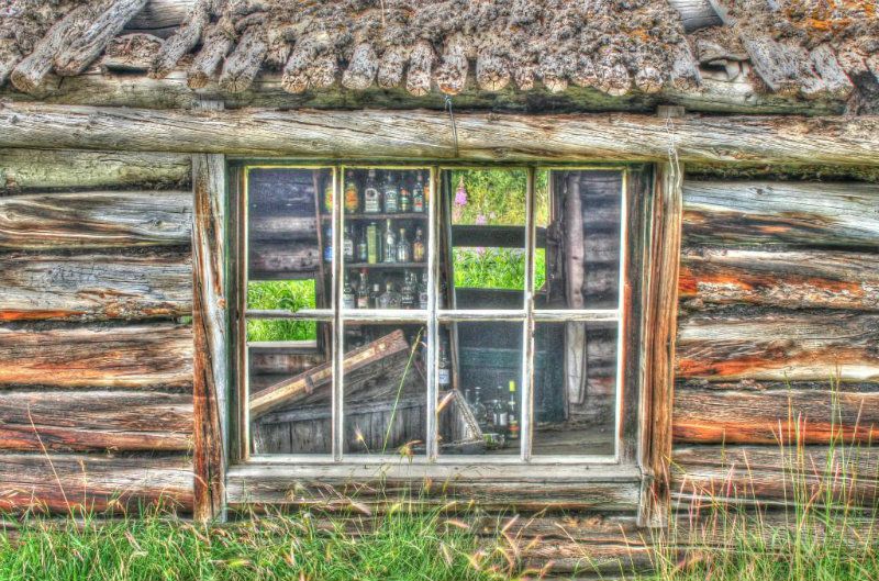
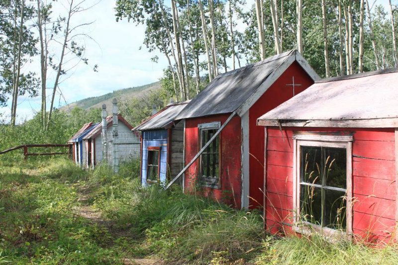
Day 4 we meet up with the Yukon River at Hootalinqua. Its an old village with some cabins still in various stages of preservation. A chap pulled up in a solo canoe and camped inside this. To me it seemed to be rodent haven.

There are quite a few campsites and a shelter. But there was a guided tour encamped there who seemed to sleep a lot and who had some sixteen 60 liter barrels, taking up all the shelter. Nevertheless we stayed the afternoon and night and continued downriver the next day. We did a major faux pas and missed the Lady Evelyn wreck on Shipyard Island (also a campsite). We passed the island on the left side. The good stuff is on the right of the island. The current was too powerful for us to paddle upstream on the right side after we realized the error of our course. Not long after, we searched the shoreline for the remains of the SS Klondike and almost too late realized we were going to run over it literally. All of it save for a two foot section of pipe was submerged. Maps indicate its general location, but it is IN the river.
We stopped at Big Salmon to poke around what is left of that historic village.
There are spirit houses about a fifteen minute walk up the Big Salmon River but they are in a bit of disrepair. We met some FN people here trying to catch salmon , with no luck.
That night we camped at Walsh Creek, named for the first Commissioner of the Yukon Territory. Evidently he had a hard time overwintering on the Yukon River ( this info was in a museum in Dawson) and nearly starved. His legacy? Everyone coming to the Yukon was required to have a year’s worth of supplies. The Chilkoot stampeders no doubt celebrated him.
http://www.skagwaystories.org/2011/03/james-morrow-walsh.html
On the afternoon of the sixth day we arrived Little Salmon village. It does have spirit houses but it’s right on the highway and actually half a dozen people live there. So we took a pic or two and left.
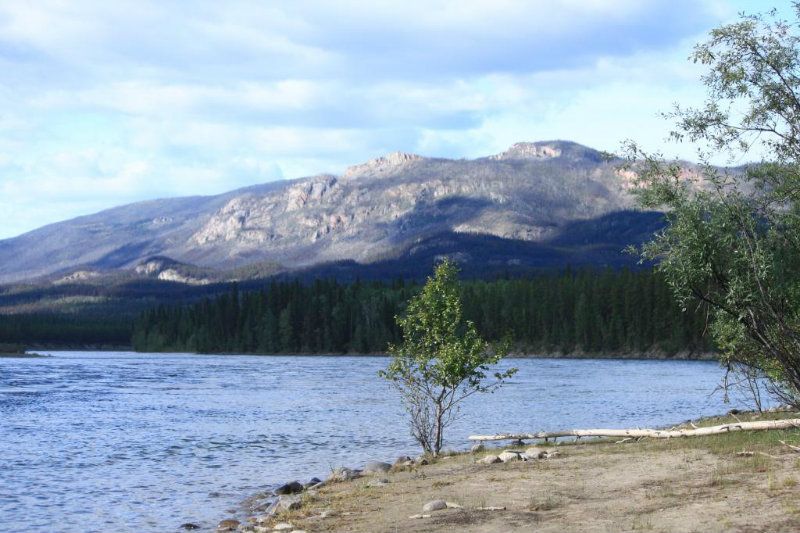
Til Carmacks from now on the highway runs close to the river but sometimes five hundred feet up. There is little traffic, so it is not really annoying.
We camped a bit downstream of Little Salmon and found a party of two who were on a large campsite up a steep bank some 15 feet who were willing to share. They were German and my husband tried to speak a little. They were very polite and did not laugh! It’s been fifty years since he uttered a word of German. Most of the people we met on the river were German. There is a non stop flight once a week Frankfurt-Whitehorse.
One of our two MSR stoves had been misbehaving and quit. But not before it entirely wasted two of our five canisters. Now pulling into Carmacks we had but two canisters left so wanted to find a grill so we could cook over a fire. We set up camp at Coal Mine Campground
http://www.coalminecampground.com/
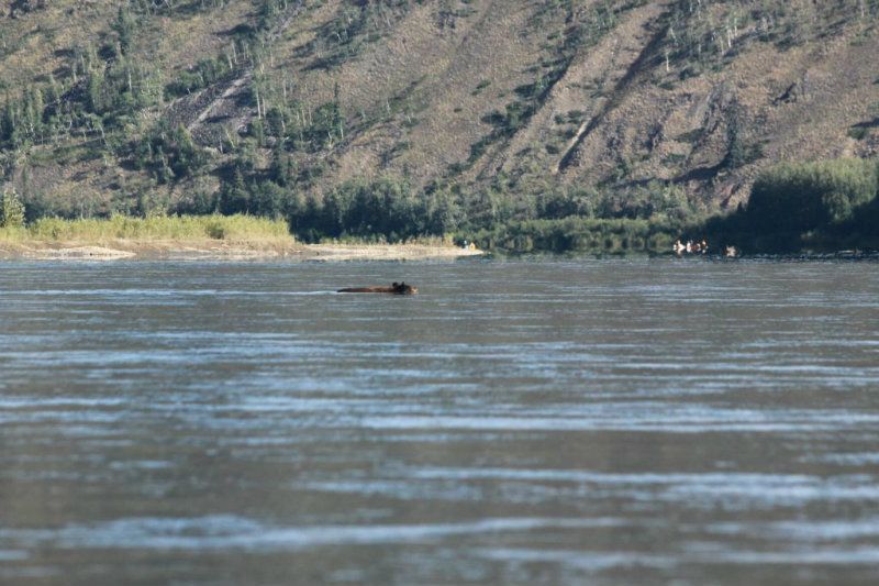
and were so busy puttering we missed the bear swimming downriver entirely. Others in camp did get a picture. Camping $15 a night and the snack bar has decent to very good food 7am-7pm. Showers are three bucks and there is a laundry. So we got on our FreeBikes and pedaled the two miles to town. Suddenly the road seemed very busy and the shoulders very soft. We found a grill downstairs in the hardware store( the grocery is upstairs and it does have fruit and vegetables)
End Part I
Start part 2
Next morning it was pouring rain. Staff said..not to worry . “It never rains in Carmacks all day”. Well by noon we were fed up with pacing the campground and reading books in the dining hall. So we left anyway and , two and a half hours later, when we ran Five Fingers it was still pouring. We got wet..from above. Not a drop from the river. I didn’t take any pictures in the rain.
We pulled in at Tatchun Creek. There is a campground there and a chance to get a little warmed up. However we did not camp there..the last thing we wanted to see was cars etc.. There are some campsites past Rink Rapids..but all were full. Finally, we found a gravel bar that did not seem too soggy (though it looks it in the photo). We are at last finding some that are appearing..the river seems to be dropping a little.

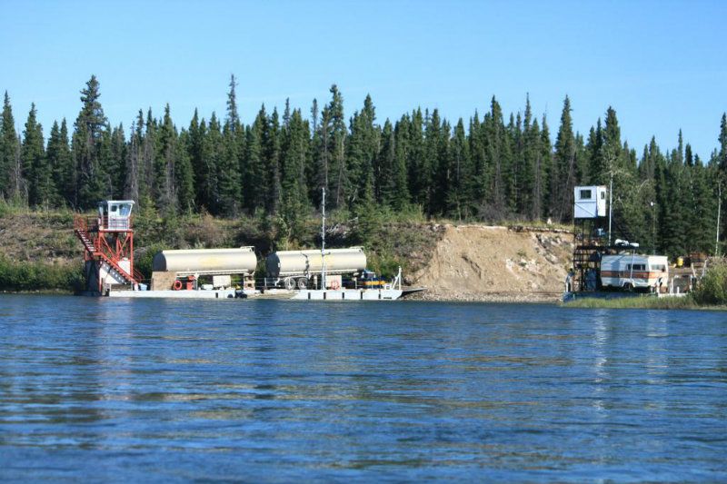
Next morning we passed Minto. The river is busy with ferry and mining operations here.
Wildlife sightings..too may eagles to count but too far away. These guys
And this guy bent on reaching the other bank..note the river traffic.
More river traffic. While we did not encounter barges every day we saw a couple in a week. The Yukon river watershed to this day remains important for gold mining.
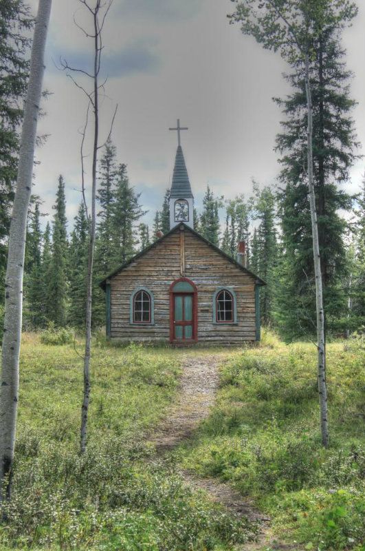
That night we pull in early to Fort Selkirk , a well preserved historical site. It was last inhabited in the 1950’s though there is a small Native village today next to it. Note the cannonball holes. The Yukon Field Forces were there for but one year..and shot across the Yukon River!
http://www.thecanadianencyclopedia.com/articles/fort-selkirk
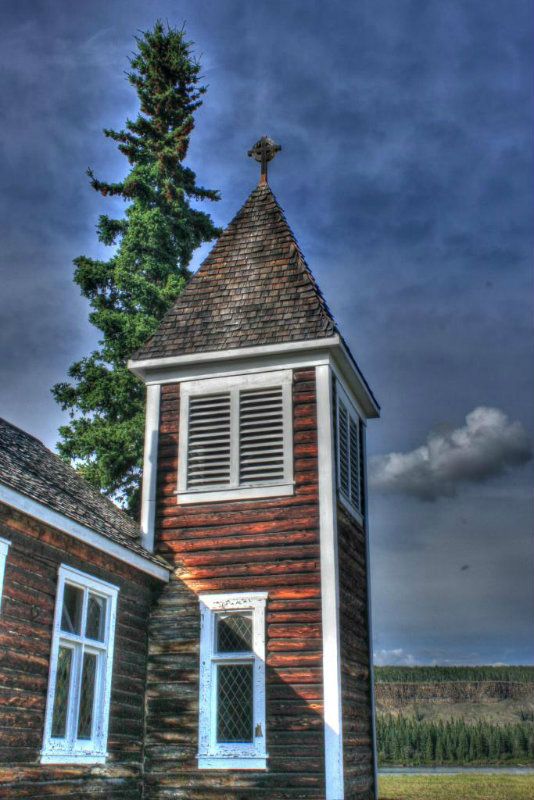
Roman Catholic Church. Once near the riverbank it was moved some 500 meters back. The priest was not happy lugging water that far.
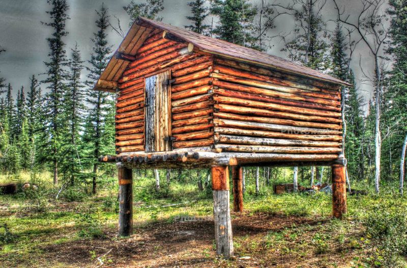
Food cache in back of church
Another church (Anglican)
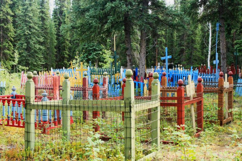
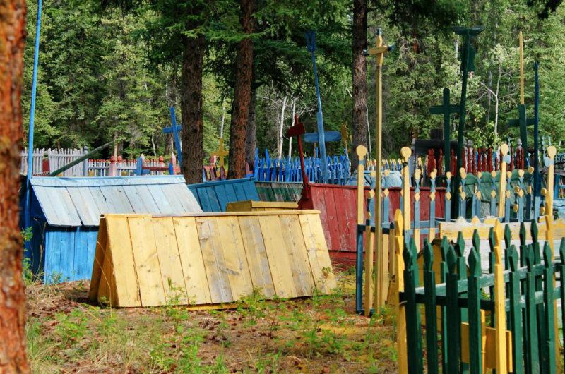
Spirit houses in back of the Catholic Church
Around “town”
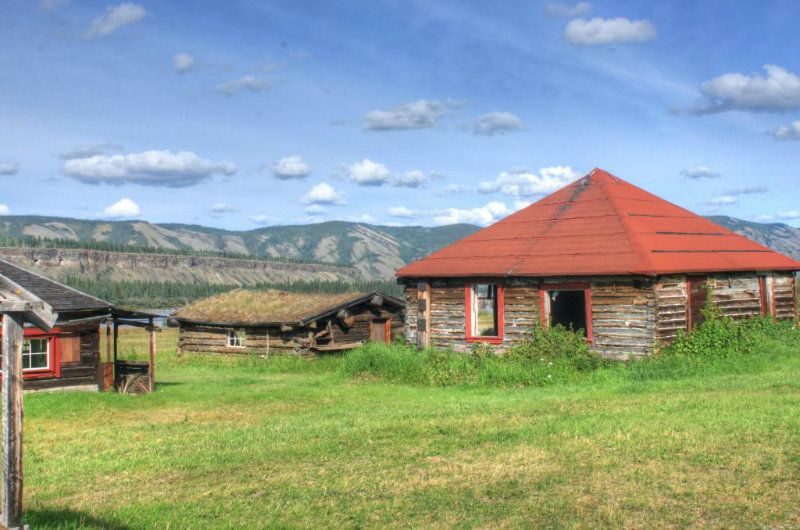
The campground at Ft. Selkirk is modern with well water, picnic tables and firewood and outhouses. Yet it is well maintained and free.
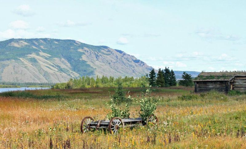
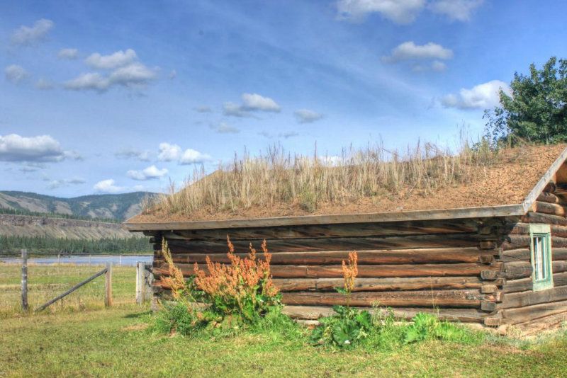
Next day our thirty five or forty miles (average days on the water were about 40 miles in six hours) brought us to Selwyn Creek. A former village too but decay is much advanced. This is the best condition building right next to the campsite.
The next campsite is much anticipated. Kirkman Creek has home baked bread and cookies( a combination of oatmeal chocolate chip) for sale. Also pies! They will cook dinner for you but $27 seemed a bit much for steak and potatoes for us. We did treat ourselves to a $15 breakfast on the gazebo..homemade bread, jellies (never had dandelion flower jelly before..good. The property owner had a lawn full of dandelions and wanted to make the best of it. I ignored the thought of the twenty northern dogs roaming around)) eggs, bacon and wonderful home fries. OJ too! Its 95 miles above Dawson and two more nights would be spent on the river. Kirkman Creek has a mine in the area of course. All of this good food comes off a wood stove in this structure.

Just downriver the White River enters in numerous braids from the west bringing a massive load of silt. We knew that we could collect from side streams, but it seemed so much easier to just fill the four gallon jug at Kirkman Creek. So we never had to wrestle with water again. This is what an intersection of a side creek and the Yukon River looks like.
One more night on a gravel bar and one at Meachem Creek. All along one side of the river it is often possible to walk along a faint path..the track of the old telegraph line between Whitehorse to Dawson. Waiting for rain to stop in the morning, then a quick two hour paddle to Dawson City.

Mileage chart
http://explorenorth.com/library/ships/yukonrivermiles.html
Part I Johnson’s Crossing to Carmacks – 6 days
We were a party of two in a rented Wenonah Cascade. 17 foot 6 inches of Royalex fat beast rented from Kanoe People in Whitehorse. We had driven cross North America and somehow” lost” two canoes in Ohio so we needed to rent for our trip( Our journey took 20,000 km over 65 days and we did not want to drag boats with us). Kanoe People shuttled us back southeast on the Alaska Highway for an hour to Johnsons Crossing for the start of our trip. We chose to paddle the Teslin River to the confluence of the Yukon at Hootalinqua rather than to paddle Lake Laberge (that decision has made us want to come back again to paddle that lovely temperamental lake). In retrospect, that decision probably was due to the fact I had read about the famous cinnamon buns available at Johnson’s Crossing. If you are a party of two, one bun will suffice. If you are a party of four one bun will suffice. If you are solo, you can just ditch all your food now. You won’t need it.
I will start with the mandatory briefing of water levels and weather. It rained almost all of July 2012. When we launched on July 27, evacuation advisories had just been posted for Marsh Lake on the Yukon River. Deep snowpack and constant July rains with warm temperatures had made water levels unseasonably high. Folks on the relatively nearby Chilkoot trail were taking twice as long to cross the pass as usual as the snow was soft and ten feet deep.
So in retrospect, we were very fortunate in that during our 13 day journey to Dawson City, there was but one whole day of rain. That was near Carmacks, where the locals insisted that there never would be a full day of rain(right!). Temperatures ranged from 5 degrees to about 20. Nothing hot, nothing excessively cold. Neoprene gloves and a good windbreaker and wool underlayers were sufficient. We thought about bringing drysuits but decided against that. We did find Chota Mukluks very useful as they did not pull off in the mud and did give our feet warmth and we could kneel in them if we wanted.
Such high water means that gravel bar camping is more difficult. Below Carmacks the usual abundance of gravel bars is reduced in high water, and where bars exist, the soil may be very soggy and boggy. We used Len Webster’s map books to locate possible campsites and corroborate our position. The books are essentially waterproof topo maps with GPS coordinates along the river with campsites indicated. Starred campsites are to be avoided. They may be lovely but suffer from a lack of downed wood and sometimes are overused. There are no supplied latrines. The author only documented campsites usable at high water, which is a nice feature. At lower water, the campsite opportunities blossom.
The Teslin starts out sluggish. We started at noonish and five hours later with no particular wind had made but twenty miles. Our campsite was up high.
So it is naturally depressing that the thought of having to do another 480 miles in twelve days is daunting. But, really, not to worry. The current picks up.
In a cove in a backwater, she waits? “What are you?” (the sight of a collared moose a two days from the last people and surrounded by wild country seems surreal)
The next day we easily make Bothwells landing and the third day lands us at Morse’s Landing . Both areas have nice beaches. From historical pictures, the beaches are more substantial than what we found. Old cabins dot both sites.
Along with handmade furniture, which I appreciate in my old age.
The Teslin’s main feature is high sandbanks, extending some 80 to 100 feet above the river. Pebbles are constantly making mini avalanches. Ergo the river is somewhat silty, yet at camp we were able to use a gravity filter without letting the water settle. And over 13 days the filter did not clog, nor seem to require backflushing.
After leaving Morses, we stop by a curious looking camp compound of several large canvas tents and a satellite dish. Turned out it was a fish count crew. They were tracking salmon and told us the run in 2012 was proving to be almost non-existent. We met a few Natives on the river who reported their fish wheels were coming up empty.
Day 4 we meet up with the Yukon River at Hootalinqua. Its an old village with some cabins still in various stages of preservation. A chap pulled up in a solo canoe and camped inside this. To me it seemed to be rodent haven.
There are quite a few campsites and a shelter. But there was a guided tour encamped there who seemed to sleep a lot and who had some sixteen 60 liter barrels, taking up all the shelter. Nevertheless we stayed the afternoon and night and continued downriver the next day. We did a major faux pas and missed the Lady Evelyn wreck on Shipyard Island (also a campsite). We passed the island on the left side. The good stuff is on the right of the island. The current was too powerful for us to paddle upstream on the right side after we realized the error of our course. Not long after, we searched the shoreline for the remains of the SS Klondike and almost too late realized we were going to run over it literally. All of it save for a two foot section of pipe was submerged. Maps indicate its general location, but it is IN the river.
We stopped at Big Salmon to poke around what is left of that historic village.
There are spirit houses about a fifteen minute walk up the Big Salmon River but they are in a bit of disrepair. We met some FN people here trying to catch salmon , with no luck.
That night we camped at Walsh Creek, named for the first Commissioner of the Yukon Territory. Evidently he had a hard time overwintering on the Yukon River ( this info was in a museum in Dawson) and nearly starved. His legacy? Everyone coming to the Yukon was required to have a year’s worth of supplies. The Chilkoot stampeders no doubt celebrated him.
http://www.skagwaystories.org/2011/03/james-morrow-walsh.html
On the afternoon of the sixth day we arrived Little Salmon village. It does have spirit houses but it’s right on the highway and actually half a dozen people live there. So we took a pic or two and left.
Til Carmacks from now on the highway runs close to the river but sometimes five hundred feet up. There is little traffic, so it is not really annoying.
We camped a bit downstream of Little Salmon and found a party of two who were on a large campsite up a steep bank some 15 feet who were willing to share. They were German and my husband tried to speak a little. They were very polite and did not laugh! It’s been fifty years since he uttered a word of German. Most of the people we met on the river were German. There is a non stop flight once a week Frankfurt-Whitehorse.
One of our two MSR stoves had been misbehaving and quit. But not before it entirely wasted two of our five canisters. Now pulling into Carmacks we had but two canisters left so wanted to find a grill so we could cook over a fire. We set up camp at Coal Mine Campground
http://www.coalminecampground.com/
and were so busy puttering we missed the bear swimming downriver entirely. Others in camp did get a picture. Camping $15 a night and the snack bar has decent to very good food 7am-7pm. Showers are three bucks and there is a laundry. So we got on our FreeBikes and pedaled the two miles to town. Suddenly the road seemed very busy and the shoulders very soft. We found a grill downstairs in the hardware store( the grocery is upstairs and it does have fruit and vegetables)
End Part I
Start part 2
Next morning it was pouring rain. Staff said..not to worry . “It never rains in Carmacks all day”. Well by noon we were fed up with pacing the campground and reading books in the dining hall. So we left anyway and , two and a half hours later, when we ran Five Fingers it was still pouring. We got wet..from above. Not a drop from the river. I didn’t take any pictures in the rain.
We pulled in at Tatchun Creek. There is a campground there and a chance to get a little warmed up. However we did not camp there..the last thing we wanted to see was cars etc.. There are some campsites past Rink Rapids..but all were full. Finally, we found a gravel bar that did not seem too soggy (though it looks it in the photo). We are at last finding some that are appearing..the river seems to be dropping a little.
Next morning we passed Minto. The river is busy with ferry and mining operations here.
Wildlife sightings..too may eagles to count but too far away. These guys
And this guy bent on reaching the other bank..note the river traffic.
More river traffic. While we did not encounter barges every day we saw a couple in a week. The Yukon river watershed to this day remains important for gold mining.
That night we pull in early to Fort Selkirk , a well preserved historical site. It was last inhabited in the 1950’s though there is a small Native village today next to it. Note the cannonball holes. The Yukon Field Forces were there for but one year..and shot across the Yukon River!
http://www.thecanadianencyclopedia.com/articles/fort-selkirk
Roman Catholic Church. Once near the riverbank it was moved some 500 meters back. The priest was not happy lugging water that far.
Food cache in back of church
Another church (Anglican)
Spirit houses in back of the Catholic Church
Around “town”
The campground at Ft. Selkirk is modern with well water, picnic tables and firewood and outhouses. Yet it is well maintained and free.
Next day our thirty five or forty miles (average days on the water were about 40 miles in six hours) brought us to Selwyn Creek. A former village too but decay is much advanced. This is the best condition building right next to the campsite.
The next campsite is much anticipated. Kirkman Creek has home baked bread and cookies( a combination of oatmeal chocolate chip) for sale. Also pies! They will cook dinner for you but $27 seemed a bit much for steak and potatoes for us. We did treat ourselves to a $15 breakfast on the gazebo..homemade bread, jellies (never had dandelion flower jelly before..good. The property owner had a lawn full of dandelions and wanted to make the best of it. I ignored the thought of the twenty northern dogs roaming around)) eggs, bacon and wonderful home fries. OJ too! Its 95 miles above Dawson and two more nights would be spent on the river. Kirkman Creek has a mine in the area of course. All of this good food comes off a wood stove in this structure.
Just downriver the White River enters in numerous braids from the west bringing a massive load of silt. We knew that we could collect from side streams, but it seemed so much easier to just fill the four gallon jug at Kirkman Creek. So we never had to wrestle with water again. This is what an intersection of a side creek and the Yukon River looks like.
One more night on a gravel bar and one at Meachem Creek. All along one side of the river it is often possible to walk along a faint path..the track of the old telegraph line between Whitehorse to Dawson. Waiting for rain to stop in the morning, then a quick two hour paddle to Dawson City.
Mileage chart
http://explorenorth.com/library/ships/yukonrivermiles.html
")