Dickens Lake to French Lake Portage Clearing Trip
August 31 to September 8, 2024
This trip was done in consultation with Ric D. from Missinipe and with the aim of clearing portages along this route. We had a chainsaw and other cutting instruments with us. We were able to improve most of the portages and all of the campsites.
Note: We did this trip with very low water levels. Approaches to and from water that was deep enough to float a canoe were difficult because the low water left exposed mud flats with occasional rocks in them. Several of the portages had to be extended in order to reach a place along the creek where we could access enough water to float our canoes. At higher water levels it might be possible to wade or line canoes through some of the rocky rapids we encountered. For those who are considering doing this trip we found that at these low levels, the trip was quite difficult. We recommend attempting it at average or higher water levels
Start: Dickens Lake Recreation Site just off Saskatchewan Highway 102 about 20 km north of Missinipe.
Finish: Roadside access to French Lake on the Grandmother’s Bay Road. It would be possible to paddle down French Lake, portage to Grandmother’s Bay and then paddle across Otter Lake to Missinipe for an alternate end point.
We launched at the dock at the Recreation Site on the west side of Dickens Lake and paddled approximately 7 km to the outlet stream at the east side of the lake. The first part of the paddle on Dickens Lake is through an old burn but as you go eastward the area has not been burned. There is a marked campsite on the south shore but we did not inspect it. There appears to be a possible campsite on the east point of a small bay near where the outlet stream leave the lake. We paddled a short way down the small outlet stream until we encounter a steep, rocky rapid.
Portage #1 We did not record the length of this portage. It starts on RL just before a steep, rocky rapid. We had to move a few rocks to allow our canoes to get close to the take out. The portage is rough and hummocky with holes especially in the second half of the portage.
We paddled a short distance along the small stream until we came to a steep rocky rapid and the next portage.
Portage #2 This portage starts on RR just before a steep, rocky rapid. We did not record the distance of this portage. A guesstimate would be that it could be as short as 50 meters or as long as 125 meters. There were at least three endings to the portage that could be used at different water levels. We had to extend the portage by about 75 m to find deep enough water in the creek to float our loaded canoes. The part of the portage extension through the forest was OK but when we turned the trail toward the creek we encountered about 10 m of very rough terrain with low bushes and hidden holes. In addition, the low water meant we had to walk through mud to load the canoes.
We were able to walk (with some gelcoat loss) our canoes down a human-cleared channel for about 15 m then we paddled out onto a slightly deeper, bulrush lined section of the creek. This section is about 1 km long and, I suspect, in average water depths, there would be enough water to float a loaded canoe. In the low water levels that we encountered, we ran aground many times in this 1 km section. At times, both paddlers were able to use their paddles to pole the canoe to deeper water but frequently the stern paddler had to get out and push the boat until the water got deep enough to float the boat. This was very tiring. At the end of this section, you leave the bulrushes, the forest starts and the creek disappears amongst a wall of rocks. Evidently, at some times, it is possible to wade or line loaded canoes down this next section to the old bridge, portage the bridge and then wade or line canoes to the next small lake. At our water level, we encountered a continuous barrier of medium to large sized boulders with almost no water. In places, the stream completely disappeared under and among the rocks. There were numerous trees that had fallen across the steep, rocky channel so we wondered if would ever be possible to wade or line canoes down this section. Where the forest starts, on RR there is the beginning of a portage trail that is a total of about 325 meters long. We were tired and it was late so we decided to camp near the beginning of the portage trail. We had two quite large tents but we were able to clear two tent sites and we made a decent campsite. The next morning we cleared the portage trail to the old mining road, crossed the road and then cleared the trail to the navigable part of the creek below the road. We then portaged our gear and canoes. It would be possible to camp on the old road.
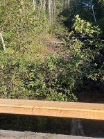
Picture looking upstream from the bridge on the old mining exploration road. Supposedly one can wade or line canoes down this section, portage the bridge and then wade or line the rest of the way to the next small, unnamed lake. You will have to look very, very closely to see any water amongst the rocks.
Portage #3 About 325 meters long and in good condition. The first few meters of the portage were wet but then it was good.
We loaded our canoes and paddled out onto the small lake (called Greywacke Lake on Google Earth but unnamed on our map or on Toporama). Although it was quite early, after our tiring day the previous day, we decided to camp at the old mining site on this lake. The campsite is behind a screen of trees but it has a number of flat sites for tents and we were able to make a short trail to a rocky outcrop so we could sit and view the lake. There are remnants of the mining exploration buildings and lots of bits of drill core samples so it is not exactly a “wilderness” campsite. We paddled to a nearby point and went for a swim and had lunch. It was quite delightful.
We passed a pleasant evening and night and the next morning we paddled onward about 1 km to the portage at the south end of the lake.
Portage #4 On RR and about 200 m long and fair condition when we arrived but it was in good shape after we did some improvements. There are water gauges at both ends of this portage – perhaps from the mining exploration days?
We portaged then paddled about 1 km to the south end of this small unnamed lake.
Portage #5 On RL and about 300m long. When we arrived, this portage was in serious need of some attention. We spent about 2 hours working on it and it was greatly improved. This portage is the first of two portages separated by a small pond. At our low water levels, the small pond was very small and the muddy shore was quite large. In normal water levels, it would likely be possible to access the pond near the “end” of the portage trail but we were forced to continue to portage along the edge of a grassy beaver meadow with old logs and holes hidden in the long grass. We stayed on the higher, firmer ground away from the pond until we got parallel to where the water was deep enough to float a canoe and then portaged straight toward the pond. The footing got progressively worse as the grass thinned and the mud increased. We placed some old sticks and logs in places but the black, sucking mud made going very difficult. After a considerable struggle we were able to load the canoes and get them into the water with paddlers on board. For this effort, we were treated to about a 150 meter paddle to the start of the next portage.
Portage #6 On RR with less mud and a more sandy beginning. About 280 m long. We spent about 2 hours working on this portage. The first few meters are on a steep side hill and after that it is more level but it has a number of roots and holes.
We portaged our gear and came out on the small unnamed lake where the Stewart River comes in from the north. We decided to camp at the campsite marked on the west side of this lake. This campsite has a lower kitchen area and some tent sites up quite high. We improved the trails to the upper sites. There was room for our two large tents quite close together. With some more effort, it would be possible to develop one or more tent sites. We went for a paddle in the late afternoon to see the lake and view the falls on the outlet stream. Although there is not a trail to a viewing site, we would recommend bush-whacking to view the falls from above. We spent two nights at the campsite here because we were tired and because it rained quite a lot on the first night, on the next afternoon and a lot on the second night. After our second night we paddled about 800 m to the next portage trail at the south end of this lake.
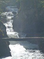
Picture of the falls on the Stuart River.
Portage #7 On RL about 25 m to the left of the start of the falls. About 125 m long. After we cleared the trail it was in good condition. This portage has a long, very steep hill on it – going down for us. The trail was so steep that it was difficult to walk down even without a load. With such a steep hill and after a day and a half of rain, we felt that someone or something would get hurt if we tried to carry gear and canoes down this hill. After some discussion, we decided to carry our canoes and gear to the beginning of the steep section, load the gear in the canoes and slide the canoe and all down the hill. We used our throw bags to belay the canoe and we put logs across the trail in places where there were rocks. One person was on belay and another guided the canoe down the hill. This worked very well and didn’t seem to cause any significant damage to the canoes. Once at the bottom of the hill we unloaded the canoes and portaged everything to the end of the portage.
We loaded up and paddled upstream to see the falls but it was difficult to see them from the canoe. One person got out and walked up the stream until he could see them and he took a few pictures to show the others. We paddled about 700 m down this widening of the Stewart River to the next portage trail.
Portage #8 about 250 m long. This portage starts part way down the outflowing stream on RR. We cleared it. It goes over a ridge and back down to the river. Just after the put in there is a short section of rocky rapid to negotiate. We paddled a little over 1 km to the next portage.
Portage #9 On RR and about 100 m long. This by-passes a steep rocky rapid. This is an extremely rough and difficult portage. There is a very narrow trail along a steep side hill that sometimes goes into side channels of the river, sometimes has logs placed to walk on, sometimes goes onto little islands, sometimes cuts back into little rocky channels, etc., etc. Footing was difficult and required constant attention. At higher water levels, parts of this “trail” would be in the water. We had to use walking poles to maintain our balance and could only carry one pack at a time. For the only time on this trip two people had to skid/carry each canoe to safely navigate this “portage”.
We paddled on the winding river for a little over 1 km until we came to a reed bed that extended completely across the river. The matted reeds would not allow for paddling through or for using the weeds to pull through. One paddler had to get out of each canoe into knee deep or deeper water to pull the canoes through these weeds for about 30 m. We paddled on for about 800 m until we came to another obstacle. This was a short, shallow, rocky rapid. There appeared to be a portage on RR but we did not check it out. We were able to run this rapid with some scraping and then we were out on Bear Lake.
We camped at the east campsite indicated on the map so that we could see the sunset. This is a nice campsite that has now been improved. We stayed here for two nights. On the middle day, we cleared some walking trails and cleaned up some of our gear and generally had a lazy day. In the late afternoon we paddled over to see the west campsite marked on the map. It is much higher from the lake and has room for several tents.
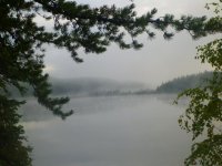
Misty morning.
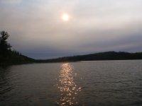
Smoky skies for the last two days and most of the way home
We left at about 10:00 a.m. and paddled down French Lake where we had lunch on a tiny islet then we came back to the Grandmother’s Bay Road takeout where we were picked up and shuttled back to Missinipe. Showers, beverages, supper then bed and we left for home early the next day.
August 31 to September 8, 2024
This trip was done in consultation with Ric D. from Missinipe and with the aim of clearing portages along this route. We had a chainsaw and other cutting instruments with us. We were able to improve most of the portages and all of the campsites.
Note: We did this trip with very low water levels. Approaches to and from water that was deep enough to float a canoe were difficult because the low water left exposed mud flats with occasional rocks in them. Several of the portages had to be extended in order to reach a place along the creek where we could access enough water to float our canoes. At higher water levels it might be possible to wade or line canoes through some of the rocky rapids we encountered. For those who are considering doing this trip we found that at these low levels, the trip was quite difficult. We recommend attempting it at average or higher water levels
Start: Dickens Lake Recreation Site just off Saskatchewan Highway 102 about 20 km north of Missinipe.
Finish: Roadside access to French Lake on the Grandmother’s Bay Road. It would be possible to paddle down French Lake, portage to Grandmother’s Bay and then paddle across Otter Lake to Missinipe for an alternate end point.
We launched at the dock at the Recreation Site on the west side of Dickens Lake and paddled approximately 7 km to the outlet stream at the east side of the lake. The first part of the paddle on Dickens Lake is through an old burn but as you go eastward the area has not been burned. There is a marked campsite on the south shore but we did not inspect it. There appears to be a possible campsite on the east point of a small bay near where the outlet stream leave the lake. We paddled a short way down the small outlet stream until we encounter a steep, rocky rapid.
Portage #1 We did not record the length of this portage. It starts on RL just before a steep, rocky rapid. We had to move a few rocks to allow our canoes to get close to the take out. The portage is rough and hummocky with holes especially in the second half of the portage.
We paddled a short distance along the small stream until we came to a steep rocky rapid and the next portage.
Portage #2 This portage starts on RR just before a steep, rocky rapid. We did not record the distance of this portage. A guesstimate would be that it could be as short as 50 meters or as long as 125 meters. There were at least three endings to the portage that could be used at different water levels. We had to extend the portage by about 75 m to find deep enough water in the creek to float our loaded canoes. The part of the portage extension through the forest was OK but when we turned the trail toward the creek we encountered about 10 m of very rough terrain with low bushes and hidden holes. In addition, the low water meant we had to walk through mud to load the canoes.
We were able to walk (with some gelcoat loss) our canoes down a human-cleared channel for about 15 m then we paddled out onto a slightly deeper, bulrush lined section of the creek. This section is about 1 km long and, I suspect, in average water depths, there would be enough water to float a loaded canoe. In the low water levels that we encountered, we ran aground many times in this 1 km section. At times, both paddlers were able to use their paddles to pole the canoe to deeper water but frequently the stern paddler had to get out and push the boat until the water got deep enough to float the boat. This was very tiring. At the end of this section, you leave the bulrushes, the forest starts and the creek disappears amongst a wall of rocks. Evidently, at some times, it is possible to wade or line loaded canoes down this next section to the old bridge, portage the bridge and then wade or line canoes to the next small lake. At our water level, we encountered a continuous barrier of medium to large sized boulders with almost no water. In places, the stream completely disappeared under and among the rocks. There were numerous trees that had fallen across the steep, rocky channel so we wondered if would ever be possible to wade or line canoes down this section. Where the forest starts, on RR there is the beginning of a portage trail that is a total of about 325 meters long. We were tired and it was late so we decided to camp near the beginning of the portage trail. We had two quite large tents but we were able to clear two tent sites and we made a decent campsite. The next morning we cleared the portage trail to the old mining road, crossed the road and then cleared the trail to the navigable part of the creek below the road. We then portaged our gear and canoes. It would be possible to camp on the old road.

Picture looking upstream from the bridge on the old mining exploration road. Supposedly one can wade or line canoes down this section, portage the bridge and then wade or line the rest of the way to the next small, unnamed lake. You will have to look very, very closely to see any water amongst the rocks.
Portage #3 About 325 meters long and in good condition. The first few meters of the portage were wet but then it was good.
We loaded our canoes and paddled out onto the small lake (called Greywacke Lake on Google Earth but unnamed on our map or on Toporama). Although it was quite early, after our tiring day the previous day, we decided to camp at the old mining site on this lake. The campsite is behind a screen of trees but it has a number of flat sites for tents and we were able to make a short trail to a rocky outcrop so we could sit and view the lake. There are remnants of the mining exploration buildings and lots of bits of drill core samples so it is not exactly a “wilderness” campsite. We paddled to a nearby point and went for a swim and had lunch. It was quite delightful.
We passed a pleasant evening and night and the next morning we paddled onward about 1 km to the portage at the south end of the lake.
Portage #4 On RR and about 200 m long and fair condition when we arrived but it was in good shape after we did some improvements. There are water gauges at both ends of this portage – perhaps from the mining exploration days?
We portaged then paddled about 1 km to the south end of this small unnamed lake.
Portage #5 On RL and about 300m long. When we arrived, this portage was in serious need of some attention. We spent about 2 hours working on it and it was greatly improved. This portage is the first of two portages separated by a small pond. At our low water levels, the small pond was very small and the muddy shore was quite large. In normal water levels, it would likely be possible to access the pond near the “end” of the portage trail but we were forced to continue to portage along the edge of a grassy beaver meadow with old logs and holes hidden in the long grass. We stayed on the higher, firmer ground away from the pond until we got parallel to where the water was deep enough to float a canoe and then portaged straight toward the pond. The footing got progressively worse as the grass thinned and the mud increased. We placed some old sticks and logs in places but the black, sucking mud made going very difficult. After a considerable struggle we were able to load the canoes and get them into the water with paddlers on board. For this effort, we were treated to about a 150 meter paddle to the start of the next portage.
Portage #6 On RR with less mud and a more sandy beginning. About 280 m long. We spent about 2 hours working on this portage. The first few meters are on a steep side hill and after that it is more level but it has a number of roots and holes.
We portaged our gear and came out on the small unnamed lake where the Stewart River comes in from the north. We decided to camp at the campsite marked on the west side of this lake. This campsite has a lower kitchen area and some tent sites up quite high. We improved the trails to the upper sites. There was room for our two large tents quite close together. With some more effort, it would be possible to develop one or more tent sites. We went for a paddle in the late afternoon to see the lake and view the falls on the outlet stream. Although there is not a trail to a viewing site, we would recommend bush-whacking to view the falls from above. We spent two nights at the campsite here because we were tired and because it rained quite a lot on the first night, on the next afternoon and a lot on the second night. After our second night we paddled about 800 m to the next portage trail at the south end of this lake.

Picture of the falls on the Stuart River.
Portage #7 On RL about 25 m to the left of the start of the falls. About 125 m long. After we cleared the trail it was in good condition. This portage has a long, very steep hill on it – going down for us. The trail was so steep that it was difficult to walk down even without a load. With such a steep hill and after a day and a half of rain, we felt that someone or something would get hurt if we tried to carry gear and canoes down this hill. After some discussion, we decided to carry our canoes and gear to the beginning of the steep section, load the gear in the canoes and slide the canoe and all down the hill. We used our throw bags to belay the canoe and we put logs across the trail in places where there were rocks. One person was on belay and another guided the canoe down the hill. This worked very well and didn’t seem to cause any significant damage to the canoes. Once at the bottom of the hill we unloaded the canoes and portaged everything to the end of the portage.
We loaded up and paddled upstream to see the falls but it was difficult to see them from the canoe. One person got out and walked up the stream until he could see them and he took a few pictures to show the others. We paddled about 700 m down this widening of the Stewart River to the next portage trail.
Portage #8 about 250 m long. This portage starts part way down the outflowing stream on RR. We cleared it. It goes over a ridge and back down to the river. Just after the put in there is a short section of rocky rapid to negotiate. We paddled a little over 1 km to the next portage.
Portage #9 On RR and about 100 m long. This by-passes a steep rocky rapid. This is an extremely rough and difficult portage. There is a very narrow trail along a steep side hill that sometimes goes into side channels of the river, sometimes has logs placed to walk on, sometimes goes onto little islands, sometimes cuts back into little rocky channels, etc., etc. Footing was difficult and required constant attention. At higher water levels, parts of this “trail” would be in the water. We had to use walking poles to maintain our balance and could only carry one pack at a time. For the only time on this trip two people had to skid/carry each canoe to safely navigate this “portage”.
We paddled on the winding river for a little over 1 km until we came to a reed bed that extended completely across the river. The matted reeds would not allow for paddling through or for using the weeds to pull through. One paddler had to get out of each canoe into knee deep or deeper water to pull the canoes through these weeds for about 30 m. We paddled on for about 800 m until we came to another obstacle. This was a short, shallow, rocky rapid. There appeared to be a portage on RR but we did not check it out. We were able to run this rapid with some scraping and then we were out on Bear Lake.
We camped at the east campsite indicated on the map so that we could see the sunset. This is a nice campsite that has now been improved. We stayed here for two nights. On the middle day, we cleared some walking trails and cleaned up some of our gear and generally had a lazy day. In the late afternoon we paddled over to see the west campsite marked on the map. It is much higher from the lake and has room for several tents.

Misty morning.

Smoky skies for the last two days and most of the way home
We left at about 10:00 a.m. and paddled down French Lake where we had lunch on a tiny islet then we came back to the Grandmother’s Bay Road takeout where we were picked up and shuttled back to Missinipe. Showers, beverages, supper then bed and we left for home early the next day.
Last edited:

