• Happy Birthday, Grandma Moses (1860-1961)! 🎨🖌️🖼️

Yukon River downstream of Dawson

Joined
Nov 9, 2022
Messages
123
Reaction score
91
Location
Columbia, MD
I feel like I had previously posted this question, but I cannot find it for the life of me. I have done direct messages with a few fellow members (yknpldr - you are AWESOME!) asking about navigating the stretch of the Yukon downstream from Dawson, but figured I would put it out for all.

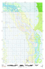
I am paddling from Whitehorse to Dalton Crossing this summer with two others (following the route of the 1K race), and am wondering how others have navigated the braids downstream of Circle, AK (we have the popular Rourke books that cover everything from Whitehorse to Circle)? We have topo maps (which are a bit too broad a scale for navigation) and we are printing maps from Google Earth / Google Maps (but that is very paper intensive). We will have electroncs with us as well, but if anyone out there has any resources for paper maps (or any general suggestions), I would love to hear!

Thanks!
 
As I have separately communicated with NkonF5user, but I will repost some of the major points for any other reader's benefit. I studied and created my best guess at the 1000 mile Yukon River race route in great detail for several months, particularly through and around the thousands of islands, gravel shoals, and the most highly braided and annual changeable segments of the Yukon Flats. I had the benefit of Yukon River experience, having previously raced the much shorter Yukon River Quest, just 440 miles to Dawson Ciity (referred to as a "sprint" by Y1K finishers). Topo maps were hopelessly outdated, highly inaccurate, and practically useless below Dawson. My primary navigation source was fairly recent images from Google Earth. From those images I created a primary main channel deep water route, as well as numerous "short cut" routes as options, with on site decisions to take dependent on water levels and in some cases any immediate need to cut distance and time during the race if a competitor was noted as being a bit too close. Using GE to "fly" my designated best route dozens of times while winter training on a paddle machine in my living room, I was able to memorize most of the details of island passages, best choice of river bend navigation, and braided paths traveling down river, most of which I easily later recognized from my bow seat.

Some short cuts proved to be extremely valuable to besting our time, while others ended up only as lessons learned on what not to do the next time through. As a voyageur canoe team we easily negotiated the memorized route with GPS next point directional/distance aid when later actually navigating on the river. There was little need to occasionally actually refer to the paper maps with their labeled mile posted waypoints to correlate with the GPS odometer. A detailed MS Excel program was used by my pit crew to from time to time insert our location coordinates and point arrival time from our SPOT transmissions. From that, it automatically updated our expected arrival at any subsequent waypoint and finish time could be accurately determined.

I printed on standard printer paper nearly 100 pages of maps labeled with my route choices and almost 800 GPS way points, averaging about 10 miles per page, depending on level of detail that I wanted to show in each particular segment. Each page was treated front and back with a good liquid waterproof coating, which also made the paper somewhat tear resistant, then dried well before inserting into plastic sleeves to carry all in a 3-ring binder. They have survived multiple Yukon River race trips in the binder.
 
Last edited:
i use caltopo.com for map generation and trip planning. they have numerous map and imagery layers you can choose from or overlay, you can mark routes, points, etc. you can also save pdfs or order prints, both of which you choose what scale you want the map at, etc. not the friendliest interface, but highly functional once you get the hang of it. (costs like $20 year for the basic tier - i'm on some grandfathered in legacy plan so i can't speak to what tier has what nowadays, but i get my money's worth from it).

quick example of just scanned topo maps (Circle at the southern end of the map), as if printed on an 11x17 paper at 1" = 1 mile scale.
 

Attachments

  • caltopo 001.png
    caltopo 001.png
    946.3 KB · Views: 12
While Caltopo is great - i use Caltopo and SARtopo along with NYSDEC forest rangers as our primary resource during SAR incidents. It is most useful of course, where and when the terrain does not change much since the last map survey. From one year to the next on the Yukon River, I have noted significant changes in where you can and cannot paddle. Around Circle AK, we could see large undercuts of earth and permafrost falling into the current, some making large potential swamping waves on our boat resulting in large changes in where we could go within an open flowing channel from one year to the next. Some places had formed and reformed shallow gravel bars, so if you go that way you may end up walking while dragging your canoe over shallow gravel until you get back into paddleable deep water.

Choose your channel to paddle. Both with Circle AK at the bottom of the images brelow. What is the date of the Caltopo map you are using at Circle? GE tends to update every couple of years, but it still is not 100% accurate from year to year.

Which route is the shortest and which is the fastest? (hint: they are not necessarily the same, rarely true]
Proposed primary track and and optional alternate tracks from multiple years shown with mile marker waypoint labels.
naked circle.jpgcircle 2024.jpg
 
Last edited:
Back
Top