• Happy Apple Cider Day! 🍎🍵

The Rainbow-Debsconeag Wormhole

Joined
Dec 16, 2016
Messages
691
Reaction score
706
Location
Bangor, Maine

Pre-Trip​


The Debsconeag Lakes Wilderness Area (The Nature Conservancy) and the state Nahmakanta Unit (Maine Bureau of Parks and Lands) combine for form a ~90,000 acre preserve in the area southwest of Baxter State Park. The "100 mile wilderness" stretch of the AT passes through here. It's a very rocky collection of small to medium sized ponds and moderate height peaks and cliffs. Nothing huge like Katahdin or Chesuncook, but instead just lovely scenery at mezzo scale. I keep wanting to reuse the word "rough" -- there is very little plain old dirt in the area, only rocks, roots, moss and mud. Debsconeag means "Carrying place" in the Abanaki language and indeed the ponds are connected by a number of portage trails. There are roads of course, but for the most part they poke in from the perimeter and none cross the center.

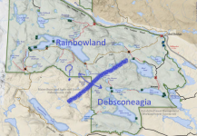
The idea for this trip started with the map. The northwest and southeast parts of the wilderness area are oddly disconnected, the Rainbow Lake area mainly accessed from the north, the Debsconeag area from the east and south. To travel between them on offically mapped routes one has to either go all the way over to Nahmakanta (long portage followed by a whitewater run that dries up in summer), endure an absurd mountaintop portage along the AT to Hurd Pond, or go up to the West Branch and float/portage all the way down to Debsconeag Deadwater. Rainbow Lake and Second Debsconeag Lake are a mere 2.5 miles apart, with the smaller Beaver and Minister ponds even closer, surely there was a route connecting them, back in the day?
rainbow-deb-crayon.png
Now where is that jump gate?

Despite some searching, I couldn't find the key trail for such a route on any old maps. In David Cooke's terminology (Above the Gravel Bar), this would have been a "neighborhood route", not an important long distance trail like the Millinocket Carry or the Maliseet Trail, so I suppose the lack of documentation is not all that surprising. Still, it would have been heartening to see a dotted line somewhere. With that in mind, the "Can't Get There from Here Canoe Club" (i.e., Hope and me), set out to find the elusive "wormhole" between Rainbowland and Debsconeagia.

We planned a three night trip starting at the Little Holbrook Pond access in the northwest corner of the preserve, and finishing at the Grant Brook Road bridge near where the West Branch empties into Ambajejus Lake. Nearly all of the route was either "in the book" or known to us from previous visits, so other than the uncertain "wormhole" we were confident it would all prove navigable.

Day Zero (Thursday)​


Hope and I met at Katahdin General Store in Millinocket, the last chance to buy wine, cookies or brake fluid before heading into the woods (this time only cookies were required). Work schedules meant that we couldn't start until late Thursday afternoon, so we were hustling to make the best use of daylight. We dropped Hope's car at our planned takeout, the bridge where the Grant Brook Road crosses the West Branch of the Penobscot, and headed further west to our starting point, the Little Holbrook Pond access. The road to the latter is a bit sketchy, and recent rains had made a few large puddles, but I managed to avoid beaching my Subaru and we were unloading at about 6pm. It was raining lightly, but we weren't too fussed about that since the forecast for the rest of the weekend was dry.

It was a couple hundred yards from the parking area to the put-in on the pond, but we won't count that as a portage. (I like when land managers buffer the access, a parking lot at the water's edge is unnecessary and detracts from both water quality and scenic beauty. Also, the last 100 yards is usually muddy anyway.) Our planned route had 6-8 portages total, including a long one that would presumably be pure bushwhacking, so we both packed fairly light. We were on the water at about 6:30pm. We didn't dillydally around as we knew there weren't any good campsites on Little Holbrook or Holbrook, and thus wanted to get to Rainbow before dark.
IMG20230504183053.jpg
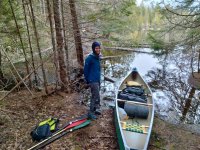
Rain gear required, but good to be getting out there

We were using my Penobscot 16, with seats and thwarts pretty much stock.

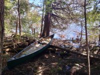
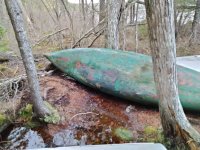
The carry from Little Holbrook to Holbrook is just a hundred yards. There are a bunch of cached boats at the south end, which is curious. Would someone carry a canoe 200 yards from their vehicle to the put-in, paddle 0.5mi across Little Holbrook, walk 100 yards and then launch a different boat on Holbrook? Maybe those are lucky fishing boats on that pond only? IDK.
IMG20230504185638.jpg
Lucky fishing canoe?

Some art gallery should do an exhibit of cached canoes. This one had stories to tell, I'm sure, all rendered in degenerating fiberglass.
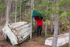
HolbrookRainbowBigBeav2ndDeb_CanoeTrip_May2023 (4).jpg
Parking for Sears brand jonboats only?
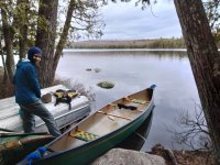
IMG20230504185642.jpg

Arriving at the south end of Holbrook Pond, we took out at yet another cache of boats and located the portage trail leading to Rainbow. The trail isn't on any recent maps, but I knew from a previous visit that it was in decent shape. It is shown on the 1950's topo, but the route has changed slightly. I believe the Rainbow Lake Lodge staff maintain it so they can bring people on day trips to Holbrook.

We didn't take any more pictures since it was getting dark and we were in a hurry. Although we'd packed light, with a ~60# royalex boat and rough trails we weren't attempting any single carries, so we had to walk the ~0.6mi trail three times. The first hike over with the packs went fine, we had to search for the trail in places but we always eventually found a red blaze. Returning unladen we were practically jogging as the light was fading. For the third pass Hope was carrying our small drybags, PFDs and one paddle; I was just carrying the canoe. Fortunately one of those drybags had a headlamp or we'd have been screwed. Hope led the way, and I angled in the general direction of the light while trying not to trip.

Given that this was ostensibly a bushwhack portage trip in search of a lost route, I really shouldn't have complained about portaging on a trail, but I sure did complain. The modern routing of the trail was fine for nimble foot traffic but was a huge pain for a canoe. Often it would squeeze between a tree and a boulder in such a way that one couldn't get through while balancing the canoe -- there was room overhead, but it was above the boulder not above the trail. A proper portage trail may muddy your boots but it doesn't require any sharp turns or odd yoga poses.

It was fully dark when we finally arrived at the put-in on Rainbow Lake (more cached boats), relieved to have only a short paddle ahead of us that evening. Paddling in the dark is way easier than hiking in the dark. We got out a second headlamp and commenced loading up.

We had a bit of a scare when we couldn't find my PFD -- was it back at Holbrook? -- but it turned out to be just a few yards back on the trail. Once on the water, we followed the shore to the west looking for a campsite. The official map showed two in the northwest cove, and before long we found one, easily visible as a clearing at the water's edge with (what else) a cached boat. The rain had eased up, so we quickly made camp and warmed up some food.

(to be continued)
 
Looking forward to the wormhole, which has already begun by paddling in a black hole. While it's sometimes difficult for me to remember all the dramatis personae in our threads, I do recall Hope as the Queen of Maps who has hats and shirts that change color in certain parts of Maine.
That's the one! I guess the hat was stowed due to rain in the first few pictures.
 

Day One​


(sorry for the slow start on this TR, thought I'd have time yesterday)

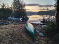
The thermometer in my tent read 37F Friday morning. It was a bright and pleasant morning, but still quite chilly. There were a few clouds around and when the sun went behind one it was immediately uncomfortably cold.

IMG20230505052708.jpg
Morning on Rainbow Lake -- Clouds will please move on!

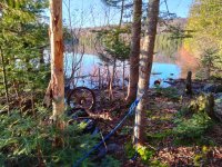
The campsite turned out to be the end of an old road (now snowmobile trail) from Chesuncook Pond (not to be confused with Chesuncook Lake). It was a pretty good campsite, with a picnic table and some interesting artifacts.

IMG20230505061340.jpg
Old car axle and painter line

We got on the water at about 8:30, with a full day ahead of us.

Rainbow Lake is high, about 1000', and the forests around it are mostly deciduous. In early May the trees were budding but not leafed out. A big lodge compound sits on a on a southern peninsula, looking well kept and perhaps a bit less rustic than one would expect for the surroundings. I believe many of the secondary trails around the lake are maintained by lodge staff. There are three different trail sign styles in the area: Rainbow Lake Lodge, The Nature Conservancy (TNC), and the Maine Appalachian Trails Conservancy (MATC).

The winds were manageable and mostly behind us, so it was easy to traverse the 4 miles or so to the east end of the lake. When we arrived there we found the stream emptying in from Little Beaver Pond. As we were scouting around the cove the wind picked up, and we were glad the day's lake travel was behind us (we hoped).

There was a pretty good takeout leading to a trail, which turned out to be the white-blazed AT. In fact the AT crossed the stream here, leading to a pair of takeouts on both sides.

IMG20230505093627.jpg
Takeout and trail near Little Beaver brook

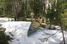
It's obviously not hard to follow the AT, but just after the takeout we encountered an obstacle in the form of a large snowdrift. We could mostly walk on top of it, but we would make deep post holes in places and had to watch for shrub voids.

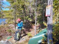
The official map showed a spur trail to Big Beaver Pond, skirting Little Beaver on the east side. Soon enough we found it, just a couple hundred yards east of the takeout / snowdrift on the AT. There was even a sign, courtesy of MATC. We made our way with our packs.

The trail to Little Beaver was easy. A signed turnout led to a pleasant campsite. Beyond Little the trail became more muddy and less distinct, although we could still follow it. (This was the second time in this still-young trip that a trail "in the book" proved to be tough sledding, and we hadn't even gotten to the wild stuff.) Soon enough we arrived at the put-in on Big Beaver. It looked pretty well used, with some cached boats (of course). On the map this pond looks like a dead end, but you never know.

IMG20230505102818.jpg
Put-in on Big Beaver Pond

Note that this cached canoe looks almost brand new. The Lodge must have had a good year.

Returning to the takeout for the canoe, we were again at the big snowdrift. I definitely wasn't going to cross it with a canoe on my head, so I kind of launched the boat across and gingerly walked around.

HolbrookRainbowBigBeav2ndDeb_CanoeTrip_May2023 (9).jpg
No blackflies, know snow

Carrying the canoe to Big Beaver I fell on my arse trying to navigate a muddy stretch. No damage, but I did pick up quite a bit of mud (no photo). Finally we were on Big Beaver, boat and gear together, no known trails beyond.

It's worth noting that we actually crossed the Rainbow/Debsconeag drainage divide between Little Beaver and Big Beaver -- i.e., Big Beaver drains into Second Debsconeag. So actually Big Beaver is not the big brother of Little Beaver, but rather the little brother of Third Debsconeag, or the big brother of Big Minister (Bigger Minister?). The stream from Big Beaver to Second Debsconeag doesn't seem to have a name. Bigger Minister Brook? Lesser Third Debsconeag Stream? We just called it The Stream.

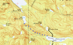
portage_doodle_new2.png
From 1954 Harrington Lake 62,500 -- the "wormhole" in blue dots

We knew we didn't know what we'd find in the woods, but we had some realistic plans about how to proceed.

  • Bad Plan: portage east straight over the ridge to Little Minister Pond, a distance of about 0.9mi. Although this was the shortest route, we knew it was a bad idea for several reasons. The forestland on the ridge was harvested about 15 years ago, so it would be an exceptionally busy bushwhack. Also, the terrain west of Big Minister and Little Minister is steep and very bouldery, perhaps not technical rock climbing but more than we'd want to do with the canoe.
  • Plan A: (blue dots) portage parallel to the stream but a few 20' countourlines higher to avoid any streamside muck. This was our best guess at what the original portage route would have been.
  • Plan A~: portage east until we struck the logging road on the ridge (not shown on the old map above, but visible on satellite imagery), then follow it around north then east to an apparently washed out culvert about half a mile northwest of Big Minister, then bushwhack down to Big Minister where there was a known good trail. This would be a long, boring and difficult carry far from any likely historical route, but it would suck less than giving up.
  • Plan B: forget this foolishness and road portage to Nahmakanta, run the river, and finish on Pemadumcook. This would be a good trip in its own right, but we'd be stretched for time.
  • Plan C: give up and return to our starting point on Little Holbrook.

Note that the Plan A route goes steadily down hill, descending about 450' in 1.5-2.0 mi. That's a big plus when dragging something, but it also means that the cost of turning around is high.

With all that in mind, we scouted the area south of Big Beaver looking for a jump gate.

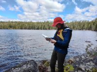
IMG20230505115851.jpg
Classic Hope: wilderness, a map, and that hat

First, we found a trail (!) on the west side of the stream. We followed it for a quarter mile or so, but it was going south, not east or southeast as we wanted to go. We guessed it leads to Moose Pond or the unnamed pond. Relunctantly we decided not to follow the trail.

There was a rough campsite and/or shore lunch spot just west of where the stream left Big Beaver. We might have camped there if it had been later, but it was still early. About 1pm we left the canoe and headed out with just our packs in the general direction of Second Debsconeag.

IMG20230505124357.jpg
Getting ready for the big bushwhack portage

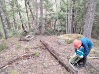
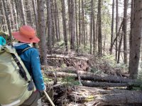
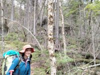
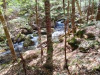
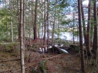
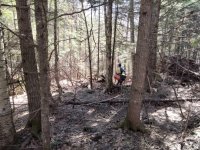
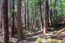
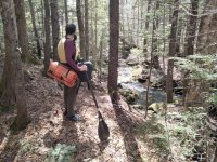
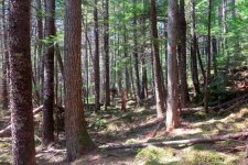
The going was tough, but it was passable, at least for hikers. We brought two of our three paddles and shamelessly used them as walking sticks, which we really needed. The slope on our left was strewn with huge erratics, and we found it was better to stay below them rather than endure the up/down zigzagging of trying to hold an isocline without a trail. Sometimes we even walked streamside, there were a couple marshy sections but mostly it had a solid bank. I kept an eye out for linable sections, but there were none, every fifty yards there was a mini-waterfall, quite scenic but no place for a boat. We really caught the season right -- I'm sure the area is perfect blackfly habitat but they weren't out yet. It was the first weekend in May.

IMG20230505130309.jpg IMG20230505131624.jpg IMG20230505141007.jpg

Around 3pm Second Debsconeag finally came into view. The nothwest corner of the lake was pleasant rocks-and-pine-duff terrain and we sat down for a break and a snack. It had taken us 2 hours 15 minutes to hike down from Big Beaver.

IMG20230505150538.jpg
Second Debsconeag comes into view

IMG20230505150547.jpg
Taking a break

As we snacked, we considered our next decision. The canoe was still up at Big Beaver. It had taken us 2:15 to hike down with packs, we figured we could hike back in about 2 hours (we'd be unencumbered, but going uphill instead of downhill). It would be around 3:30 by the time we finished our late lunch. Sunset around 7:45. Our legs were tired, but not totally knackered. Should we go back up, or make a rough camp where we were?
 

Evening of Day One​


Sitting on Second Debsconeag eating our snacks, we did the math on the return trip for the canoe. 2 hours up to Big Beaver would make it around 5:30, giving us about 2 hours with good light, then at most another hour with fading light. Getting caught after dark in a trailless wilderness without our camping gear would really suck. Could we get the canoe down in 3 hours, when hiking with packs had taken 2:15? Hmmm, take the over on that. Not to mention the "last run of the day" effect -- what if somebody twisted an ankle or worse?

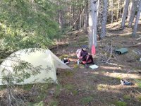
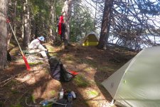
Being prudent, mature bushwhackers we decided to stay put and make camp on Second Debsconeag, heading up first thing in the morning for the canoe. We weren't far from the official campsite, probably a 5 minute paddle, but we didn't have a boat, and the place we were sitting looked pretty good. Another place about 100 yards further on looked even better, so we stopped there and called it a day.

Our spot was very comfortable for an undesignated site, with level tent pads and good access to the water. The woods behind camp sloped up in an inviting way, although we knew from studying maps that there was no overlook up there.

IMG20230505174303.jpg
In camp early

We had time on our hands, and a few early season jumbo mosquitoes were annoying us, so it was tempting to build a fire. I poked around a bit with my trowel looking for a suitable fireplace, but everywhere the pine duff seemed to be at least 8 inches thick. It's hard to be both safe and leave-no-trace with so much fluff around. It was windy, we were on a pristine wilderness lake in an undesignated campsite, there were several ancient looking king pines around. All things considered, we both agreed that it was better to forgo a fire, although one would have been kind of nice.

HolbrookRainbowBigBeav2ndDeb_CanoeTrip_May2023 (14).jpg
Time for dinner

We cooked our dinners on stoves, ate, and retired early.

Day Two​

We got up early, eager to finish the business of the portage.

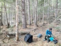
We knew we would be away from camp for at least several hours, so we gave some thought to what we brought with us. We put snacks and some just-in-case items in a drybag with a shoulder strap. The paddles as walking sticks had been very handy on the way down, and there was an abundance of wood, so we quickly made walking sticks. We got going about 7:15.

We left our camp set up, figuring it would give us the option of napping or even staying a second night when we returned.

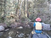
Hiking back up to Big Beaver we moved at a measured pace, knowing this was the slack leg and the real work would be the return with the canoe. We stayed closer to the stream this time. Walking unburdened like that I found I really tuned in to the minutiae of bushwhacking. All of the small decisions you make on choice of route -- over, under, around, through -- are constantly with you, and you're always learning and updating your parameters. Do I need to push that small fir aside, or can I just ignore it and walk straight through? How firm is that mud? Can I duck under that without unshouldering my bag? Hope and I had slightly different parameters, owing to size and footwear (my Bean boots to her trail runners).

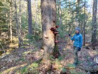
On the way up we stopped to consider this impressive fungus.

IMG20230506073338.jpg
A ladder of shrooms?

We reached Big Beaver just before 9am. We took a break and had a snack. My ultimate portage fuel is candy corn, but I didn't have any, so I had to settle for a large quantity of raisins. That's about as much sugar as you can get from a handful of do-gooder natural stuff.

HolbrookRainbowBigBeav2ndDeb_CanoeTrip_May2023 (19).jpg
Fueling up for the port

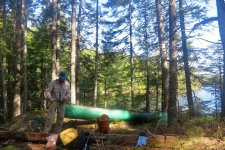
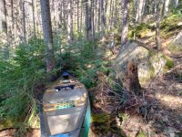
The carry with the canoe went essentially as planned. It was a drag, and it took a long time, but that was the plan. As is usually the case with these sorts of carries, Hope stayed 50 yards or so ahead and scouted the route. The default was for me to angle in her general direction with the canoe, but sometimes she'd stop, turn around and say "not this way!". With the canoe the challenge is always to avoid trees too closely spaced. In a pinch, one can flip the canoe up on it's side, but neither carrying nor dragging is comfortable in that orientation so it's to be avoided if possible. The small, springy conifers in the understory could often be ignored, I'd just shove the boat through there, they'd part around it and then close behind it.

IMG20230506102308.jpg
That way?

I carried the canoe properly when it was clear overhead and on the ground. That was nice when it happened, but most of the time I was dragging, either directly or with a painter. Here's one stretch of "pretty good" terrain where I could actually carry the canoe with dignity and grace.

HolbrookRainbowBigBeav2ndDeb_CanoeTrip_May2023 (23).jpg
Portaging like I'm on a trail

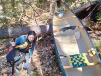
This blowdown is a good example of over/under/around -- the boat went over, Hope went under, I went around.

IMG20230506094050.jpg
Blowdown or canoe rest?

IMG20230506111309.jpg
A Zav is a high class walking stick (n.b., that one is the Black Rec model, we didn't bring anything superultralight)

If you drag a boat down hill long enough, eventually you'll get to water. (Except in Death Valley?) Anyhow, we arrived at Second Debsconeag at around 1pm. We immediately launched, preferring to paddle the few hundred yards to our camp rather than walk.

IMG20230506130818.jpg
Ahoy Second Debsconeag!

For those of you keeping track, with fresh morning legs it took us almost six hours to retreive the canoe. Had we started at 3:30pm the previous day, with sunset at 7:45, it would not have gone well.
 

Attachments

  • HolbrookRainbowBigBeav2ndDeb_CanoeTrip_May2023 (23).jpg
    HolbrookRainbowBigBeav2ndDeb_CanoeTrip_May2023 (23).jpg
    265.8 KB · Views: 7
  • IMG20230506093215.jpg
    IMG20230506093215.jpg
    220.2 KB · Views: 7

Afternoon/Evening Day Two​

After another snack / late lunch, we broke camp and got back on the water. We could have stayed, but we wanted to make some progress to our takeout and were looking forward to one of those beachy sunset campsites on First Debsconeag.

The 0.8mi carry from Second to First Debsconeag was an annoyance. We'd both traveled it before and since it's a maintained, in-the-book trail we discounted it as a triviality in planning the trip. It wasn't hard or anything, but coming at the end of the day it was not appreciated. The bog bridging was broken in places. I grumbled.

Back in the water on First Debsconeag, there was a strong west wind with gusts. At first it was a welcome tailwind, but as we got further east and gave it some more fetch it kicked up some waves and we had to pay attention.

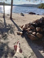
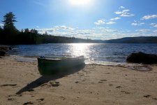
We glanced at the campsite at the west end of First Debsconeag, but it was in the shade and we were thinking of sun, so we continued down the lake. There are three beachy campsites at the east end of the lake, all nice. The northernmost one was occupied; we took the middle one, just above the outlet. This was an official TNC-maintained site with all mod cons.

We left the canoe in the middle of the beach in front of the site and couldn't stop taking pictures as the sun set behind it. (I did eventually tie it and turn it over.)

IMG20230506172355.jpg
It was a good day for a barefoot campsite

HolbrookRainbowBigBeav2ndDeb_CanoeTrip_May2023 (33).jpg

HolbrookRainbowBigBeav2ndDeb_CanoeTrip_May2023 (46).jpg

The campsite was very comfortable, but we could sense the transition to semi-wilderness. A couple motorboats buzzed by, and there was some trash.

Day Three​

This was our departure day. We didn't have too much distance left, so there was no need to rush.

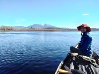
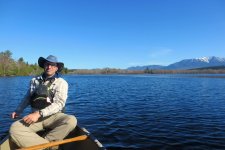
Paddling out of First Debsconeag you come to Debsconeag Deadwater on the West Branch of the Penobscot, where canoeists are required to take photos with Katahdin in the background. We did.

IMG20230507081517.jpg
HolbrookRainbowBigBeav2ndDeb_CanoeTrip_May2023 (49).jpg
Hope has a real camera so I got the better mountain

Descending the big river the water level was high and things didn't look familiar, but we did find the takeout for the portage around the upper section of Passamagamet Falls (that island? no that island.). The lower section of the falls was a bit wooly with the high flow, but we were able sneak in below the haystacks and run it with only a couple wave splashes. No photos as we were fully battened down.

We got to our takeout at the bridge about 9:30. We both agreed it was a great trip, and driving back for the upstream car we were immediately talking about where the Can't Get There from Here Canoe Club would go next.

Post trip notes​

One of the great things about this trip from a planning perspective is that it had one huge challenge in the middle of it, with well known routes on either end. We knew if we could find the "wormhole" we'd be home free. Contrast that with the Carry Brook trip, which had a number of hurdles, none as large as a two mile bushwhack portage but collectively similar in scale. On this trip there was never the doubt of "what if it gets worse".

I was surprised at the lack of damage to my canoe from this trip. I dragged it probably 2/3 of the distance on the main 2mi carry. I made a point of avoiding granite boulders, but was otherwise pretty gruff with it. It has scuffs and pine tar all over, but nothing on the hull that actually requires repair. I put a dynel skidplate on the stern not long before the trip, and it has a thick (every drop of resin!) kevlar felt skidplate on the bow from a previous owner. I suppose without the weight of paddlers and gear a royalex boat is pretty bombproof/spruceproof. I did tear one of my deck bungees and some of the fabric on the yoke pad, but those are the only repair issues from the trip. Anything above the gunwhales gets in the way, especially in the woods.
 
Last edited:
These CGTFH posts are great. Much appreciated to someone stuck in a cabinet shop for the foreseeable future.
 
Good stuff. Thanks. I've got to send a team to look for evidence of a long abandoned portage as part of my job in the next month or so. Guess I'll tell them to be on the lookout for cached boats.
 
Great report and well-written as always. Do you use a mapping GPS in addition to your paper map expertise?
 
Thanks guys. I enjoy these trips more because I know that afterward I'll be able to share them with people who understand canoe tripping.

Great trip report and I really like that you guys take unusual routes! Is Hope doing her ArcGIS story map as well? (I love that format but I'm too cheap and I'm already over my head with other things)
Yes!
https://arcg.is/vWCbz1
It's fun for me to read Hope's story map trip reports. We pool our photos but write up our experiences independently, and although it's the same trip sometimes we make different observations.

Great report and well-written as always. Do you use a mapping GPS in addition to your paper map expertise?
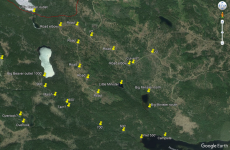
Thanks. Before the trip I mark some points of interest in Google Earth, and then export a KML file which I load up in Organic Maps (works well offline) on my phone. On the ground I mostly prefer paper map and compass, or just dead reckoning when there's a convenient reference like a stream or ridge, but it's nice to be able to check. These were the points for the Big Beaver - Second Debsconeag carry. You can see many pertain to the Plan A~ route on the woods roads and then down to Big Minister. I'm sure glad we didn't have to do that, bushwhacking in early successional forest can be really miserable. Best I can tell that area was harvested around 2000-2005.

GE_points_2.png
 
Many thanks for the enjoyable trip report Goonstroke!

Now, if you could please transit the Churchill Lake to Aroostook River via the Steele route; North Twin Brook, Spider Lake, Chase Lake, Munsungan Lake..... so I'll know if it's worthwhile? Just joking. Problem for me is that I can't consider a trip in northern Maine until late August/ early September, so the brook will likely be really bony as well as jammed with blowdown trees!
 
although it's the same trip sometimes we make different observations
I prefer solo trips but I have always had a great appreciation for the fact that we each see / remember things differently and, therefore, having a partner can enhance the memory by reminding us of things that didn't initially make as much of an impact for us as they did on the other(s). I also find the storymaps format unique as well as being enjoyable

Again, thanks for taking us along.
 
Many thanks for the enjoyable trip report Goonstroke!

Now, if you could please transit the Churchill Lake to Aroostook River via the Steele route; North Twin Brook, Spider Lake, Chase Lake, Munsungan Lake..... so I'll know if it's worthwhile? Just joking. Problem for me is that I can't consider a trip in northern Maine until late August/ early September, so the brook will likely be really bony as well as jammed with blowdown trees!

That'd be a great trip. Pick up some chert when you're there! If you did it upstream you could use Webster Stream and the Millinocket Carry to make a loop.

One of the tough things about Allagash area trips is that the car shuttle can be as epic as the trip itself, so I'm always trying to figure out a loop. Of course the loop trips tend to involve multiple hurdles.
 

Pre-Trip​


The Debsconeag Lakes Wilderness Area (The Nature Conservancy) and the state Nahmakanta Unit (Maine Bureau of Parks and Lands) combine for form a ~90,000 acre preserve in the area southwest of Baxter State Park. The "100 mile wilderness" stretch of the AT passes through here. It's a very rocky collection of small to medium sized ponds and moderate height peaks and cliffs. Nothing huge like Katahdin or Chesuncook, but instead just lovely scenery at mezzo scale. I keep wanting to reuse the word "rough" -- there is very little plain old dirt in the area, only rocks, roots, moss and mud. Debsconeag means "Carrying place" in the Abanaki language and indeed the ponds are connected by a number of portage trails.

I love the concept of finding something on the map and looking for it. I'm also impressed you did this with a Penobscot. Thanks for the great write-up.
 
Thank you for another superb trip report. I admire your skill, creativity and capacity for struggle. Well done!
 
A great adventure. I enjoyed reading about your planning and decision making.
 
Back
Top