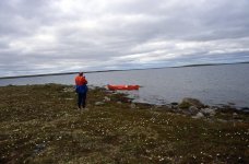
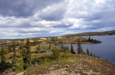
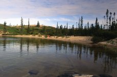
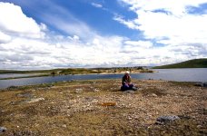
• Happy Patent for First Computer Mouse (1970)! 🖥️🖱️🐁

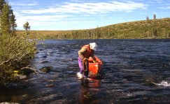
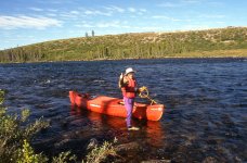
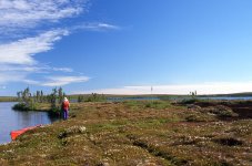
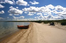
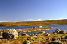
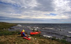
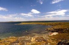
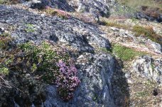
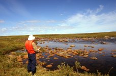
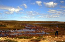
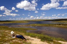
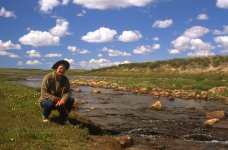
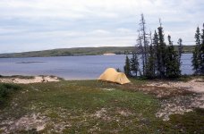
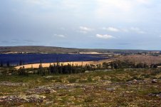
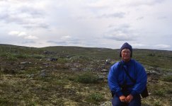
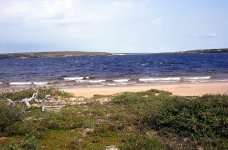
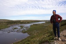
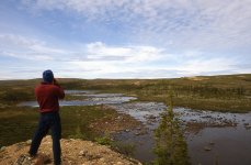
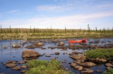
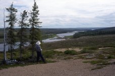
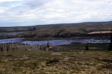
Snowdrift River, Northwest Territories (2001)

Joined
Aug 21, 2018
Messages
1,726
Reaction score
1,914
Location
Pender Island, British Columbia Canada
northern rivers 141 jpeg.jpg


Kathleen and I chose to paddle the Snowdrift River for four reasons. First, we could land at the same spot at which we began our Thelon River trip in 1993, which very much appealed to us. We loved that camping spot at the east end of Lynx Lake. Secondly, instead of travelling east toward Hudson Bay, we could paddle west toward Great Slave Lake. Starting at the same spot but ending up in completely different watersheds intrigued us. Thirdly, during the first part of the trip, we would be living on the tundra and camping on eskers, one of our favourite landscapes. And finally, during the last portion of the journey, we would enjoy the transition back to the boreal forest. There was also the strong possibility of finding Tundra Tom's ecotourism camp at the west end of Whitefish Lake. If so, that might provide a pleasant interlude.

The only information that we could find on the Snowdrift River was a six-page summary prepared by Ed Struzik as part of the series of Northwest Territories River Profiles. Ed found the “upper reaches of the headwaters too shallow for canoe navigation,” with water levels “less than a foot (30 cm) deep for long stretches. There were also a lot of rapids and rock gardens below Sandy Lake.” As a result, Ed’s group began their trip “on a small lake about 15 km (9 miles) below Sandy Lake.”

This didn’t concern us (or should I say me) too much. Kathleen and I are used to shallow, rocky rapids. And a portage or two is just part of every wilderness canoe trip. Besides, our trip would begin at Lynx Lake. We had no choice. We had to go through Sandy Lake and the shallow, turbulent water below.

The Snowdrift River ends its journey at Great Slave Lake, near the small community of Lutseltk’e, which until 1992 was known as Snowdrift. Ideally, Kathleen and I would have paddled all the way to Lutseltk’e. Ed’s summary, though, noted that the last 50 km (30 miles) of the Snowdrift River below Austin Lake contained “approximately 35 rapids and waterfalls, most of (which) require portaging.” I kind of like portaging, but like Ed, we decided to end our trip at Austin Lake.

snowdrift002jpeg.jpg


Sandy Lake was approximately 134 km (83 miles) and 11 days into our trip. We had allowed 2 days to complete the 10-km (6 miles) stretch of four rapids below Sandy Lake that are marked on our topographic map. Ed reported that another rapid marked on our map, about 4-5 days below Sandy Lake, is actually a waterfall, and is a must portage.

I had allocated 26 days to paddle 330 km (205 miles) between Lynx Lake and Austin Lake. This would give us plenty of time to do the Snowdrift River comfortably. As I told Kathleen, “We have to average only 12 km/day (7.5 miles) to complete the trip.”

By comparison, Kathleen and I did the Thelon's 950 km (590 miles) in 37 days, for an average of 25.7 km/day (16 miles). This included nearly 200 km (124 miles) of tundra lakes and 7 portages, one of which was 5.5 km (3.4 miles) long. Carey, Janice, Kathleen, and I did the Coppermine's 645 km (400 miles) in 29 days, for an average of 22.3 km/day (13.8 miles). This included 4 days on a large tundra lake, 15 portages totalling 9.6 km (5.9 miles), 13 drags totalling 5.8 km (3.6 miles), and 4 trackings upstream totalling 1.7 km (1 mile). We did 283 km (175 miles) on the Seal River in 15 days, for an average of 18.9 km/day (11.7 miles). That included a couple of portages and some scouting of the 39 rapids, 16 of which were rated Class III or IV.

Of course, starting and ending our Snowdrift River trip in two completely different watersheds meant that Kathleen and I would have to cross over the height of land. Six years had passed since our struggles on the Coppermine River, and Kathleen had apparently forgotten about the potential rigours of dragging, portaging, tracking, lining, and occasionally paddling our canoe over a continental divide.

snowdrift slide show title copy.001.jpeg

Even so, I genuinely believed the Snowdrift River would be the most gentle wilderness canoe trip we had ever attempted. As I told Kathleen, “There is only one rapid out of Whitefish Lake, and only a few rapids below Sandy Lake. We’ve never had a trip so easy. In fact, this will be the easiest canoe trip that we have ever done!”

I don’t know why I say those things. I just do. And I don’t know why Kathleen continues to believe me. She just does. I was confident, though, that the Snowdrift River would be easy. Only 12 km/day (7.5 miles). That’s doable, even if we portaged and dragged much of the way. I’m not saying that I would want to portage and drag much of the way. I’m just saying that it would be possible.

And certainly we wouldn’t have to portage and drag very much of the way. Most of the first 114 km (71 miles) would be on Lynx and Whitefish Lakes. No portaging or dragging required on these lakes. From the west end of Whitefish Lake, it was only 20 km (12 miles) to Sandy Lake, just beyond the continental divide. I had allocated 12 days to reach the west end of Sandy Lake and its outlet to the Snowdrift River. Only 12 days from Lynx Lake and we would be lazily drifting the final 200 km (124 miles) down to Austin Lake. This would, without doubt, certainly be the easiest trip we had ever done. Just Kathleen and me. Alone on the river. Floating easily through the wilderness. A perfect canoe trip.

I don’t remember if I really stressed to Kathleen the information in Ed Struzik’s brief Snowdrift River report that described the “upper reaches of the (Snowdrift) headwaters (below Sandy Lake as) too shallow for canoe navigation. Maybe Ed was wrong, After all, he hadn’t actually paddled that stretch of river below Sandy Lake. I’m not just being naively optimistic here. Kathleen and I have a fair amount of experience with shallow rocky rivers. We don’t need much water to float our canoe. We’d be content with as much as 30 cm (1 ft).

Anyway, from the west end of Whitefish Lake, where we would begin our journey over the height of land, the tentative itinerary indicates that we would need to average only 14 km/day (8.5 miles) to reach Austin Lake in time for our pre-arranged pickup by float plane. And, if we had to, we could portage the entire 10 km (6 miles) below Sandy Lake. At three loads each, it would be a total distance of only 50 km (30 miles) . It would be like a moderate, 3-day backpacking trip. And half of that distance would just be sauntering back to pick up another load. After completing the portage, we could make up time and distance quickly by putting in long days on the flowing Snowdrift River. Piece of cake. Anyway, I never believed that we would need to portage the entire 10-km (6 miles) stretch.

July 1. We drove into the Queen Elizabeth Campground in Fort Smith, where we spent the evening talking canoeing and Canadian exploration history with a German couple from Leipzig. They had just paddled 600 km (372 miles) in 20 days, beginning on the Clearwater River in Saskatchewan. Four of those days included the 20-km (12 miles) Methye Portage, which connected the Hudson Bay watershed with the Mackenzie River drainage system. They were following journals and reports of the Fur Brigade Trail dating back to Alexander Mackenzie. They planned to continue down the Slave River to access Great Slave Lake, and then down the Mackenzie River to Inuvik. Two East Germans, young and adventurous, living more Canadian history and geography than most Canadians are even aware exists.

The next morning we felt some anxiety as we stood on the float plane dock. It was a morning of transition. We were about to embark on another adventure of unknown stories. Another adventure out onto the Barren Grounds, our favourite landscape. At the last moment, on a whim, we packed the rest of our highway food (salami, pepperoni, cheese, cookies, apples and oranges) into the plane. We lifted off Four-Mile Lake into a northwest wind of 15 knots. Two hundred and eighty-eight pounds (131 kg) of gear, plus the canoe tied onto the left pontoon of the Cessna 185.

Ninety minutes later, we landed at Manchester Lake to refuel from fuel drums that had been cached there. The wind had increased to 25 knots, and our pilot Gary now looked a bit worried. I didn’t know why, but Gary explained.

“The lake might not be long enough to take off into this wind. If we don’t lift off by the time we come even with that point down there, I’ll have to shut ’er down. Then we can float through the channel to the next lake and see if that lake is long enough to take off into the wind.”

Apparently Gary really was worried. Even so, we lifted off easily just before reaching the point and continued east for 45 minutes to where we looked down on Lynx Lake.

snowdrift003.jpg

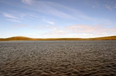
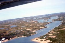
This is what the outlet to the Thelon River from the east end of Lynx Lake in 1993. This time though, the outlet bay to the Thelon River seethed in crashing waves, and breakers rolled across the lake’s surface, running before the wind.

Gary’s voice cracked through the head set: “We gotta get out of here, and look for somewhere else to land. The wind is at 55 knots!”

For those of you who don’t know, a knot is equal to one nautical mile, or 1.151 miles/hour (1.852 km/hour). This puts the wind blowing toward us from the northwest at 63.3 miles/hour (101.9 km/hour). I didn’t know those conversions myself until I looked them up just now, nearly 13 years later. I think Gary knew all along what 55 knots meant, as he now looked very worried. I don’t know how much wind a Cessna 185 can tolerate, but as Gary said, “We gotta get out of here!”

And out of there we got. We banked left, to the port side, and swung back towards the west. We flew in silence, our bodies tense, as the plane tossed and heaved against the wind. We stared downward, looking for safety. You might ask, “Just where do you think you’re actually going to find safety? Isn’t it windy everywhere? Isn’t it windy all the way back to Fort Smith?”

I’m glad you weren’t there to ask those questions. You would have been right, of course. Realizing that, I might have been more worried. As it was, I still wasn’t too worried. Things always seem to work out for me.

Gary announced his plan through the head set. “We have to find calmer water in the lee of an island, any island big enough to break the wind even just a little. Then we just might be able to land.”

Sounded like a good plan to me. I certainly didn’t have any better plan. Only problem was, though, there didn’t seem to be a lot of big islands in sight. Actually, there weren’t any big islands in sight. Just low, small pieces of land surrounded by crashing waves. I now began to worry. I looked at Gary, whose face showed resolve. We flew and searched, and I truly began to appreciate the old phrase, “Any port in a storm.”

“I’m gonna try to take the plane down here,” Gary said. “The waves look a bit smaller by that island.”

We began our slow descent. “Oh my, oh my,” Gary said. “Those swells must be four feet (120 cm).” Kathleen and I didn’t say anything. Gary was in charge. Our fate was in his hands. I trusted him.

Suddenly we pulled out of our descent and rose again, and circled around. Gary said, “I gotta check for rocks. We don’t want to hit any rocks.”

Again, a good plan. We circled around until Gary was satisfied that there were no rocks blocking our intended path to the shore. We began our descent for the second time.

“Oh my, oh my, those swells must be eight feet (240 cm).”

I’m not making this up. That’s what Gary said. I expected that we would now lift up again, like before, and look for somewhere else to land. Eight-foot swells certainly sounded worse than 4-ft. swells. In fact, they sounded twice as bad. Gary might have been exaggerating during the excitement of our predicament, but the breaking waves did look darn big.

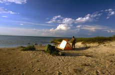
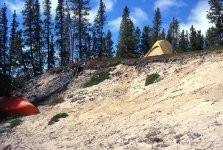
But no, we continued slowly downward. Float planes are supposed to land softly on the water. That’s what pontoons are for. On previous canoe trips, we had landed softly every time. This time, though, we hit the water very hard and bounced back up into the air, like a stone skipping across the water. We hit the water again, and bounced a second time. Again, we hit the water, and bounced a third time. The Cessna 185 now veered sharply to port side, and Gary gunned the throttle. This time, when we hit the water, we didn’t bounce but rammed forward onto a beach at the foot of an esker, maybe 3 m high. Gary turned to me, reached across the cockpit, shook my hand, and said, “Boy, am I glad to be on the ground.”

“You know, Gary, I thought the waves were worse the second time we started to descend. I thought you were going to pull up.”

“I wanted to, but we had already lost too much speed. We were committed to whatever was going to happen.” I’m glad Gary didn’t tell me that at the time.
snowdrift004.jpg


We set up camp at 5:00 p.m. as the wind intensified even more. We fed our highway food, two gorp snacks and some of our supper soup to Gary, who had brought no supplies with him, not even a jacket. “If I can’t fly out of here by 10:00 this evening, I’ll have to stay overnight.”

We loaned Gary one of our sleeping bags while he rested, waited, and shivered in the cockpit. I guess he felt more comfortable in his plane than by our fire. At 9:45 the wind slackened and Gary escaped to the southwest, leaving only a few minutes before it became too dark to fly legally.

We were now alone, as we wanted to be, but we felt a little bit uneasy. We didn’t really know where we were, although Gary and I both independently picked the same small island on the map. I don’t know why I didn’t just ask Gary to refer to his GPS on the plane. Kathleen and I carry only maps and compass, which are useful only if you know approximately where you are. What had we done? The myriad of bays, channels, and low islands would be quite difficult to navigate if we were very wrong about our location.
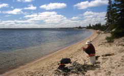
snowdrift005.jpg

July 3. We slept late and woke to a calm morning. Best of all, there were almost no bugs. We enjoyed a slow, relaxing morning of bannock. During breakfast, I studied the shoreline west of our camp. According to the map, the island I believed we were on showed a sharp bend to the north around an obvious point. This shoreline, however, seemed to extend more or less straight, with only a slight curve to the north.

We strolled west down the beach and soon confirmed that there was no sharp point bending north. Just a small bay nestled into the shore, which then continued stretching west. We were definitely not where we thought we were. This was bad news. We climbed to the top of a beautiful east/west trending esker that extended for 4–5 km (2.5-3 miles). Where could we be? We studied the map, which indicated that only one long esker existed in the immediate area. So, we must be on that esker. If so, we were on a peninsula of the mainland and were only a few kilometres west of the island that we thought we were on last night. Not so bad.
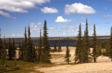
snowdrift006.jpg

We hiked across to the north side of the peninsula, checking landmarks, curves, and bays in all four directions. We became pretty confident that we knew where we were, a very comforting feeling. I wasn’t absolutely, completely certain, though. The landscape was low and flat, and many islands and narrow peninsulas share similar physical features. And it was possible that we were just trying to make ourselves feel better by claiming to know where we were. After all, last night we also “knew” where we were.
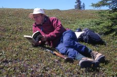
snowdrift007.jpg

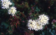
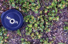
Nevertheless, we enjoyed the rest of the afternoon strolling across the tundra to greet old botanical friends: Alpine-Azalea, Bog Laurel, Bog Rosemary, Prickly Saxifrage, and Labrador Tea. We lay down and immersed ourselves in a close-up view of the tundra’s floral elegance.
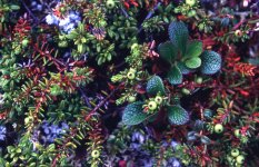

snowdrift008.jpg


A Lapland Longspur burst out of a beautiful carpet of Red Bearberry and Crowberry that spread downhill below our feet. Crowberry, the only member of its botanical family, produces a profusion of black berries eaten by birds, voles, lemmings, and bears. Crowberry also makes fantastic kindling for starting campfires. This trailing, ground-hugging plant often grows near the water’s edge and is commonly crushed by ice thrust up onto the shore by high water and strong winds during spring breakup. It’s fragile, reddened, dead stems and leaves become tinder dry and burst into flames at the touch of a match.

After hiking north, east, and south on the peninsula for about 10 km (6 miles), we arrived back at camp, tired but satisfied. We were now even more convinced that we knew where we were. I felt immensely happy. I love this Barren Grounds landscape—its openness, its emptiness, its vistas, its freedom, and its fragrances, especially that of Labrador Tea. We dozed on the beach in the afternoon warmth. Still almost no bugs. Lynx Lake lapped gently against the shore. Tomorrow we would paddle.

July 4. Our 20th wedding anniversary. Kathleen surprised me with a very cute “Bunnies in Love” card. I laughed right out loud when I saw it. It was so darn cute! Did I give Kathleen anything? I don’t remember. Nothing was written in my journal about any gifts. Anyway, there was no time for romance. We had paddling to do. We were already one day and several kilometres behind schedule.

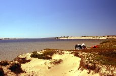
We put on the water at 10:15. So beautiful to paddle through the Barren Grounds. Quiet and inviting. A mosaic of water, tundra, sand and eskers. We paddled 10 km through a maze of islands to reach the north shore of Lynx Lake. We then turned west, closely studying landmarks. I checked our map and compass frequently.


snowdrift009.jpg

At lunch we hiked over a low ridge to confirm that a small river drained into Lynx Lake at this point. We were becoming positive that we knew for certain where we were on the map.


snowdrift010.jpg

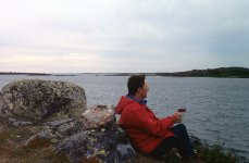
We stopped at 4:30 on a 2-m ridge of Red Bearberry growing in the cracks of the hard Canadian Shield. Bog Laurel proliferated along the shore. We camped in a narrow channel studded with islands. This further confirmed our location, as only one such channel was indicated on our 1:250,000 topographic map. It was time to stop worrying about where we were.

A diving Red-breasted Merganser entertained us during supper, which we prepared using our small Coleman backpacking stove, as no wood was available. We had 10 more days of fuel, which I hoped was enough for the 12 days that I estimated it would take us to reach more or less consistent stands of trees west of Whitefish Lake. What, you say? Ten days of fuel for 12 days to reach trees? Well, we’re bound to find little bits of wood along the way. No need to carry more fuel than necessary.

In celebration of our anniversary, we enjoyed fruitcake for dessert, followed by a bedtime brandy. A heavy haze crept into the evening sky as the wind shifted to the southwest, bringing in smoke from the many fires reported to be burning in northern Saskatchewan and Manitoba. Unfortunately, the wind was picking up again, which makes paddling impossible.

As we lay in the tent that evening, we reflected on our paddling day, during which we saw one caribou, and many small groups of flightless Canada Geese noisily running along the shore, away from our approaching canoe. Early in the paddling day, we had likely passed within 2 km (1.2 miles) of the outlet to the Thelon River, which had been our planned starting point for this trip. The outlet remained obscured, however, behind low ridges. It would have been nice to visit our camp of 1993, but 2 km was close enough. Close enough to say that we had begun this trip at the same place as our 1993 Thelon River trip. Instead of heading east to Hudson Bay, however, we were now heading west, over the height of land, to reach the Mackenzie River drainage system. danged exciting.
 
I can't imagine landing in a little plane with winds of 100 K an hour! You should have bought a lottery ticket on that day, sure seems like everyone got lucky. I'm pretty much a slave to my GPS now when in new country. So nice to fire it up and see where you are, you don't need to use it for navigation, but takes a lot of guess work out of situations like you faced. Can't wait to read the rest of the report!
 
I can't imagine landing in a little plane with winds of 100 K an hour! You should have bought a lottery ticket on that day, sure seems like everyone got lucky. I'm pretty much a slave to my GPS now when in new country. So nice to fire it up and see where you are, you don't need to use it for navigation, but takes a lot of guess work out of situations like you faced. Can't wait to read the rest of the report!

Mem,

I actually wasn’t worried when Gary was searching for a place to land. I should have been, but I didn’t know better at the time. As they say, ignorance is bliss.

Kathleen and I had booked last January to fly with Ahmic Air out of Yellowknife out onto the Barrens in June. Trip has been postponed until next summer because of Covid-19. The fine print on our receipt from Ahmic Air discusses weather delays, including “Company Wind cut-offs: Surface winds consistently above 25 knots.” That’s less than half of what we were dealing with in our flight to Lynx Lake. In retrospect, I am a little surprised that we were in the air.

Our kids gave us a GPS quite a while ago, but I usually left it at home. I love, and feel confident with maps and compass. We did, however, take the GPS on our 2117 canoe trip in the East Arm of Great Slave Lake. We needed to know exactly where we were before calling Ahmic Air to pick us up on the 17th day. I became addicted to it. I sometimes used it 3 or 4 times in the tent at night, just for the fun of it. It’s reading never varied, which was good to know.

I hope you do like our story. I will likely not post again until tomorrow, as Kathleen and I reserve Sunday for just being together, with minimal distractions. I also don’t want to finish this TR too quickly. This is my last trip report. After that, I have nothing left to add to this forum.

Michael
 
"This is my last trip report. After that, I have nothing left to add to this forum."
Michael

There are 5-6 members here that whatever they post I read, you are one of them. Your comments are valuable to the well being of this forum. I for one, want to keep reading any thing you have to say on any subject.
 
Last edited:
What a great trip! What a great report!

I was once in a float plane that was forced down by due high winds but I have no idea how much wind. I know the pilot was looking around for a lake he could land on (and presumably be able to take off from, which I have learned are two different things.) After we landed, the pilot turned the nose into the wind and was "flying" only on the water, into the wind in order, I assume, to keep us upright and not blown around. I was pretty hyped up and anxious. Also, the pilot only spoke French and my French is just functional. So I didn't really know what was going on. After a couple of hours, the storm had passed and we took to the air again.

I have also had the thrill of not knowing where I am. I can really relate to the impending panic of being lost amid the islands. Your report made me shiver.

I have never used a GPS, like you, using a compass and maps. Brad loves them though, so I am likely to have one along on any trip he participates in. A GPS can have it's batteries run down, get wet and stop working, etc., I feel more confident with map and compass skills.

Greatly looking forward to the next installment. Thank you so much for posting.
 
"This is my last trip report. After that, I have nothing left to add to this forum."
Michael

There are 5-6 members here that whatever they post I read, you are one of them. Your comments are valuable to the well being of this forum. I for one, want to keep reading any thing you have to say on any subject.

Thanks for your encouragement, Birchy. But there are a lot of people on this forum with more knowledge and expertise than me. Anyway, here comes the next chapter.

snowdrift011.jpg - Click image for larger version  Name:	snowdrift011.jpg Views:	0 Size:	204.1 KB ID:	112324

July 5. Thunder, lightning, and rain overnight. We decided that the weather was too gloomy and windy to paddle, so we spent a lazy morning and afternoon hiking along an esker ridge.

snowdrift012.jpg - Click image for larger version  Name:	snowdrift012.jpg Views:	0 Size:	573.0 KB ID:	112325

Saw a lone muskox and a lone arctic fox. Both eyed us cautiously, often looking back as they ran away. Also saw one White-crowned Sparrow.

snowdrift013.jpg - Click image for larger version  Name:	snowdrift013.jpg Views:	0 Size:	502.8 KB ID:	112334


The spruce trees were covered with vibrant scones, which revealed the promise on a new Arctic spring. Just as Kathleen was photographing the cones, her brand new crown fell out. For no reason at all. You might remember my crown came out on the Anderson River while I was eating very sticky, dried pineapple rings. There was a reason why my crown came out. Kathleen’s crown came out for no reason at all. It just decided to jump out.
Kathleen said she felt no pain. Not yet, anyway. But we were both worried. Still 25 days to go before our scheduled pickup at Austin Lake. We wandered back to camp somewhat dejected. Long-tailed Jaegers and Herring Gulls soared overhead.

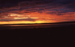
After a soup supper, we crawled into the shelter of our tent, serenaded briefly by Harris’s Sparrows, until the thunder, lightning, and rain once again bombarded our very exposed, rocky campsite. We both wanted to leave this spot. We lay on our sleeping bags, hoping for an opportunity to paddle. It would be great to paddle in a late evening calm. It would be fantastic to float on a placid lake into a low-angle sun. We were ready.

snowdrift014.jpg - Click image for larger version  Name:	snowdrift014.jpg Views:	0 Size:	351.6 KB ID:	112326

At around 8:30 p.m., we received our wish, as the storm just suddenly and completely disappeared. We quickly packed up and shoved our canoe out onto the lake just before 10:00 p.m. For the next couple of hours we paddled beneath the intoxicating, restful calm of “midnight” twilight, navigating through a jumble of islands and bays. The flat, somewhat featureless landscape required constant attention to my maps and compass.

After leaving the maze of islands, we paddled 2 km through a clear channel and then swung north around a cape projecting into Lynx Lake. We then paddled 2 km (1.2 miles) up the cape until we were more or less opposite a large island (2 km × 2 km) situated about two-thirds of the way across an open body of water between us and the southwest shore of Lynx Lake. We wanted to be on that southwest shore, which provided the shortest, safest route to the river flowing into Lynx Lake from Whitefish Lake. Staying on the northeast shore would force us to cross several very large, deep bays. We don’t like crossing large, deep bays because of the potential for strong winds and high waves.

Well, I should say that we believed we were opposite the large island. We should be, according to my understanding of where we were. Despite a full moon, though, the night was dark, and we could only faintly make out the general features of this presumed large island.

Trusting our judgement, we began the approximate 2.5-km (1.5 miles) open crossing at 1:00 a.m., heading for the presumed middle of the large island at a bearing of 250°. Kathleen and I paddled hard, worried that the wind might return. Fortunately, though, we paddled across in calm conditions and reached the island in about 35 minutes.

snowdrift015.jpg - Click image for larger version  Name:	snowdrift015.jpg Views:	0 Size:	264.5 KB ID:	112327

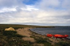
We beached our canoe and hopped out on shore, hoping to find a suitable campsite. No luck. Just boggy and wet. Despite shivering with cold, we paddled north along the island’s eastern shore and finally stopped to set up camp at 2:45 a.m. At 3:30 the sun rose in the northeast horizon, instantly warming us.

We slept until 10:00 a.m., waking to a hot, calm morning. We scrounged some firewood from a small thicket of spruce, and cooked a delicious breakfast bannock. Having firewood was now even more important to us, as one of the fuel bottle’s lid had come loose, completely draining 3 days’ supply of white gas. I don’t know how this could have happened. Such accidents can be serious, or at least uncomfortable. We now had only 7 days of fuel left and approximately 11 days remaining on the Barren Grounds.
During breakfast, a canoe, far out on the lake, passed by, heading east. We were a little disappointed that it did not stop. It would have been nice to chat to people, even strangers. It would have been nice to share stories, yarns, and adventures. Thirty minutes later, a second canoe appeared far out on the lake, heading to shore, likely because of an imminent thunderstorm. Out on the lake is a dangerous place to be during a lightning and thunderstorm. We just happened to be camped where the two paddlers landed.

“Where are you headed?” I asked.

“We started at Sandy Lake, and we’re heading down the Thelon River to Baker Lake.”

“It’s a great trip. We did the Thelon in 1993.”

“Did you write a book about your trip?”

“Yes, I did.” I wondered why he asked that question.

“Well, last week in Yellowknife I bought your book.” (Note. He was referring to our book Three Seasons in the Wind: 950 km by Canoe Down Northern Canada’s Thelon River. Kathleen and I self-published this small book, based on our diaries. Over the years, some people have called, or written, or emailed to say that they actually enjoyed our story. Always nice to hear.)

I kid you not—it really happened just like that. There’s almost zero chance that we would see anybody else out here. So what’s the probability that this chance encounter would be with someone who had read (or at least bought) our book. Apparently, the probability was greater than zero.

(Note: When I was a kid, about 12 years old, I enjoyed watching the Tonight Show with Jack Paar. Jack hosted the show, before Johnny Carson, from 1957 to 1962. Whenever Jack said something that he thought might be a little or a lot unbelievable, he would hold up his hand, as though taking an oath, stare directly into the camera, and say, “I kid you not.” I am holding my hand up right now and staring directly at this page. Those two paddlers who just happened to come ashore at our camp had bought our book in Yellowknife. I kid you not.)

We chatted for only a few minutes before our two visitors, from Germany, wandered down the shore about 100 m (yards) to prepare their breakfast. They didn’t seem to want company. Besides, one of them spoke no English at all. The thunderstorm arrived, rain enveloped our low shoreline, and we retired to our tent.

The Germans had been paddling with a GPS. They almost certainly knew exactly where they were. They had been paddling from Sandy Lake, a lake that Kathleen and I would pass through just after we crossed over the height of land to the Snowdrift River. The Germans were likely following the same route that we wished to follow, only in reverse. It was, after all, the safest and shortest route. We must, therefore, be on the large island that we were aiming for in the early morning darkness. Good for us. Just to make sure, though, we spent the afternoon hiking across our tundra island. A long inlet confirmed our exact position on the east side of the large island. This time I quasi promised myself that I might quit worrying about where we were.

snowdrift016.jpg - Click image for larger version  Name:	snowdrift016.jpg Views:	0 Size:	305.4 KB ID:	112328

Kathleen and I love tundra plants, and are always very careful not to step too heavily on them. You have to put your feet down somewhere, though, and we enjoyed the very earthy fragrance released by Labrador Tea, a member of the heather family, as we returned to camp.

snowdrift017.jpg - Click image for larger version  Name:	snowdrift017.jpg Views:	0 Size:	790.6 KB ID:	112329

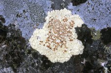
We also came across this Bloodspot Lichen, which grows only on acidic, usually granitic rocks.

We intended to go to bed early and put on the water by 5:00 a.m., hoping to reach the esker at Lynx Creek tomorrow, approximately 27 km (17 miles) to the west.


July 7. We lay in the tent for most of the morning, listening to the wind and rain. At 11:00 a.m. we rose to a cloud-filled sky. We boiled water for tea, ate a bumbleberry granola bar for breakfast, and put on the water at 12:30 p.m. Not exactly 5:00 a.m., but we were on the water, and on our way.

A perfect day for paddling. A slight tailwind. Not too hot. Not too cold. Not too sunny. Almost no bugs. We paddled easily, nearly due west (280°) toward the Lynx Creek esker, behind which we would find the narrow opening leading to Whitefish Lake.
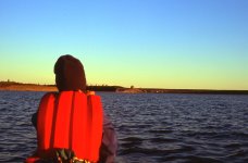
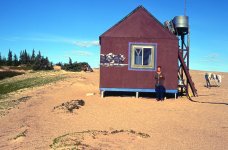
We stopped in the late afternoon for a paddling break and for a snack of hot soup and peanut butter on graham crackers.


snowdrift018.jpg - Click image for larger version  Name:	snowdrift018.jpg Views:	0 Size:	638.1 KB ID:	112330

While Kathleen photographed the pinkish-red blooms of Bog Rosemary,

snowdrift019.jpg - Click image for larger version  Name:	snowdrift019.jpg Views:	0 Size:	469.3 KB ID:	112331

I took a compass bearing up Lynx Lake to confirm our position and direction. I didn’t like it that I could see all the way down Lynx Lake, without any visual obstruction. There seemed to be no end to Lynx Lake.

“We better get going, Kathleen. We still have a long way to go.”

Around 6:30 in the evening we crossed the last large bay before we would reach the narrow notch leading toward Whitefish Lake. We crossed over to the north shore and headed 240° down the peninsula pointing toward the Lynx Creek esker, expecting to reach the notch leading to Whitefish Lake in a few minutes.

After 20 minutes we hadn’t found the notch but instead found ourselves in a bay with cabins at the far end of Lynx Creek. Somehow we had missed the notch. How could that be? Kathleen and I don’t go that fast in our canoe. How could we have sped right on by the notch without seeing it? (OK, memequay. I hear you. We should have had that GPS!)

snowdrift020.jpg - Click image for larger version  Name:	snowdrift020.jpg Views:	0 Size:	569.7 KB ID:	112332

We beached the canoe and climbed to the top of the esker for a better vantage point. The topographical features before us matched those indicated for the bay at the western end of the Lynx Creek esker. We pointed them out to ourselves.

“There’s the anvil-shaped peninsula on the south shore.”

“There’s that little island about a kilometre (half-a-mile) west of the narrow opening to Whitefish Lake.”

Yep, we had indeed been paddling along the Lynx Creek esker but somehow had missed the channel leading to Whitefish Lake.

snowdrift021.jpg - Click image for larger version  Name:	snowdrift021.jpg Views:	0 Size:	430.1 KB ID:	112333

We paddled back east along the esker and set up camp in a very beautiful spot below a tundra bluff. A sandy beach with plenty of sheltering trees and abundant firewood. We cooked and leisurely dined on a wonderfully tasty shepherd’s pie. We sipped our tea and retired to the tent at 10:30 p.m. We planned to stroll east along the esker tomorrow to confirm that we actually did know where the opening to Whitefish Lake was. (Note: We always pitch our tent, away from the campfire. We put our gear and food under the canoe, far enough away from the tent that the bear doesn't confuse us with the food. Close enough to the tent that I believe I would hear the bear, and be able to run it off with my .308. So far, so good.)
 
Last edited:
snowdrift022.jpg

July 8. We rose at 8:00, fully refreshed, and gazed out upon a warm, sun-soaked beach with virtually no bugs despite the calm conditions. We lingered over the best of our bannocks on the trip thus far—and that’s saying something because all bannocks are very good.

Around noon we sauntered east along the esker, and within 30 minutes confirmed our position. We had crossed to the north shore a smidge too late last night and had already gone by the notch, which was obscured by our poor angle of vision.

snowdrift023.jpg

Our compass now pointed 70° to where a small river led to the rapid coming out of Whitefish Lake, approximately 5 km (3 miles) to the north.


snowdrift024.jpg


We decide to take another rest day to bathe, and do laundry on our 7th day of the trip. We have plenty of time. This is not a rushed trip.

snowdrift025.jpg

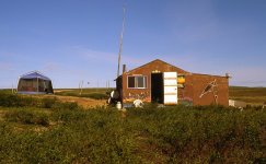
We then sauntered west to the end of the esker, about 3 km (almost 2 miles), to the little cluster of buildings that we saw last evening. We actually did saunter. We were in a sauntering mood. In addition to the main cabin, there was a smaller cabin, a weather station, two komatiks on plastic runners, an aluminum boat, and approximately 40 cords of wood. The cabin windows were boarded over to defend agains bears. (Note: In case you were wondering, komatik is an Inuit word for their traditional sled designed to travel on snow and ice.)

snowdrift026.jpg


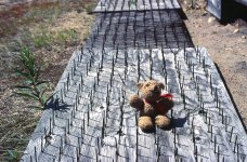
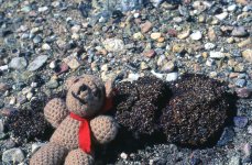
Steel spikes on wooden platforms had been placed beneath each window to further deter bears from breaking in. (Note: We always take Beency, Kathleen's croched bear, on our canoe trips. He helps me navigated while he rides in the map case. Unfortunately, he was sleeping last evening when we paddled by the notch.) Yes, we had missed the notch by about 100 m because we didn’t know, at that very moment, precisely where we were. This was just an example, however, of how being “lost” provides opportunity. If we had paddled directly from our previous camp to the notch, we would never have discovered the community at the end of Lynx Creek. It’s not always necessary, or even best, to know, in minute detail, exactly where you are every second. And this applies not to just wilderness canoe trips. For example, on more than one road trip, I have discovered interesting towns or coffee shops because I had taken the wrong road. I like to live life a little serendipitously.

The surrounding area was quite scenic, and we agreed that it would be a fantastic spot to spend another northern winter. It would be interesting to find out who owns this place and whether or not we could rent it. If we come across Tundra Tom at Whitefish Lake, he might be able to tell us.

snowdrift027.jpg

We then wandered back along the esker toward camp, stopping often to photograph plants. Well, actually, we were still sauntering, but I don’t want to overuse that word.

snowdrift028.jpg

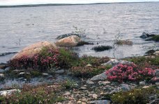
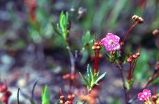
Bog Laurel, another member of the heather family, was covered in red and pink blooms.

snowdrift031.jpg

Rock Cranberry fruits overwinter and are still on the plant as this year's flowers first emerge. Rock Cranberry (the small-leaved plant), therefore, forms an important source of early food for animals, including bears.

snowdrift032.jpg

Even though it's only early July, long before there were any of this year’s berries ready, we came across this fresh bear scat composed of rock cranberry seeds.

Seeing fresh bear scat always worries us just a little bit.


snowdrift029.jpg

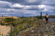
We enjoyed a leisurely stroll back to camp. Geological features such as eskers and glacial moraines often provide an extended growing season compared to the rest of the tundra.

snowdrift030.jpg

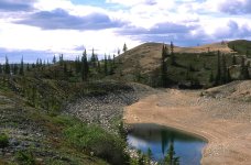
Eskers and moraines provide a coarse-textured soil, where water drains away quickly. The permafrost is deep under ground, the active layer is thick, and the surface soil is warm, loose, and dry. This allows spruce trees to grow beyond the “nominal” limit of treeline.

July 9.Up early, almost with the sun, at 5:00 a.m.—warm, calm and clear. After the 3rd award-winning bannock in successive mornings, we put on the water at 8:00 a.m. Off to meet the rapid flowing out of Whitefish Lake, which we fully expected to portage. We were navigating with a 1:250,000 topographic map. Any rapid marked on such a small-scale map must be a “real” rapid. On the other hand, Whitefish Lake was only 3 m (10 feet) higher in elevation than Lynx Lake, spread out over several kilometres between the two lakes. That’s not too much of a gradient. Maybe we would be able to paddle up the rapid.


snowdrift033.jpg

A little less than 2 km (1 mile) from the rapid, we encountered current and paddled hard, ferrying from inside bend to inside bend, slowly making our way upstream. In a few minutes, we approached the rapid itself, which was nothing more than a shallow, wide, Class I riffle with strong current. Too strong to paddle against. While Kathleen walked along the shore, taking pictures, I dragged the loaded boat about 150 m (yards) around the inside bend in knee-deep water.


snowdrift034.jpg

I have come to believe that one of the greatest thrills of wilderness canoeing is to beat a potential portage. A drag upstream was not a portage. This first potential portage had been easily defeated.


snowdrift035.jpg

Kathleen and I had now left Lynx Lake behind, and we prepared to head north, deep into the vast tundra surrounding Whitefish Lake.

A few kilometres (couple of miles) later, we encountered a solo paddler, on the right bank, cooking his breakfast. Jeff, about 22 years old, had originally planned to ascend the Yellowknife River with a friend and eventually work his way overland to the Coppermine River. They intended to paddle all the way down the Coppermine River to Kugluktuk. Jeff didn’t explain why, but his friend quit on the second day out.

Undaunted, Jeff returned to Yellowknife, found a two-week job, and chartered a flight with Tundra Tom. Jeff worked for one week at Tom's Whitefish Lake lodge in lieu of the $500.00 charter fare, and was now heading down Whitefish Lake, Lynx Lake, and Howard Lake to the Elk River. He then planned to descend the Elk River to the Thelon River, from where he would work his way back up the Thelon to Lynx Lake. I don’t remember what Jeff planned to do once he arrived back at Lynx Lake. I do know, though, that Jeff was in for a helluva trip, made even more difficult by paddling on his own. I hope he made it. Such a strong spirit, with grand visions, needed to succeed.

snowdrift036.jpg

After wishing Jeff good luck, Kathleen and I paddled away easily beneath the sun-filled, blue sky into a slight headwind. We stopped for lunch and for our mid-afternoon snack, on a narrow, white sand beach. Sipping our tea quietly, we listened to the water lapping up gently onto shore. No bugs. Four Arctic Terns twirled and dove into the water. Truly an Arctic paradise, except for the defenceless family of Lapland Longspurs being plundered, just then, by a Parasitic Jaeger.

snowdrift037.jpg


After 23 km(14 miles) we camped on a small island north of LaRoque Bay, on the north side of the first peninsula. Very calm. Very quiet. American Tree Sparrows hunted for bugs. Bumblebees foraged among the Bog Rosemary blooms. Loons cried plaintively and softly. We were surrounded by calm water and glowing tundra. We had enjoyed a truly beautiful day, and are very fortunate to share this truly beautiful life with each other. The only downside, in an otherwise perfect memory, was a powerboat that passed by twice. We were surprised and disappointed to hear that noise penetrating and overpowering our quiet solitude. On the other hand, the boat likely belonged to Tundra Tom, who, we now knew from Jeff, was indeed at the west end of Whitefish Lake. We looked forward to meeting him, and seeing his camp.
 
Thanks for posting this Michael! It's been a challenge for me as I've been reading the same story in your book at the same time but this post has many more pictures! ;) I've been enjoying both!

Doug
 
Thanks Doug. This TR is a melding of our slide show, and the expanded diary in our book. Slide shows have all the images, but only a small portion on the story. Our book was self-published, print-on-demand, which uses lower quality paper. No colour images allowed. Only 15 “free” images. So the book has the complete story, but only a small, poorer-quality, black and white subset of the images. Posting on canoetripping.net allows the complete story and all of the higher-quality colour images. Can’t be better than that for sharing our story!
 
The tundra biota diversity is astounding. I understand why you didn't want to hurry with so much to see and experience.
Thanks for yet again another great northern trip report.
 
Thanks for your kind words, Dan and Odyssey. Much appreciated!

July 10 . We woke late, 8:00 a.m., to a beautiful morning—just a slight breeze. We cooked our breakfast bannock on the stove, as there was no wood on our island. We packed up leisurely and set off for the mainland, 1 km (0.6 miles) away, at 10:15, in a brisk breeze.

snowdrift038.jpg

A few minutes later, Kathleen noted that “The wind sure seems to be picking up.” By mid-crossing, the white caps appeared, and the rolling swells exceeded our comfort threshold. We turned and ran with the wind to the nearest shore, squeezed our canoe between large rocks in the breaking surf, and stood on shore at 10:30.

For the next several hours, we hiked and relaxed on shore, dozing beneath the intermittent sun. We lay in the fragrance of Labrador Tea and lunched on soup and crackers. At 3:00 p.m., we thought the lake looked a little calmer, and we thrust our canoe out into the surf.

“It does seem calmer, don’t you think?”

“Maybe just a little.”

snowdrift039.jpg

It turned out, though, that we were wrong. We rounded the next point into deep rolling, breaking waves. Our canoe surfed backward down a trough as we lurched and tossed toward the safety of a small, sheltered cove.

Again, we stood on the beach. Only 2 km(1.2 miles) travelled by 3:30 after more than five hours “on the water."

snowdrift040.jpg

We strolled down the beach with our plant identification books and photographed Alpine-Azalea, in full bloom, cascading down an igneous rock face.

snowdrift041.jpg

According to Page Burt, in her book Barrenland Beauties, the tender twigs of Alpine Azalea are protected from the wind during winter by snow sifting down into the intertwined leaves and twigs, which forms a protective drift over the entire plant. In summer, the leathery waxy surface of the leaves reduces water loss.

snowdrift042.jpg


We then spotted a plant, Least Willow, that we had never seen before. Again, according to Burt, Least Willow is the most northern of willows and is the only willow that occurs north of the 80th parallel. This species is less than 15 cm (6 inches) tall, and occurs in moist areas where the snow persists until late in the season. It must flower and produce seed very quickly because it has sunlight for such a short time after the snow melts.Now that Kathleen and I had seen Least Willow, it seemed to be growing everywhere. Perhaps we had just been overlooking it all the time.

snowdrift043.jpg

At 6:30 the weather again seemed calmer. We repacked the canoe and paddled across the cove. The waves still rolled off the point but not nearly as intimidating as three hours ago. The shoreline gradually turned north, and then west, and with each turn, we gained more shelter from the southeast wind. By 8:00 p.m. we were paddling in the beauty of a wind-free evening beneath a low-angle sun. At 8:30 we glided into a calm bay and set up camp on a welcome sandbar. Tea, cheese, and gorp completed our day. Only about 31 km (19 miles) to go to the end of Whitefish Lake, and Tundra Tom’s camp.

July 11. We woke to a grey, off-and-on drizzle, but relative calm. We put on the water at 11:00 a.m., after a bumbleberry granola bar and tea. Good paddling conditions. Better to be paddling in the rain than spending a morose day on the shore in the rain.

The wind soon quickened, producing whitecaps and rolling troughs from the southeast.

“You know, Kathleen, the map shows a large island only about 6 km (3.75 miles) ahead. If we could get there, we should be sheltered from the wind."

We paddled hard, but the wind gusted even harder. The day was fast becoming work rather than joy. We gained the point, and the island, and nestled into a small cove for lunch about 2:30.

“We're nearly off this lake, Kathleen. The wind can't get us now unless it reverses direction."

We turned slightly west, still sheltered from the wind, to begin a 2-km (1.2 miles) open crossing of a deep bay. Kathleen spotted three muskox on the left bank, and we veered off course to scoot down the shoreline to see if we could get closer. They were already on the move, however, and we could not close the distance to less than 200 m (yards).

We then turned toward the opposite shore, into a strong headwind. How can this be? Had the wind shifted 180° to blow from the northwest? Seemingly it had. It was my fault, though. I should have known better. I should never have been so rash as to say something like, “The wind can’t get us now.” At least I should have kept those thoughts to myself. By now, I should have known better than to challenge the wind when paddling on a tundra lake. It was just plain foolishness.

Also, I had recently read a quote from someone, I can’t remember who, that went something like, “On a wilderness canoe trip on the Barren Grounds, you don’t need a compass. All you have to do is head directly into the wind and eventually you get to where you want to go.”

We were paddling into a headwind. So we were probably going in the right direction. That was good to know.

Anyway, we struggled to reach the opposite shore, and then sailed back out of the bay, toward open water, to round the next point. We repeated this process two more times. Let me explain this process more carefully. We didn’t want to paddle directly across the mouth of the bay. The waves were too high, and the canoe would be broadside to the strong wind. So we paddled into the bay, into the headwind. We continued paddling toward the foot of the bay, reducing the length of fetch, until the waves seemed small enough to safely cross over to the opposite shore. We then sailed back out of the bay, powered forward by what was now a strong tailwind.

I don’t like strong tailwinds, which produce a following sea. I could’t see the waves chasing me from behind. I just knew they were getting larger the closer I got to the mouth of the bay. I used my paddle like a rudder to hold our position as we picked up speed all the way and then zipped around the point at the mouth of the bay, like a skier performing a telemark turn. As we reached the point of our second bay, we sent a frightened family of Greater White-fronted Geese scurrying across the tundra. They had probably never before seen canoeists performing telemarking turns.

When we rounded the point of that second bay, we stared into a very deep bay, which veered sharply left into what seemed an even stronger headwind. We paddled pretty much as hard as we were capable of paddling to reach a narrow spit of land about halfway into the bay. We beached the canoe in the relative shelter of the spit, and stood on shore to rest and to assess our situation.

We agreed that it was still too far to cross the bay in this wind. We decided to continue straight into the wind, battling shallow water and rocky shoals all the way to the foot of the bay.

We paddled across to the opposite shore and then sailed, a little more comfortably this time, back out of the bay. We rounded the point and made one final push to a sandy inlet about 200 m (yards) into the next bay. I say “one final push” because we were by now getting pretty tired. Also, it didn’t make much sense to work so hard and still not make much progress. We should just wait for calmer weather when we could simply paddle directly across the mouths of these bays.

snowdrift044.jpg

As we began setting up camp, a powerboat started away from an esker across the channel from us. The boat initially seemed to be heading toward us before turning west. We thought they were coming to visit. We would have liked to have chatted to them. Maybe they didn’t see us. Perhaps we should have waved.

Oh well. We needed to get our camp ready for the night, anyway. No time for unannounced guests. We found enough firewood for tea, supper, burning garbage, and boiling water for shaving and washing our faces. We lay in the tent at 9:30 p.m., surrounded by swirling winds, rain, and thunderstorms. It felt good to rest.

snowdrift045.jpg

Around midnight, the storm seemed to blow itself out. I crawled out of the tent to stand in the calm. The esker across the channel sat bathed in sunlight filtered through the passing storm. We should reach the end of Whitefish Lake and the ecotourism camp of Tundra Tom tomorrow, now only about 5–6 km(3.4 miles) away.

July 12. We were on the beach, loading the canoe at 8:30 a.m. The wind had resumed several hours ago, and swells rolled across the bay. Only small whitecaps, though. The conditions appeared paddle-able, but just barely. We thrust our canoe through the waves breaking on the beach and paddled away at 9:30. Very strong gusts immediately drove stinging rain directly at us. We struggled to round the end of the spit to head deeper into the bay. Minutes later we were back on the beach, to rest and to discuss our situation.

“What do you think? Do you want to continue on?”

“We’ve just started. Let’s not give up yet.”

We paddled hard and stopped again very near the foot of the bay. We sat in the canoe for a few minutes and then paddled across to the opposite shore of the bay.

The wind now blew even stronger, and the wide bay frothed with deep rollers. Only 5–6 km (3-4 miles) to the end of Whitefish Lake, though. Maybe we could make it. We headed down the shore toward the mouth of the bay. After two more stops on the beach during gale-like squalls, we finally reached the mouth of the bay. We landed on shore and hiked up the ridge—against wind that nearly knocked us over—to get a look at Whitefish Lake before heading around the point. Before us lay a seething ocean.

“We can’t paddle in this.”

“Nope.”

It was the end of our paddling day. Two hours of struggle to gain only 1 km (0.6 miles).

snowdrift046.jpg

We trudged back to the canoe and set up our tent in a low, exposed position. We crawled in to wait for calm weather. Still 5 km (3 miles) to the end of Whitefish Lake and Tundra Tom's camp. If this wind wouldn’t stop, we might never get there. We lay in the tent all afternoon—listening to the wind—listening to our tent fly flapping in the gusts.

“You know, Kathleen, all I want out of life right now is to look up and not see or hear the zipper pulls on our tent door clanging in the wind.”

We lay on top of our sleeping bags hour after hour, waiting for the wind to stop. Kathleen and I will be going to Paris in August, assuming that this wind stops before then. I wondered how many Parisian men, sipping wine on sidewalk cafés at this very moment, were wishing they could trade places with me. A rhetorical question, certainly.

But I’m guessing that there were no Parisian men sipping wine on sidewalk cafes at that very moment, wishing they were camped out on Whitefish Lake, enduring a storm that seemingly had no end. Watching well-dressed Parisian women promenade on by in the summer sun likely had much more appeal.

By 9:00 p.m. Kathleen and I gave up all hope of paddling again today, as the wind remained as strong as ever. Even so, we didn’t even unpack our gear that night. We slept in our clothes, with our PFDs as pillows. We wanted to be ready to paddle away whenever the wind decided to leave us alone. I fell asleep around midnight.
 
July13. I woke at 3:00 a.m. Breezy (the wind, not me), but certainly calmer (both me and the wind).

"Are you awake, Kathleen?"

"Yes."

"Let's go then."

We were on the water only 30 minutes later. Easy paddling. The sun appeared over the northeast horizon at 3:45 and threw our shadow up onto the tundra ridge. Beautiful paddling. Finally, we’re truly off to Tundra Tom’s.

snowdrift047.jpg

We approached the quiet community of Tundra Tom's at 4:45 a.m. For some reason, everyone seemed to be sleeping. Don’t know why. The day was getting on. Not wanting to disturb the sleepers, Kathleen and I paddled on by, a little way down the beach, to cook our breakfast bannock in the morning sun and warmth. We sipped our tea and lay snuggled in the sand. A tremendous morning. The Barren Grounds were again beautiful and alluring.

We paddled back to the compound, where Tundra Tom himself strolled down the beach to greet us.

snowdrift048.jpg

He was quite hospitable and offered us hot coffee and warm showers. We gladly accepted.

snowdrift050.jpg

Refreshed and clean after our shower, we sat down with Tundra Tom’s ecotourism guests during their breakfast.

“So, two days ago, Kathleen and I had been camped across from an esker about 6 km (3.5 miles) from here. We saw a boat with a motor leave the esker and head west. Was it your boat?”

“Yes it was,” replied a lady. “We were visiting Gordon’s esker. Lots of artifacts there.”

“I didn’t know that. Why is it called Gordon’s esker?”

“It was named for Bryan Gordon,” Tom said. “Gordon did a lot of archeological work there. About 10,000 Dene artifacts have been found on that esker.”

Tom further explained that the Whitefish Lake corridor was very important for hunting, as the caribou always crossed Whitefish Lake at Gordon's Esker because the water is only 4 ft. (1.3 m) deep.

“The caribou were easy to hunt in the shallow water.”

“Interesting. Too bad Kathleen and I didn’t know that. Would have been great to camp on the esker. I have another question for you, Tom. About a week ago, Kathleen and I paddled up Lynx Creek and came across a couple of cabins and a lot of stacked firewood. Do you know who owns that place?”

“It belongs to a trapper. But it hasn’t been used now for about 12 years.”

That surprised me a little. There was lots of stuff there (40 cords of wood, an aluminum boat, two komatiks) for a place that had been vacant for 12 years. Maybe Tom wanted to keep its status a secret.

Kathleen and I were now on the 12th day of our journey and had reached the end of the large, tundra lakes. We would likely no longer be so affected and trapped by wind. The trip had been pretty easy so far, just like I promised Kathleen. While sipping coffee, I reviewed our topographic maps for the next part of our journey, particularly the marked rapids. One of these waited for us before the height of land, four more within about 10 km (6 miles) below Sandy Lake, one at Ingstad Creek, and one more about 10 km below Ingstad Creek. You might remember that Ed Struzik’s report said that this last rapid is actually a waterfall.Ed also wrote that many more rapids existed in addition to the few marked on the topographic maps.

I asked Tundra if any other canoeists happened to be on the Snowdrift River.

“Yep. I flew a group in a few days ago. I’ll be picking them up at Siltaza Lake on July 24.”

“That’s the same day we plan to be at Siltaza Lake. Maybe we’ll see you there.”

“I doubt it. I'll be flying over you on the 24th. You might as well call that stretch below Sandy Lake a 10-km (6 miles) portage. I would never put any of my clients into there. You should let me fly you and your gear into a lake below that stretch. You’ll be saving yourself a lot of work.”

Kathleen was standing right there when Tundra offered his opinion. She didn’t look worried, though. She knew that the Snowdrift River was going to be the easiest trip of all time. I had told her it would be, and she believed me. Why should she not believe me?

I don’t know if Tundra was just trying to scare Kathleen and me into chartering his plane or if he was truly worried about our comfort. I had the impression, though, that he thought we weren’t up to the challenge. If you had been there, I’m sure that you, like me, would definitely have heard the sound of Tundra’s gauntlet being dropped.

“Thanks for the offer, Tom. But we’re committed to going over the height of land.”

“OK.” (Note: Tundra Tom Faess was a well-known guide in the area. Unfortunately, he succumbed to cancer in 2018 at the age of 63.)

A few minutes later, I chatted with two young men who were working for Tom during the summer.

Have you guys ever been into the area below Sandy Lake? What’s it like.”

“It’s pretty shallow. Lot of rocks. You’re going to have to do a lot of lining and dragging. You could slip and hurt yourself. You might sprain or break an ankle.”
I told them about the time Kathleen and I spent 11 days dragging, portaging, tracking, lining, and occasionally paddling our canoe 110 km (68 miles) overland from Winter Lake to reach the Coppermine River. They seemed reassured.

“You shouldn’t have any trouble.”


snowdrift051.jpg

We approach the western end of Whitefish lake,

snowdrift052.jpg


and soon reached the little river flowing into Whitefish Lake. No water in the “river,” though. Just rocks. Just like going overland to the Coppermine River.

snowdrift053.jpg

We portaged about 500 m (yards) to a small lake up the drainage. We hadn’t even reached the first marked rapid and already we were portaging.

snowdrift054.jpg

The tributary coming from the next small lake contained enough water to paddle all the way except for a 5-m (yards) drag. As I mentioned before, a drag is not a portage. Things were going well, now.

During lunch, looking up river, somewhere beyond which lays the height of land, Sandy Lake, Tundra Tom's 10-km portage, and the Snowdrift River.

snowdrift055.jpg

Back in the canoe, 30 minutes later, we reached the “rapid” marked on the 1:250,000 map. No rapid, though. Just a trickle of water. Not enough water to even drag upstream. I doubt this section is ever a rapid, based on what appears to be more or less permanent grass and shrubs interspersed on low islands throughout the “rapid.” Kathleen and I portaged our canoe and gear about 200 m (yards) to the next small lake. (Note: A few years ago I just checked the Water Survey of Canada reports to confirm the water flows during our trip. Unfortunately, the monitoring station at the outlet of Siltaza Lake had data only for 1976–1991.)

snowdrift056.jpg


We eventually again ran out of water and ended our paddling day with a 200-m (yards( carry to camp. Note that we carried to camp. As I explained to Kathleen, this 200 m was not really a portage. Canoeists must always carry their gear to camp. Such a routine activity cannot technically be considered a portage. A portage is when you actually have to unpack the canoe, and then pack it again, and then immediately paddle away. As you can plainly see, by this logic, Kathleen and I had avoided another potential portage.


snowdrift057.jpg


We had also enjoyed a highly successful day, which began cold and windy on Whitefish Lake but which ended very warm (27 C; 80 F) and calm. We were camped in a taiga landscape of open, scattered stands of spruce. We overlooked a narrow (1.5 canoe widths) channel that leads approximately 1 km (0.5 miles) south to a small lake near the height of land. Best of all, we were now only about 4 km (2.5 miles) east of Sandy Lake. "Yep, Kathleen, just like I promised. This is going to be a very easy trip."

(Note: Now that summer has arrived in Preeceville, we are busy with gardens, mowing lawns, and clearing trails of trees that came down during three days of strong winds. I hope you don't mind the short postings! Still got a long way to go on this trip.)
 
I live vicariously through many of these fine trip reports. Thanks.

There is a leadership lesson in the bush pilot's actions. In a dicey situation, show resolve, keep the other informed of essential facts, don’t speculate especially negative speculation.
 
snowdrift058.jpg - Click image for larger version  Name:	snowdrift058.jpg Views:	0 Size:	246.9 KB ID:	112663

July 14 . We lazed over a leisurely bannock breakfast in the morning sun and then spent an hour or so photographing plants.

snowdrift059.jpg - Click image for larger version  Name:	snowdrift059.jpg Views:	0 Size:	411.6 KB ID:	112664


We then carried to the water. We had camped “overlooking” the narrow channel, which was still a fair distance away. Far enough away that many people, such as Kathleen, would have considered this carry to the water as a portage. But, as I reminded Kathleen, this could not be called a portage because we didn’t actually unpack the canoe immediately before the carry. Unpacking and repacking the canoe in one session is required to be an official portage. We paddled off toward Sandy Lake shortly after 11:00 a.m.

snowdrift060.jpg - Click image for larger version  Name:	snowdrift060.jpg Views:	0 Size:	327.2 KB ID:	112665

We easily reached the next lake in the narrow channel, which was deep enough that we never had to get out of the boat to drag. This was very encouraging, as the last approximately 2 km (1.2 miles) to Sandy Lake was via a small, twisty river. Such streams with so many bends usually occur in deltas or flat areas with very little gradient. I had been worried about this section, concerned that we wouldn’t be able to paddle much of it. Based on our success in this narrow channel, however, the last 2 km to Sandy Lake might also be very navigable.

snowdrift061.jpg - Click image for larger version  Name:	snowdrift061.jpg Views:	0 Size:	287.3 KB ID:	112666

This lake at the end of the narrow channel lay only a few hundred metres (yards) east of the height of land. We paddled to its west end and climbed a knoll to gain perspective. Looking east, where Whitefish and Lynx Lake lead to the Thelon River which drains into Hudson Bay.

snowdrift062.jpg - Click image for larger version  Name:	snowdrift062.jpg Views:	0 Size:	344.1 KB ID:	112667

"This is it, Kathleen. Time to go over the height of land. Time to carry our stuff over the divide!"


snowdrift063.jpg - Click image for larger version  Name:	snowdrift063.jpg Views:	0 Size:	516.2 KB ID:	112668

We easily portaged 200 m (yards) up and out of the Hudson Bay drainage.

We sat down at the edge of the first lake draining to the northwest. “This is going very well, Kathleen. We’re over the height of land. The hardest part of this section of the trip is over. Maybe even the hardest part of the whole trip is over.” I was pretty happy with the day’s progress.

Kathleen asked me if we had just completed a real portage. I wouldn’t say that there was sarcasm in her voice. Indeed, there would be no need for sarcasm. Of course we had just completed a real portage. After all, we unpacked and repacked the canoe in one session. Definitely a real portage.

snowdrift064.jpg - Click image for larger version  Name:	snowdrift064.jpg Views:	0 Size:	465.1 KB ID:	112669


Looking west, where the drainage patterns flow eventually into the Mackenzie River, which ultimately ends at the Arctic Coast. We could see six small lakes and ponds laid out in a chain to the northwest, just as indicated on our 1:50,000 topographic map. The first and last of these lakes were only about 200 m (yards across. In between these two lakes lay four ponds connected by creeks, down which we should be able to drag our canoe. It didn't appear that the water would be deep enough to paddle. The outlet of the last, or sixth, lake led to the small, twisty river taking us to Sandy Lake.

“You know what, Kathleen. This doesn’t look quite right. This lake seems to be completely surrounded by a low bank. It doesn’t look like it drains to the northwest.”

“What do you mean? Are you saying that we’re not over the height of land yet?

Maybe not. This is very confusing.

I once heard a quote attributed to Daniel Boone, the 18th century frontiersman who blazed the “Wilderness Road” through the wilds of Kentucky. Someone asked Daniel if he had ever been lost. He thought about the question for a while and shook his head no.

“Nope. I can’t say that I have ever been lost. There was that one time, though, for three days, that I was a might bewildered.”

Kathleen and I were a might bewildered. We certainly weren’t lost, as we had known exactly where we were only 200 m (yards) ago. But the drainage system before us didn’t seem to match the map. This lake was supposed to drain to the four ponds connected by creeks. I don’t like uncertainty when going over the height of land. I prefer to know exactly where I am. We again hiked to the highest knoll and confirmed that another small river flowing toward us from the southwest had flattened out in this marshy area, which created ambiguous, intermittent lake shorelines. The little lakes and ponds on the map didn’t actually exist so distinctly in real life. At least not on that particular day.


snowdrift065.jpg - Click image for larger version  Name:	snowdrift065.jpg Views:	0 Size:	470.0 KB ID:	112670

In fact, there wasn’t enough water in any of these lakes to bother with trying to paddle our canoe. We bit the bullet and portaged our gear another 400−500 m (yards)

snowdrift066.jpg - Click image for larger version  Name:	snowdrift066.jpg Views:	0 Size:	352.4 KB ID:	112671

to launch our canoe on the twisty river leading to Sandy Lake.

snowdrift067.jpg - Click image for larger version  Name:	snowdrift067.jpg Views:	0 Size:	311.7 KB ID:	112672


At 4:15 p.m. we were finally on water flowing to the west—water flowing in the direction we wanted to go.

“You see, Kathleen. I told you this was going to be a gentle journey. We’ve been on the trip only two weeks and already we've reached moving water. If we're right about where we think we are, we should arrive at Sandy Lake between 5:15 and 5:45.”

snowdrift068.jpg - Click image for larger version  Name:	snowdrift068.jpg Views:	0 Size:	306.7 KB ID:	112673

We headed downstream on the barely discernible current. I didn’t count, but maybe 15 times we were frustrated by shallow, rocky sections and mudflats that required dragging and pushing the canoe. At 5:35, though, we finally reached Sandy Lake.

snowdrift069.jpg - Click image for larger version  Name:	snowdrift069.jpg Views:	0 Size:	551.0 KB ID:	112674

We paddled 2.5 km (1.5 miles) west and camped on a ridge on the south shore. A beautiful spot with spruce trees now denser and larger than even last night. We had made it over the height of land. We had successfully navigated from the outlet of Lynx Lake, through Whitefish Lake, and along a very circuitous route to Sandy Lake. We were pleased with ourselves tonight. We hoped to reach the Snowdrift River tomorrow, about 20 km (12 miles) away. We worried only a little about the rapids below Sandy Lake—the rapids that Tundra Tom said we might as well consider to be a 10-km (6 mils) portage. We would see what happens when we get there.
 
I am enjoying this so much. You have me longing for the Barrens.

A couple of questions: The style of pfd you are wearing...I can’t find those for sale anymore. Is there a name for that style? Mine is almost 30 years old and should be replaced, but I don’t trust the new tiny comfortable style. I mean, I went ahead and bought one of the latter, but I don’t like it much.

Also, 6th photo from the bottom: it looks like Kathleen has strapped to her back the same kind of very small waterproof bag that I find so useful. I can no longer find these available either. I’ve been looking for years. I realize this trip is from 2001, but I’m wondering if anyone knows if they are still available?

Erica
 
Erica,

Kathleen has had that small waterproof bag, probably since before 1990. It still performs very well, and is a comfortable and convenient size.

Our PFDs are Extrasport, which is now part of Old Town. I don't remember what style/model. We have had them for a very long time, and probably need replacing. We like them, though, and are reluctant to part with them. We have never capsized on a wilderness canoe trip, though. So perhaps we can get by with what we have for the rest of our canoeing career.

Thanks for you kind comments. Kathleen and I lover the Barrens. Soon, however, we will be leaving the Barrens behind, as we descend the Snowdrift River into the Boreal Forest.

snowdrift070.jpg

July 15 . We rose late, cooked a bannock breakfast, and put on the lake at 11:45. Instantly, a strong tailwind rose, blowing nearly due west down the lake. We surfed and sailed, feeling very uncomfortable in the following sea, before we beached in the shelter of a small cove at 12:30. Whitecaps filled Sandy Lake.

snowdrift071.jpg

We rested a bit and then hiked onto the ridge.

snowdrift072.jpg

"Kathleen, I know we've had a lot of wind, canoe drags, carries to and from camp, and even some real portages. But this is going to be a real easy trip pretty darn soon. Believe me.”

She looked skeptical.

snowdrift073.jpg

We returned to the beach for gorp and soup, and then dozed on the sand, soaking in the warmth of the sun. At 5:30 we made camp, boiled water for tea, and retired about 7:30 for reading, map reviewing, and Sunday brandy.

It had been a good day, despite so little progress. We were well rested, only about 14 km (8.5 miles) behind schedule, and ready to deal with the rapids and possibly low water below Sandy Lake. Hopefully, we would be able to get there tomorrow.

We were at about the northernmost point of the trip—62.5 degrees. From now on, we would be trending south—into denser forest.

snowdrift074.jpg
July 16. We woke at 3:00 a.m. The wind had been blowing all night. The lake looked paddle-able but was nearing the whitecap stage. “Let's get out of here. Let's go."

We ate a quick breakfast of beef jerky and peanut butter on graham crackers, and put on the water at 4:00 a.m. We crossed over to the north shore, which gave a slight but very welcome lee position to the northeast wind.

With each stroke toward the west end of Sandy Lake, we distanced ourselves a few metres farther from the wind chasing us from the Barrens Grounds. With each stroke, the wind seemed to slacken. Sun beckoned to us from the west end of Sandy Lake. Black clouds threatened us from behind. We passed by the tributary leading to the Lake of Woe but decided not to take the 4-km (2.5 miles) hike to possibly see how the lake might have gotten its name. We were already feeling woeful enough. We needed to get off Sandy Lake and away from this wind.

snowdrift075.jpg

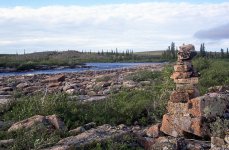
We arrived at the outlet at 7:00 a.m. and photographed ourselves at a stone pillar. I don’t know why the pillar was there. It was not in the shape of an Inukshuk. It just stood straight up, pretty much exactly Kathleen’s height. Back on the water, a few minutes later, we approached the first rapid marked on the 1:250,000 map. Very little water filtered through the rocks. We ran it, though. So far, so good.

snowdrift076.jpg

From then on, each time the river narrowed, which was frequently, rocks replaced the vanished water. Kathleen and I would hop out to guide, push, pull, and coax the canoe through the labyrinth.

snowdrift077.jpg

Still no portage, though. Canoeists were still winning.

By 10:00 a.m. we reached the second marked rapid and got out to scout. We walked down the left bank all the way to the end of the third marked rapid and reluctantly concluded that we would need to portage nearly 1 km (0.5 miles) past both rapids, over very rocky and hummocky terrain. Quite disagreeable.


snowdrift078.jpg

We stopped for lunch to fortify ourselves and then climbed a small ridge to get a better view of our task. Pretty much just a boulder field with virtually no water.

“You know, Kathleen, I think I can get the boat through this and save ourselves a portage."

"But there's no way through. You can’t drag through this.”

snowdrift079.jpg


"Oh yeah, Cupcake. There’s a dozen ways through here. Just stand back and watch. I'll be slicing our canoe through those rocks so fast you'll be able to hear the vinyl on our canoe hull rip and peel."

(Note: Pretty much everything in this story is exactly like it actually happened. The previous four sentences represent the first obvious deviation from the truth. For example, I didn’t actually refer to Kathleen as “Cupcake.” Sometimes a man just writes spicy stuff like that when he tries to embellish a story or when he wants to give the impression that he is fearless.

On the other hand, exaggeration often has a way of becoming truth. When we first gave a slide show of the Snowdrift River to our canoe club in 2002, I used the Cupcake line. The crowd liked it. I liked it. Kathleen even seemed to like it. Ever since then, my affectionate name for Kathleen has been Cupcake.

Finally, if the truth be known, I wasn’t ever slicing our canoe through those rocks fast enough for peeling vinyl to be heard at any great distance.)

snowdrift080.jpg


An hour later I was nearly through. Not too bad. One time Kathleen lent great support by helping me drag the fully loaded canoe over a 2-m wide, mid-channel island to reach more “open” water on the other side. There isn’t much else to say. Just a lot of pushing, pulling, yanking, guiding, and a few choice words at the appropriate time. Just like Janice said on the Coppermine River trip when Carey and I were dragging upstream, “Don"t worry about them, Kathleen. They’re guys. They’re loving it.”

I was indeed enjoying myself, standing in the water, struggling to get my canoe to the bottom of this nearly dry riverbed. The last 300 m (yards), however, proved impassable, so we carried to camp approximately 100 m (yards). Once again we had experienced the sheer joy of avoiding a likely portage.

We had stopped for the day at 12:30 in the afternoon, content with our progress. We had escaped the wind of Sandy Lake and had passed through the first three of four marked rapids without any real portaging.

snowdrift081.jpg


After bannock supper we climbed a ridge high above the right bank and gazed downstream. There seemed to be mostly water. I estimated a maximum of eight more kilometres (five miles) to reach permanently moving water. The worst case scenario, I told Kathleen, is only three more kilometres (two miles) of portaging on the whole trip.

“So far we've had no real portaging in this section, although we will have a carry to the water tomorrow morning. Pretty good, wouldn't you say?”

snowdrift082.jpg


“Don’t forget the so-called carry to camp today. Maybe it wasn't an official portage, but we still had to carry all our gear and the canoe. Today was hard work.”

I had to agree. I was a little tired myself. Into the tent to rest for the night at 6:00 p.m. (Note tent in the mid-ground.)
 
Micheal and Kathleen !

I can only Echo what has been said of your Trip Reports !.
They are things Dreams are made of !

Even the Grueling parts !

Thanks for sharing. I'm sure you have inspired many Younger ones, to embark on such trips, and us Old Folk, wishing we had !

Jim
 
Last edited:
Back
Top