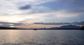
This past 4th of July weekend I headed up to the Millinocket, Maine area for a short canoe trip. All my trips seem to be short these days, but I take what I can get. This trip had the advantage of being relatively close, just 80 miles from my house, all on paved roads, about an hour and a half of driving. I planned to get an early start Friday morning, but some drama at home with our new kitten kept me up late (fyi, the vet emergency room is open 24x365 despite Covid), so my early start became a mid-morning start, and a put-in around noon.
Spencer Cove is cottage country, motorboats and second homes of all descriptions, so I loaded up my boat and got on my way as quickly as possible. No pictures. Bass boats and plastic swim docks look the same everywhere.
My plan was to paddle/portage to Nahmakanta Lake via Ambajejus, Pemadumcook, 3rd and 4th Debsconeags, then descend Nahmakanta Stream back to Pemadumcook and return. I'd never been to Nahmakanta and wanted to see it. Of course you can drive there, but I wanted to get there on my own steam. I took my royalex Wilderness since I anticipated some rock painting on the way down the stream.
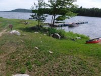
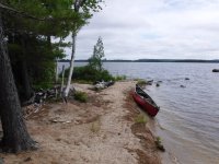
My route took me across Ambajejus Lake (some say Come-to-Jesus Lake) and along the north shore of Pemadumcook. Soon after crossing the thoroughfare to the bigger lake I paddled by this pleasant little sandy peninsula, and since I hadn't had lunch I stopped for a snack. I'm still not in the wilderness, but I'm starting to get the feeling.
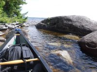
Pemadumcook is a big lake, roughly 8 miles long and 1.5 miles wide, so it doesn't take much of a breeze to make some waves, and motorboat wakes also add to the fun. Fortunately there are periodic boulders in the water near shore, so when I got tired of the waves I could duck behind one to get a drink and take a break.
On that day the wind was in the southeast, so while heading west I had a quartering tailwind, and as I got further down the lake the swells were high enough that I had to pay attention. I hate following seas. In a solo boat I usually paddle with a carbon bent shaft (Zav or GRB), but I recently picked up a Werner Journey (straight/symmetric) in glass, and it was just right for surfing down the lake.
Further along the lake I passed a camp at a point, and a friendly chap fishing asked me if I was camping and where I was going. "Prolly 3rd Debsconeag", I replied. He nodded and said "Good luck!", which reminded me that I was getting a late start on a holiday weekend and finding a campsite might require some creativity. Oh well, something always turns up.
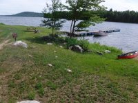
Soon enough I arrived at the landing/camp which marks the start of the portage trail to 3rd Debsconeag. I've done the 3-2-1 Debsconeag / Penobscot loop a couple of times, so I knew where it was, which is good because there wasn't a sign. My recollection is that there was a sign the last time I was there, September 2018, but maybe the lake ice got it.
While there wasn't a sign for the portage, there was this very handsome sign marking the start of the camp's private picnic area. Looks vaguely Winnie the Pooh to me. Much more pleasant (and perhaps more effective?) than the usual No Tresspassing, FO!
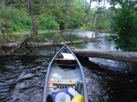
The carry to 3rd Debsconeag is about a mile, mostly on logging roads. I'd packed fairly light, so I battened everything down and single carried it. I don't mind double carrying on a nice trail, and on a rough trail it may be necessary, but I hate to walk a boring road three times. I'm getting a little old for single carries with royalex, but you know, use it or lose it.
The put-in on 3rd Debsconeag is in a shallow cove. There's actually a fancy dock with a bright yellow sign, although I didn't notice it until I was on the water. The dock seems oddly high, maybe the tide was out.
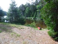
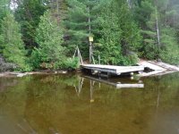
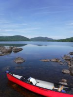
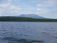
Once on the main body of 3rd Debsconeag I could see that the campsite at the eastern end was occupied, and that's the only official campsite on the lake. That was my Plan A, but I wasn't too concerned as I had a couple of ideas for "undesignated" sites. I continued to paddle west. With less fetch, that southeast wind was now all gravy, and I had a nice view of Katahdin on my right.
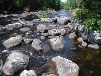
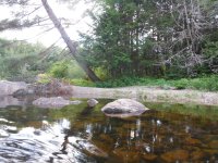
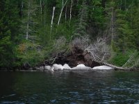
I took the picture below near the western end of 3rd Debsconeag, and it really illustrates why it can be so hard to find a campsite in this kind of terrain. Apparently some strong wind caught a grove of trees along the shore and blew them over en masse. The boulders exposed are uncommonly bright since they haven't had much time in the open to accumulate moss and bird bombs. The "land" here is basically stacked boulders with a few quarts of mud in between. Reminds me of the old saying, Maine is a great place for farming, assuming you're trying to grow rocks. Ohio may not be great paddling, but it has plenty of dirt.
There's a shallow cove in the southwest corner of 3rd Debsconeag, and this rough dock and sign on the north side marked the start of the portage trail to 4th Deb. At least this was the case in July 2020. When I was in the same place in September 2019 the portage trail was clearly marked on the south side of the cove. Go figure. I guess there are two trails, and one was closed for some reason? Deerflies were on strike? Anyway, when I was there a couple weeks ago the portage trail was on the north side of the connecting stream, but if you find it on the south side next year, don't be surprised. While I'm thinking about it, thanks to The Nature Conservancy for conserving this land and providing nice portage signs.
The dock was composed of about 1/3 new boards, 1/3 old boards, and 1/3 missing boards, but the mud in the cove looked nasty so I was glad it was there.
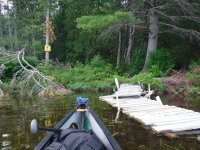
As I pulled out on the dock it was about 4pm, still several hours of daylight left, but I'm starting to think about a campsite. I know there are two official campsites on 2nd Deb, so that would be an option if I want to backtrack. I've never been to 4th Deb and according to the map it has no official campsites. The start of the trail looked pretty rough, so I decided to bring just my pack across the carry to 4th Deb. I figured I still had time to backtrack if need be, but backtracking with the boat would be demoralizing.
The trail was indeed rough and bushy in places, but it was easy to follow and I could tell it had seen some recent maintenance where a few large blowdowns were cut to allow passage. Although it was a very stumbly walk, rocks and roots, the scenery was pleasant -- the perfect trail for a double carry. My map showed this trail as 0.4 miles, but it was slow for that distance.
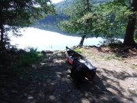
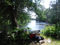
When I got to 4th deb, I immediately decided I wanted to camp there. The cove at the end of the trail had an accumulation of dry-ki, forming an open area that was almost a natural deck above the clear water.
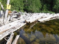
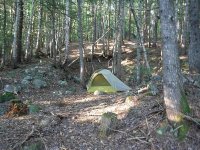
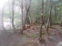
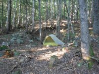
Pleasant as they were, I couldn't really make camp on dry logs, so I looked around for a suitable site. A small gravel beach on the other side of the "deck" made a nice place to cook dinner, but it wasn't a tent pad. A few rock hops led to a trail south of the gravel beach (end of the other portage trail?), and a few yards into the woods and up the hillside I found a curiously flat spot. The arrangement of the rocks around it makes me think it was once the cellar of a small building. Anyhow, it was nice and flat, no obvious widowmakers. Kitchen plus bedroom equals campsite.
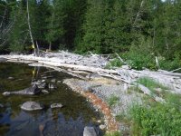
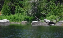
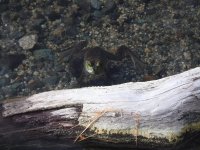
Although there's a reasonably civilized Chewonki camp at the other end of the lake, I didn't see any people or smoke from fires that evening on 4th lake. However, this bullfrog was my constant companion, always in the shallow water next to the gravel beach, sometimes making a small splash that sounded larger in the calm. Closer than 6', if I come down with Covid I'll put him on the list.
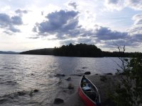
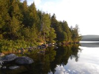
Couldn't get enough of this cove in 4th Deb, just a shoreline in the pre-sunset light.
[Split into 2 parts because I went a bit picture happy ... second half tomorrow.]
Spencer Cove is cottage country, motorboats and second homes of all descriptions, so I loaded up my boat and got on my way as quickly as possible. No pictures. Bass boats and plastic swim docks look the same everywhere.
My plan was to paddle/portage to Nahmakanta Lake via Ambajejus, Pemadumcook, 3rd and 4th Debsconeags, then descend Nahmakanta Stream back to Pemadumcook and return. I'd never been to Nahmakanta and wanted to see it. Of course you can drive there, but I wanted to get there on my own steam. I took my royalex Wilderness since I anticipated some rock painting on the way down the stream.
My route took me across Ambajejus Lake (some say Come-to-Jesus Lake) and along the north shore of Pemadumcook. Soon after crossing the thoroughfare to the bigger lake I paddled by this pleasant little sandy peninsula, and since I hadn't had lunch I stopped for a snack. I'm still not in the wilderness, but I'm starting to get the feeling.

Pemadumcook is a big lake, roughly 8 miles long and 1.5 miles wide, so it doesn't take much of a breeze to make some waves, and motorboat wakes also add to the fun. Fortunately there are periodic boulders in the water near shore, so when I got tired of the waves I could duck behind one to get a drink and take a break.
On that day the wind was in the southeast, so while heading west I had a quartering tailwind, and as I got further down the lake the swells were high enough that I had to pay attention. I hate following seas. In a solo boat I usually paddle with a carbon bent shaft (Zav or GRB), but I recently picked up a Werner Journey (straight/symmetric) in glass, and it was just right for surfing down the lake.
Further along the lake I passed a camp at a point, and a friendly chap fishing asked me if I was camping and where I was going. "Prolly 3rd Debsconeag", I replied. He nodded and said "Good luck!", which reminded me that I was getting a late start on a holiday weekend and finding a campsite might require some creativity. Oh well, something always turns up.

Soon enough I arrived at the landing/camp which marks the start of the portage trail to 3rd Debsconeag. I've done the 3-2-1 Debsconeag / Penobscot loop a couple of times, so I knew where it was, which is good because there wasn't a sign. My recollection is that there was a sign the last time I was there, September 2018, but maybe the lake ice got it.
While there wasn't a sign for the portage, there was this very handsome sign marking the start of the camp's private picnic area. Looks vaguely Winnie the Pooh to me. Much more pleasant (and perhaps more effective?) than the usual No Tresspassing, FO!

The carry to 3rd Debsconeag is about a mile, mostly on logging roads. I'd packed fairly light, so I battened everything down and single carried it. I don't mind double carrying on a nice trail, and on a rough trail it may be necessary, but I hate to walk a boring road three times. I'm getting a little old for single carries with royalex, but you know, use it or lose it.
The put-in on 3rd Debsconeag is in a shallow cove. There's actually a fancy dock with a bright yellow sign, although I didn't notice it until I was on the water. The dock seems oddly high, maybe the tide was out.


Once on the main body of 3rd Debsconeag I could see that the campsite at the eastern end was occupied, and that's the only official campsite on the lake. That was my Plan A, but I wasn't too concerned as I had a couple of ideas for "undesignated" sites. I continued to paddle west. With less fetch, that southeast wind was now all gravy, and I had a nice view of Katahdin on my right.

I took the picture below near the western end of 3rd Debsconeag, and it really illustrates why it can be so hard to find a campsite in this kind of terrain. Apparently some strong wind caught a grove of trees along the shore and blew them over en masse. The boulders exposed are uncommonly bright since they haven't had much time in the open to accumulate moss and bird bombs. The "land" here is basically stacked boulders with a few quarts of mud in between. Reminds me of the old saying, Maine is a great place for farming, assuming you're trying to grow rocks. Ohio may not be great paddling, but it has plenty of dirt.

There's a shallow cove in the southwest corner of 3rd Debsconeag, and this rough dock and sign on the north side marked the start of the portage trail to 4th Deb. At least this was the case in July 2020. When I was in the same place in September 2019 the portage trail was clearly marked on the south side of the cove. Go figure. I guess there are two trails, and one was closed for some reason? Deerflies were on strike? Anyway, when I was there a couple weeks ago the portage trail was on the north side of the connecting stream, but if you find it on the south side next year, don't be surprised. While I'm thinking about it, thanks to The Nature Conservancy for conserving this land and providing nice portage signs.
The dock was composed of about 1/3 new boards, 1/3 old boards, and 1/3 missing boards, but the mud in the cove looked nasty so I was glad it was there.

As I pulled out on the dock it was about 4pm, still several hours of daylight left, but I'm starting to think about a campsite. I know there are two official campsites on 2nd Deb, so that would be an option if I want to backtrack. I've never been to 4th Deb and according to the map it has no official campsites. The start of the trail looked pretty rough, so I decided to bring just my pack across the carry to 4th Deb. I figured I still had time to backtrack if need be, but backtracking with the boat would be demoralizing.
The trail was indeed rough and bushy in places, but it was easy to follow and I could tell it had seen some recent maintenance where a few large blowdowns were cut to allow passage. Although it was a very stumbly walk, rocks and roots, the scenery was pleasant -- the perfect trail for a double carry. My map showed this trail as 0.4 miles, but it was slow for that distance.
When I got to 4th deb, I immediately decided I wanted to camp there. The cove at the end of the trail had an accumulation of dry-ki, forming an open area that was almost a natural deck above the clear water.

Pleasant as they were, I couldn't really make camp on dry logs, so I looked around for a suitable site. A small gravel beach on the other side of the "deck" made a nice place to cook dinner, but it wasn't a tent pad. A few rock hops led to a trail south of the gravel beach (end of the other portage trail?), and a few yards into the woods and up the hillside I found a curiously flat spot. The arrangement of the rocks around it makes me think it was once the cellar of a small building. Anyhow, it was nice and flat, no obvious widowmakers. Kitchen plus bedroom equals campsite.


Although there's a reasonably civilized Chewonki camp at the other end of the lake, I didn't see any people or smoke from fires that evening on 4th lake. However, this bullfrog was my constant companion, always in the shallow water next to the gravel beach, sometimes making a small splash that sounded larger in the calm. Closer than 6', if I come down with Covid I'll put him on the list.

Couldn't get enough of this cove in 4th Deb, just a shoreline in the pre-sunset light.

[Split into 2 parts because I went a bit picture happy ... second half tomorrow.]

