Labyrinth Canyon at 24,000 CFS. June 14, 2023

This will be a quick trip report which may be of interest to those considering travelling to Utah to run the Green river through Labyrinth Canyon. Our trip was 64 miles, starting at Crystal Geyser (4.5 miles south of Green River State Park) and ending at Mineral Bottom. This is typically advertised as a “family friendly” trip with no rapids and great scenery. Having run it several times before, I was invited to accompany my son-in-law and a group from his neighborhood consisting of six men and nine boys (mostly sons of the men) age 11-15. Most had little, if any experience canoeing.
The river had been running as high as 28,000 CFS earlier in the month versus a median for this time of year of 18,000 and a typical summer flow of 2,000 CFS. It dropped to 19,000 the week before our departure but then increased to 24,000 CFS the day we put in. I was concerned about the ability of the group to pull off of the river in the current and the danger of whirlpools, eddy lines and strainers. I met a guy with 8 canoes on a trailer on the way down who had just come off the river and said they had no problems, despite several novice teams. This eased my worries somewhat. The outfitter (7 boats were rented in Moab) said that his clients had had no recent problems due to the high water either.
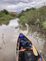
The rentals (from Moab Canoe and Kayak) were surprisingly good- nearly brand new Old Town Discovery (16’4”) and Penobscot (17’4”) polyethylene canoes. We had no portages so the weight (75 and 90 pounds!) was not a big concern. I used my 1980’s vintage 16’ Mad River Royalex Explorer. After a stern, and I thought graphic, lecture on the hazards of strainers, we set off one canoe at a time. The put in at Crystal Geyser had a very small eddy for loading and launching. My GPS indicated that we were going 8-9 MPH with easy paddling and 6-7 MPH when just drifting with the current just below Crystal Geyser! I was then surprised to go around a bend and see a wave train (avoidable) with 1-2’ waves- despite the reports that there were no rapids on this section. 24,000 CFS changes the river dramatically.
About 15 minutes into the trip we, paddling in sweep position, came around a bend and saw a yellow and blue paddle stuck in the branches of a tree which was hanging out over the river. I thought “that looks like one of the rental paddles, but it couldn’t be”. Then yells from downstream “they’re over!!!”. Somehow one canoe had reportedly hit another one and knocked it in toward the shore. 14 year old George, the bowman, hit a strainer, had the paddle ripped out of his hands and the canoe flipped from under he and his partner. He had at least obeyed instructions and grabbed onto the canoe and was trying to swim it to shore. We paddled over, backed in toward him, threw him my stern line and towed him to the shore, where some of the other canoes had pulled out. He was shook up and bruised, but alive and fortunately his head had never gone under the surface. A little more subdued group headed down the river, taking more care to leave space between the boats and not fool around.

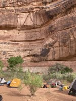
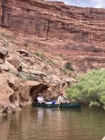
Lunch stop was uneventful as we pulled into the backed up water in a side canyon, out of the river current. Our goal was to camp the first night in Trin Alcove, (Three Canyons) which has several relatively large campsites which are accessible in high water. It was 25+ miles from the put-in, but we had no trouble covering the distance thanks primarily to the current. The GPS showed 4.8 hours moving time and an average speed of 5.3 MPH for the day. Very strong upriver wind in the afternoon had lowered our average speed substantially. The three canyons consist of large splits located in the sheer 100+ foot rock walls which line the river at this point. The river was backed up for several hundred feet into the canyons, and we were able to paddle up to a premier campsite with shade from mature cottonwood trees and the canyon walls. The only drawback was the mosquitoes. The reduction in flow from 28,000 to 19,000 CFS the prior week had left substantial pools of stagnant water along portions of the river and, despite the normal desert climate, the mosquitoes bred prolifically and were waiting for us. I had anticipated some mosquito activity and advised the group to bring headnets and long pants/shirts as well as repellant. Each boy showed up with a headnet, but some insisted on wearing only tee shirts and shorts. The insects feasted and the boys complained. The kid who was assigned to my canoe counted 52 bites on his arms alone by the last day- but still would not wear long sleeves!

Day 2- After a leisurely morning we set off about 9:30 for the Bowknot Bend, where we could hike up on a high ridge and see the river on both sides of us. The canyon walls were spectacular in the clear morning sun and the paddle down was my favorite part of the trip. However, the mosquitoes at the pullout for the hike were the worst of the trip. They were actually pretty comparable to Boundary Waters in June, which I had experienced while in college, and never forgotten. The hike wound up switchbacks and we quickly left the bugs behind. I think that the hike up is worth the effort, even for a 76 year old, and enjoyed the change of pace as well as the views.
The wind arrived earlier that afternoon, and was later accompanied by moderate, then heavy rain and hail. Most storms are short in this high desert climate and we were all surprised when the rain continued for about four hours. Fortunately we had room to set up a rain tarp for shelter while we cooked dinner.
The next morning was sunny again and let us dry out our gear before packing. The river was now wider and slower in most sections than the prior two days. We lunched at Register Rock, which has a cliff wall and boulders covered with names carved into the soft stone surfaces. There was a small wave train across from the eddy where we pulled out and one of the adults and his son managed to flip when they backed into the waves after the lunch break. The final miles were relaxing and we arrived at the Mineral Bottom takeout in the late afternoon, well ahead of our designated rendezvous with the outfitter/shuttle at 10:00 the next morning.
The trip was pretty much a success, as everyone made it back alive and at least some of the boys said that they liked it. A few others, generally those who didn’t want to paddle, were less enthusiastic, and might not opt to go canoe tripping again. We travelled 25 miles the first day, 19 on day two and 20 the last day, with relatively short days on the water. I enjoyed the paddling, even though I was basically soloing in a relatively slow tandem canoe with a 140 pound dead weight in the bow most of the time. I would advise those travelling to get here to come in the fall, versus spring. The bugs are generally gone and the scenery is even more spectacular when the cottonwood trees along the river have turned to gold. The slower current in the fall also makes for a more mellow trip and less concern for the safety of novice paddlers.

This will be a quick trip report which may be of interest to those considering travelling to Utah to run the Green river through Labyrinth Canyon. Our trip was 64 miles, starting at Crystal Geyser (4.5 miles south of Green River State Park) and ending at Mineral Bottom. This is typically advertised as a “family friendly” trip with no rapids and great scenery. Having run it several times before, I was invited to accompany my son-in-law and a group from his neighborhood consisting of six men and nine boys (mostly sons of the men) age 11-15. Most had little, if any experience canoeing.
The river had been running as high as 28,000 CFS earlier in the month versus a median for this time of year of 18,000 and a typical summer flow of 2,000 CFS. It dropped to 19,000 the week before our departure but then increased to 24,000 CFS the day we put in. I was concerned about the ability of the group to pull off of the river in the current and the danger of whirlpools, eddy lines and strainers. I met a guy with 8 canoes on a trailer on the way down who had just come off the river and said they had no problems, despite several novice teams. This eased my worries somewhat. The outfitter (7 boats were rented in Moab) said that his clients had had no recent problems due to the high water either.
The rentals (from Moab Canoe and Kayak) were surprisingly good- nearly brand new Old Town Discovery (16’4”) and Penobscot (17’4”) polyethylene canoes. We had no portages so the weight (75 and 90 pounds!) was not a big concern. I used my 1980’s vintage 16’ Mad River Royalex Explorer. After a stern, and I thought graphic, lecture on the hazards of strainers, we set off one canoe at a time. The put in at Crystal Geyser had a very small eddy for loading and launching. My GPS indicated that we were going 8-9 MPH with easy paddling and 6-7 MPH when just drifting with the current just below Crystal Geyser! I was then surprised to go around a bend and see a wave train (avoidable) with 1-2’ waves- despite the reports that there were no rapids on this section. 24,000 CFS changes the river dramatically.
About 15 minutes into the trip we, paddling in sweep position, came around a bend and saw a yellow and blue paddle stuck in the branches of a tree which was hanging out over the river. I thought “that looks like one of the rental paddles, but it couldn’t be”. Then yells from downstream “they’re over!!!”. Somehow one canoe had reportedly hit another one and knocked it in toward the shore. 14 year old George, the bowman, hit a strainer, had the paddle ripped out of his hands and the canoe flipped from under he and his partner. He had at least obeyed instructions and grabbed onto the canoe and was trying to swim it to shore. We paddled over, backed in toward him, threw him my stern line and towed him to the shore, where some of the other canoes had pulled out. He was shook up and bruised, but alive and fortunately his head had never gone under the surface. A little more subdued group headed down the river, taking more care to leave space between the boats and not fool around.

Lunch stop was uneventful as we pulled into the backed up water in a side canyon, out of the river current. Our goal was to camp the first night in Trin Alcove, (Three Canyons) which has several relatively large campsites which are accessible in high water. It was 25+ miles from the put-in, but we had no trouble covering the distance thanks primarily to the current. The GPS showed 4.8 hours moving time and an average speed of 5.3 MPH for the day. Very strong upriver wind in the afternoon had lowered our average speed substantially. The three canyons consist of large splits located in the sheer 100+ foot rock walls which line the river at this point. The river was backed up for several hundred feet into the canyons, and we were able to paddle up to a premier campsite with shade from mature cottonwood trees and the canyon walls. The only drawback was the mosquitoes. The reduction in flow from 28,000 to 19,000 CFS the prior week had left substantial pools of stagnant water along portions of the river and, despite the normal desert climate, the mosquitoes bred prolifically and were waiting for us. I had anticipated some mosquito activity and advised the group to bring headnets and long pants/shirts as well as repellant. Each boy showed up with a headnet, but some insisted on wearing only tee shirts and shorts. The insects feasted and the boys complained. The kid who was assigned to my canoe counted 52 bites on his arms alone by the last day- but still would not wear long sleeves!

Day 2- After a leisurely morning we set off about 9:30 for the Bowknot Bend, where we could hike up on a high ridge and see the river on both sides of us. The canyon walls were spectacular in the clear morning sun and the paddle down was my favorite part of the trip. However, the mosquitoes at the pullout for the hike were the worst of the trip. They were actually pretty comparable to Boundary Waters in June, which I had experienced while in college, and never forgotten. The hike wound up switchbacks and we quickly left the bugs behind. I think that the hike up is worth the effort, even for a 76 year old, and enjoyed the change of pace as well as the views.
The wind arrived earlier that afternoon, and was later accompanied by moderate, then heavy rain and hail. Most storms are short in this high desert climate and we were all surprised when the rain continued for about four hours. Fortunately we had room to set up a rain tarp for shelter while we cooked dinner.
The next morning was sunny again and let us dry out our gear before packing. The river was now wider and slower in most sections than the prior two days. We lunched at Register Rock, which has a cliff wall and boulders covered with names carved into the soft stone surfaces. There was a small wave train across from the eddy where we pulled out and one of the adults and his son managed to flip when they backed into the waves after the lunch break. The final miles were relaxing and we arrived at the Mineral Bottom takeout in the late afternoon, well ahead of our designated rendezvous with the outfitter/shuttle at 10:00 the next morning.
The trip was pretty much a success, as everyone made it back alive and at least some of the boys said that they liked it. A few others, generally those who didn’t want to paddle, were less enthusiastic, and might not opt to go canoe tripping again. We travelled 25 miles the first day, 19 on day two and 20 the last day, with relatively short days on the water. I enjoyed the paddling, even though I was basically soloing in a relatively slow tandem canoe with a 140 pound dead weight in the bow most of the time. I would advise those travelling to get here to come in the fall, versus spring. The bugs are generally gone and the scenery is even more spectacular when the cottonwood trees along the river have turned to gold. The slower current in the fall also makes for a more mellow trip and less concern for the safety of novice paddlers.

