- Joined
- Mar 16, 2022
- Messages
- 39
- Reaction score
- 138

Tim Lake – Nip R. – Magnetawan Lake Loop
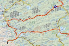
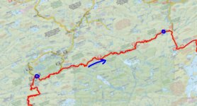
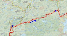
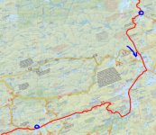
Total travelling distance = 127 km. 42 portages, totaling 17,370 m, the longest being 2,140 m.

The prep for this trip was straight forward. Stove fuel was easier to procure this year, hotel vacancy was not an issue for the drive up, and Rich had spent many lockdown afternoons preparing the dehydrated meals for the year. We could not find a 4th person, so we were going into the park with one tandem canoe and myself going solo.
Goals of the trip were the following:
- Avoid some of the Covid Crowd on HWY60, hence the Tim Lake access point choice.
- Complete the last remaining stretch of the Nipissing River that Ryan and I had not already experienced (Loontail junction to the P1930 into Remona)
- take Rich into some of the big, beautiful lakes south of Catfish (our favourite area of the Park)
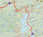
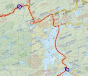
- see some of the historical locations on the Nipissing River and Burntroot Lake.
- visit two interior Ranger Cabins (Highview and White Trout).
The one obstacle we did have to overcome was the lack of campsites close to the Tim access on the last night of our trip. Everything was booked solid all the way up past Longbow (at the time we were planning on coming out the Tim River). This meant we would need to exit the Park at Magnetawan. We drove up in two vehicles and had to perform the one-hour car swaparoo on the first and last day. A bit of a pain, but in the end a small price to pay for an epic week.
Day 1: Tim River (access point) to Nipissing River (Grass Lake)
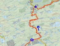
Total travelling distance = 24.5 km including 11 portages, totaling 3,135 m, longest being 820 m.
We had previously completed this section on a spring trip in 2018 and knew exactly what to expect. We knew it was going to be a full day, especially with the wasted time of car juggling before even pushing off in the boats.
It was a decently cool morning for August, and it was calling for rain by midafternoon.
One of the first things we noticed when launching at the Tim access was how high the water levels were. The small dock at the launch point was 5-6 inches under water. With much of our scheduled trip taking place on rivers, this excited me more than it should have. We also noticed, by visiting two access points, that there were a ton of people in the Park.
The stretch of the Tim River from the access point to Tim Lake is a really nice paddle. An excellent first 20 minutes to the trip, which likely can’t be beat by many other access points. Tim Lake was fully occupied, and we had already passed 3-4 loaded boats leaving the Park. Behind us to the west we could see the towering rain clouds approaching.
The portages between Tim and Big Bob are not overly hard, but they are up hill and with the recent rain they were muddy/slippery. On the first portage Rich managed to slip and fall while descending towards Chibiabos. He twisted his ankle pretty good but was confident he was good to continue. On one of the final portages into Big Bob Ryan also slipped and fell forward into one of the many mud filled quagmires. No damage to Ryan, just some muddy clothes and hands. These lakes are small but feel secluded while still being very close to the access point.
We had planned to stop and eat lunch on the beach on the eastern end of Big Bob. This plan was thwarted by the previously noted high water... the beach was now a sandy bottom on a weedy shoreline. I was less excited about water levels at this point. We elected to not eat at the campsite we passed on Big Bob (it really is an excellent spot) and elected to stop and eat at the falls on the P200m into the Nipissing.
At the end of the portage there is a bit of pulling and weaving to get yourself out to the main flow of the river. The path is fairly obvious through the rushes when travelling in our current direction, but from experience it is less obvious when trying to leave the Nipissing towards the portage.
The section of the Nipissing from the P200 to the third campsite down river is fantastic. The river is wide and reasonably straight, we usually see some wildlife (moose), and the portages are easy (plus they bypass awesome rapids / waterfalls). These rock formations are quite oxidized and are flanked on both sides by towering white pines, so when fishing in the pools at the bottom the backdrop is stunning. Enjoy this stretch while you can, as the next 3-4 hours of your day will be terrible.
Shortly after the third campsite the river narrows, and the alder becomes the focus of your attention. There are a few sections that require some lift overs, and some sections where cutting of alder was required. For the most part, we were queued up behind each other and were pulling our way down stream, paddles optional. During this time the expected afternoon rain also began, so things got very wet and miserable. Just when you are about to lose your patience, when all hope appears to be lost, the river widens again near the 4th campsite down river.
We considered staying at this campsite, as we were all very cold and wet (we were shivering uncontrollably, which goes to show that even in August body temp can be a concern), but the campsite was garbage. There are actually very few good campsites on the Nipissing River, especially for hammock campers.
We made the wise decision to push on into the quickly fading light and arrived at our campsite on Grass Lake shortly after sunset. Grass Lake is essentially a wider spot in the river with one or two large switch backs through the weeds. The campsite is top notch though, and once we had a roaring fire going we all quickly forgot the trials and tribulations of the afternoon. Night one is normally a fresh meal, so on the menu was a full pork tenderloin , twice baked potatoes and fried peppers all washed down with a litre of the finest boxed wine.
We had fished the bottom of all the portages we could with not a single nibble all day. Our quest for the Nipissing brook trout would need to continue in the coming days.
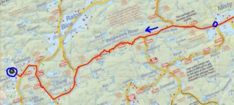
Day 2: Nipissing River (Latour Creek) to Nipissing River (Highview Cabin)
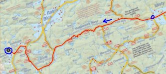
Total travelling distance = 13.9 km including 6 portages, totaling 850 m, longest being 365 m
We awoke to a calm, misty morning. One of those damp and quiet mornings where nothing seems to be moving. That included Rich and Ryan, who slept until the coffee was already perked and the bacon was sizzling. After packing up and eating our bacon / egg / cheese wraps we slipped into our still damp clothing from the day prior. This has got to be one of the worst feelings you consistently get while in the back country, something that no one is looking forward to.
We left the campsite later than we had hoped, but the plan for the day was not as ambitious as the day before. Our plan was to head downstream past the Highview cabin to the campsite at the end of the Nod Lake portage, around 19 kms in total.
As we made out way through the section of river before the Loontail Creek junction we seemed to be waking up every single duck / goose in the Park. The morning was very calm, with a slight fog, and we were paddling fairly quiet, so during every twist and turn of the river we were met with the rapid flutter of wings from the startled waterfowl.
Once we passed the junction Ryan and I entered the final section of the Nipissing that we had yet to experience. For many years we had planned and dreamt of completing this portion of the river, and finally we were making it a reality.
The river does bend back and forth quite a bit, but not as monotonously as the lower end of the Nipissing near Cedar Lake. The portages are very simple, not long, and they typically hug the shoreline. Some care needs to be taken when on these river portages though, as the grasses can grow up and obscure your view of the holes and rocks by the riverbanks.
We avoided several of the portages entirely, as the water was high, and the obstructions were not difficult to avoid. Some of the portages take you around a blind corner, so we elected to portage all of those. In hindsight, all of those ended in rocky drops at the bottom end so we correctly elected to portage.
The campsites on the P365m (High Dam) were half decent, but most of the campsites in this stretch appear to see little use. The access to the river sites are not great due to the high riverbanks (and we were in high water) and the available space is limited at most sites.
We fished the bottom end of all of the portages and started to get some nibbles. At the bottom of the P90m and P110m I was able to hook on to a brook trout but was not able to land either.
The section leading up to Dogay’s dam is exceptionally nice. The river is wide, slow, and the shoreline is dotted with massive white pine. Rich and Ryan were likely annoyed by my occasional comments regarding how much I enjoy sections of river like this… how each bend in the river looks like a post card to heaven etc etc. There are many things I enjoy in the Park. Some involve big lakes and sunsets, but most involve quiet rivers and solitude.
On the P155m around Dogay’s dam Rich managed to stumble over some blowdown and took another tumble on his sore ankle. At the end of the portage Rich dipped his ankle into the cool water to bring down the swelling, while Ryan and I patiently fished the pools. I managed to catch a few little brookies, nothing worth keeping. We wrapped up Rich’s ankle with a tensor bandage we carry for such occasions and paddled on.
When we got to the forked portage (P100 to fork, P2865 to Gibson’s Lake, P875 to Nipissing) we started thinking about finding home for the night. This would leave us nearly 5 km’s behind schedule (1 hour) but it would let Rich put his foot up and rest his ankle for the night. When we got to the first campsite on the portage it was filled with lots of fallen / cut trees. The prospects for finding suitable hammock spots was limited, and overall it was not a very appealing campsite. Halfway down the portage we finally made it to one of the ranger cabins that I was the most interested in visiting, the Highview cabin.
This little ranger cabin is positioned 10-12 feet above the Nipissing River and has a nice little view back upstream. You will know you are close when you see a large rectangular clearing on the left-hand side of the portage. Clearings like this always get my nerves up, as I think they would be perfect locations for bears to sit in the high grass munching on berries. Alas, no bear encounter on this trip.
The cabin is pretty remote, and one of the harder cabins to reach for most people but was in decent shape. The cabin itself is set very low and requires a taller person to duck to enter but once inside it is very cozy. Around the cabin, on the walls and in the grasses close by, there are a multitude of relics from years gone by. An old broken-down cast-iron stove, various cans and metal implements can be found if you poke around. The side of the cabin has various saws and wheel rims, plus a massive set of moose antlers. Behind the cabin there is a rare sight in the Park, a fully roofed outhouse.
With the condition of the party, and the appeal of having a roof over our heads and a stove to dry out our gear, we decided to stay the night at the cabin. Rich took some Ibuprofen and elevated his ankle, Ryan started the fire and made dinner, and I caught some fish down by the river.
After we played some cards and swapped some stories we settled down for a much-needed rest. Before going to bed we stepped out into the clearing and took in a perfectly cloudless sky and the multitude of stars visible. It is nights like this, surrounded by good friends, in such a beautiful setting that recharges the soul and cements in your mind a memory that will last a lifetime. Tomorrow is another day, and we are now behind schedule and hopefully Rich’s ankle responds well to the rest.

