Has anyone ever run Glasby Creek from Glasby Pond to the Oswegatchie in the 5-Ponds Wilderness? I watched a trip report on YouTube where a man and his wife put in near Wanakena at the Cat Mountain Trailhead, portaged across to near Dannick's Landing, over to Cat Mountain, a bunch of the 5 Ponds, and then came back via the Oswegatchie over the course of 30 miles/1 week.
I'm looking for a shorter loop. Google Maps makes it look doable... and I'm wondering if the creek will be higher and more passable in the Spring (Easter Weekend). But then Oz will be running high/strong too.
Thoughts?
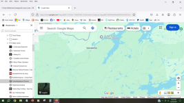
Added a pic for clarity. Orange line is rough hiking trail. Red circle is Glasby Pond. Red dashed line is rough Glasby Creek to where it joins the Oz. High Falls is about 3/4 mile SE of that junction.

I'm looking for a shorter loop. Google Maps makes it look doable... and I'm wondering if the creek will be higher and more passable in the Spring (Easter Weekend). But then Oz will be running high/strong too.
Thoughts?
Added a pic for clarity. Orange line is rough hiking trail. Red circle is Glasby Pond. Red dashed line is rough Glasby Creek to where it joins the Oz. High Falls is about 3/4 mile SE of that junction.
Attachments
Last edited: