-
Happy Birthday, Grandma Moses (1860-1961)! 🎨🖌️🖼️
You are using an out of date browser. It may not display this or other websites correctly.
You should upgrade or use an alternative browser.
You should upgrade or use an alternative browser.
The most picturesque places you've paddled
- Thread starter stevet
- Start date
Steve, when I read the topic, I thought it was about our most decorative canoe paddles rather than the most picturesque places we've paddled, so I altered the title.
I have paddled in many different types of picturesque places, but unfortunately most were so long ago that I don't have photos, especially all my trips into California's Sierra Nevada Mountains and its coastal mountains among the redwood trees. So, I'll select a different type of picturesque for which I have photos—Juniper Springs, Florida. (Mike Galt Lotus Caper canoe.)
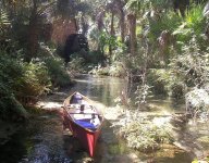
I have paddled in many different types of picturesque places, but unfortunately most were so long ago that I don't have photos, especially all my trips into California's Sierra Nevada Mountains and its coastal mountains among the redwood trees. So, I'll select a different type of picturesque for which I have photos—Juniper Springs, Florida. (Mike Galt Lotus Caper canoe.)

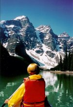
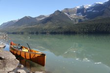
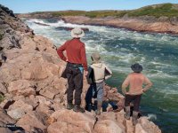
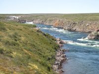
Picturesque, like beauty, I suppose, is in the eye of the beholder. It depends somewhat on what one seeks. Even so, everywhere I have paddled I consider picturesque. After all, I would never choose ugly as a paddling destination. That being said, based on the preferences of most people, the most classically beautiful place I have ever paddled is the South Nahanni River in the Northwest Territories.
South Nahanni River, Northwest Territories
Last edited:
Glenn, I would put Juniper Springs right near the top for beauty….along with a Lotus Caper
Trinity River, CA
Grande Rhonde River, Oregon
Green River, Utah
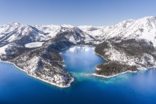
Lake Tahoe, NV
Klamath River, CA
Grande Rhonde River, Oregon
Green River, Utah
Lake Tahoe, NV
Klamath River, CA
- Joined
- Nov 19, 2013
- Messages
- 1,384
- Reaction score
- 390
In a canoe it's a split between the Boundary Waters and the Okefenokee National Wildlife Refuge. If you'll indulge my old kayaking habit, it would be off the coast of Maui, watching humpback whales breaching on a paddling outing off the coast.
That's all for now. Take care and until next time...be well.
snapper
That's all for now. Take care and until next time...be well.
snapper
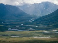
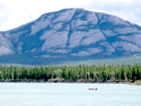
1.Turtle Mtn on the Yukon River at the entrance of Lake Laberge. The near shore landscape for the next 35 miles of lake paddling before becoming river again looks similar to this, and it just calls out as if to say “hike me”. We later did hike on some of it near Whitehorse.
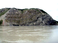
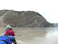
2. Calico Bluff on the Yukon River, 12 miles below Eagle, AK. If you have seen the tv show “Life Below Zero", then you have seen this metamorphic outcrop near where Andy Bassich lives.
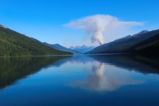
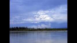
3. A pyrocumulonimbus cloud, while paddling on the Yukon River below Eagle AK caused by a forest fire beneath. Shortly after spotting this one, we could see as many as seven at the same time all around our horizon.
 .
.
2. Calico Bluff on the Yukon River, 12 miles below Eagle, AK. If you have seen the tv show “Life Below Zero", then you have seen this metamorphic outcrop near where Andy Bassich lives.
3. A pyrocumulonimbus cloud, while paddling on the Yukon River below Eagle AK caused by a forest fire beneath. Shortly after spotting this one, we could see as many as seven at the same time all around our horizon.


 .
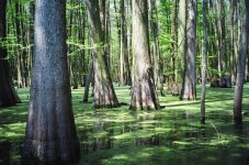
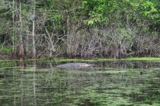
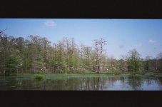
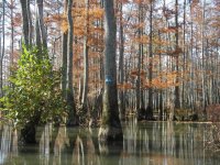
.Oh man, how about a few from the southeast.
Lake: Lake Jocassee, Fontana Lake
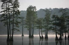
Low Country: Congaree National Park, Santee River Delta
Mountain Stream: Chattooga, Shavers Fork Cheat
Big Water: New River from Hinton to Hawk's Nest
Lake: Lake Jocassee, Fontana Lake
Low Country: Congaree National Park, Santee River Delta
Mountain Stream: Chattooga, Shavers Fork Cheat
Big Water: New River from Hinton to Hawk's Nest
- Joined
- Nov 22, 2021
- Messages
- 239
- Reaction score
- 121
I was very impressed with the Buffalo River and the whole area around it.
Not a fan of swamps. I know some people think they are beautiful, but I don't get it.
Boundary Waters has a subtle beauty. Not a knock your socks off awe inspiring beauty. It's more about the experience.
I'd have to put any of the three flat water canyonlands paddles (Stillwater, Labyrinth, Meander), equal to or above the Buffalo.
Of the three, I'd have to rate Stillwater highest.
I don't have a handy shot from Stillwater, but here is one from Labyrinth.

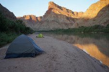
and Meander.
Not a fan of swamps. I know some people think they are beautiful, but I don't get it.
Boundary Waters has a subtle beauty. Not a knock your socks off awe inspiring beauty. It's more about the experience.
I'd have to put any of the three flat water canyonlands paddles (Stillwater, Labyrinth, Meander), equal to or above the Buffalo.
Of the three, I'd have to rate Stillwater highest.
I don't have a handy shot from Stillwater, but here is one from Labyrinth.


and Meander.
- Joined
- Mar 16, 2017
- Messages
- 229
- Reaction score
- 148
I go for the little creeks with narrow channels and absolute quiet except for the wildlife. A patch of water lillies against some reeds, maybe a Big old turtle on a log. Isabella Creek in the Quetico is one of my favorites.
Not a fan of swamps. I know some people think they are beautiful, but I don't get it.
I am one who is entranced by the beauty of big swamps, especially AmSouth swamps, and the ability to endlessly slalom among cypress, tupelo and hardwood trees, and the ever-imminent danger of getting totally lost within 100 yards of paddling.
Here are a few photos of my favorite swamp of all, Sparkleberry Swamp in South Carolina, which comprises about 16,000 acres of flooded forest plus the Congaree and Wateree Rivers.
The put-in at Sparkleberry Landing in Rimini:
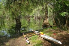
Winding through the trees, you eventually get into a "flat" (aka a sort of lake). You have to know which direction to go on the flat.
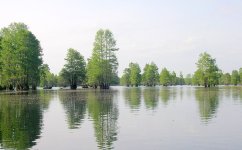
Crossing the flat, you come to the surrounding flooded forest. Where to go? Where are the water trails? Look for painted blazes on trees.
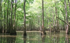
Sometimes you can see a water trail without any tree blazes:
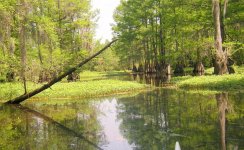
But most of the time the vegetative landscape keeps changing, often chaotically, and the real or faux water trails seem to open up in infinite possible directions:
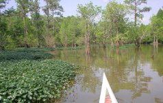
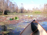
High enough ground to land a canoe is rare, unless you have experience and know where to go:
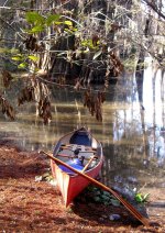
Many times there are no blazed trails, no obvious trails, and you are completely checkmated as to which direction to go. In those cases, you take a risk and be sure to leave bread crumbs on a mapping GPS, which is mandatory if you are alone and without a guide.
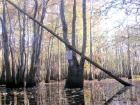
Yes, the beauty of some swamps is overwhelming, and the mental pleasure of never quite knowing which way to go is simultaneously spooky, titillating and exhilarating. (BTW, there is no bridge; the sign was taken from somewhere else and hung on the tree.)
This. So much. Even if you're not really lost....the mental pleasure of never quite knowing which way to go is simultaneously spooky, titillating and exhilarating.
Sorry, I don't have anything particular to share at the moment.
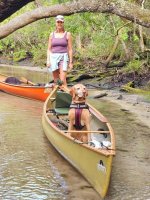
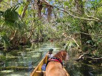
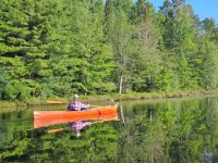
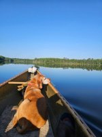
Exploring the springs near Crystal River Florida … ( 1st two ). Next two, Lake 5, Clam Lake Wisconsin
Rapidfire with a Greenland paddle. I've never seen that, but GPs are popular with kayakers so it makes sense for a pack canoe.
I can not keep up with her Glenn, that paddle and her canoe .., she is off and it is effortless!
Similar threads
- Replies
- 7
- Views
- 379
- Replies
- 4
- Views
- 755
- Replies
- 8
- Views
- 2K
- Replies
- 12
- Views
- 2K

