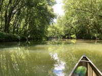
Two forks of Caesar’s Creek join and flow into the reservoir. With water still running high, I decided to see how far upstream I can get on the main fork without lifting/portaging over drops and low areas.
Caesar’s Creek is named after an escaped slave from Virginia. Caesar came into the Little Miami valley, ran a gauntlet, became a member of the Shawnee tribe around 1770. He married an Indian woman, started a farm along the stream that bears his name. His home was near the primary trail to the Ohio river and Kentucky frontier (sacred hunting grounds), not far from the principal Shawnee village of Chillicothe (near modern day Xenia, OH).
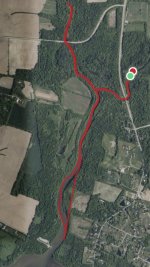
For my paddle, I launched 1/2 mile east of the confluence on Anderson’s Fork at the former New Burlington town site, which was razed/flooded when the reservoir was created. At the intersection, I turned north on the primary fork and proceeded another 1/2 mile or so until the canoe would not float over rocky drops. Turning back southward, I passed through the intersection and continued to the mouth of the stream opening into the reservoir. Backtracking, I turned back up the Anderson fork, returning to the landing at the old settlement.
Total loop was just over 4 miles. I paddled above the confluence on both forks with a single blade paddle, from the confluence to the lake and back I used a 260cm double blade canoe paddle.
My rate was about 12 minutes per mile faster using the double blade. I was paddling about 33 minutes per mile with the single blade with a steady, yet unhurried pace.
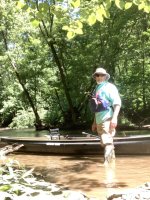
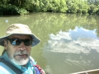
The NS Phoenix was a delight to paddle. I enjoy going dogless with a nimble boat on small steams. Weather was just gorgeous with temperatures in the 60s, minimal wind.


I managed to pause my GPS app for a spell on the south end of the loop. I did not portage across the land as shown.

Caesar’s Creek is named after an escaped slave from Virginia. Caesar came into the Little Miami valley, ran a gauntlet, became a member of the Shawnee tribe around 1770. He married an Indian woman, started a farm along the stream that bears his name. His home was near the primary trail to the Ohio river and Kentucky frontier (sacred hunting grounds), not far from the principal Shawnee village of Chillicothe (near modern day Xenia, OH).
For my paddle, I launched 1/2 mile east of the confluence on Anderson’s Fork at the former New Burlington town site, which was razed/flooded when the reservoir was created. At the intersection, I turned north on the primary fork and proceeded another 1/2 mile or so until the canoe would not float over rocky drops. Turning back southward, I passed through the intersection and continued to the mouth of the stream opening into the reservoir. Backtracking, I turned back up the Anderson fork, returning to the landing at the old settlement.
Total loop was just over 4 miles. I paddled above the confluence on both forks with a single blade paddle, from the confluence to the lake and back I used a 260cm double blade canoe paddle.
My rate was about 12 minutes per mile faster using the double blade. I was paddling about 33 minutes per mile with the single blade with a steady, yet unhurried pace.
The NS Phoenix was a delight to paddle. I enjoy going dogless with a nimble boat on small steams. Weather was just gorgeous with temperatures in the 60s, minimal wind.


I managed to pause my GPS app for a spell on the south end of the loop. I did not portage across the land as shown.


