• Happy Apple Cider Day! 🍎🍵

Leaving in the wee hours tomorrow morning...

Joined
Oct 29, 2019
Messages
648
Reaction score
1,124
Location
southeast PA
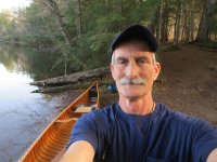
I have finally managed to sandwich my first visit to the St. Regis Canoe Area tomorrow between work and family obligations! My 15’ wood canvas canoe and I are heading to Long Pond to begin a two night tour through to St. Regis Pond and Little Clear Pond. Once finished it’s over to Vermont to finish a cabinet & interior trim job for my son; no rest for the wicked!

Pictures to follow.
 
Taught FS classes up there for 10 summers and LOVED the area. It defines “canoe country”. Enjoy!
 
You definitely hit a sweet spot in the weather. I live south of where you'll be but our forecast is for temperatures in the 70s during the day and upper 40s overnight with no rain until Wednesday. Have a great trip and enjoy having the place to yourself.

That's all for now. Take care and until next time...be well.

snapper
 
Have a great trip Patrick. Can not wait to see picks, I love your canoe - looking forward to your trip report, enjoy the unusually warm weather.

Bob
 
So, sandwiched between work constraints and my grandson's heart surgery, I managed to get out to the St. Regis Canoe Area for my first canoe trip there. Before I go any farther, YES, my grandson is doing well. He had major heart surgery (he's only 14 months old!) for a congenital heart defect. The surgical team at Boston Children's Hospital closed a hole in his ventricular septum, switched his pulmonary artery & aorta to their correct chambers, and subsequently re-connected his coronary arteries... on Friday the 13th no less! Whew. He may be coming home by this Saturday if his recovery continues to go well.

PART ONE: Long Pond to Bessie Pond

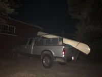
Having loaded my canoe and gear in my truck the evening before, I arose early and left home here in southeast Pennsylvania at 4:30 AM, hoping to arrive in the canoe area early enough to both transit Long Pond and carry to my intended campsite on Bessie Pond.
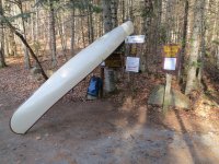
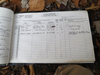
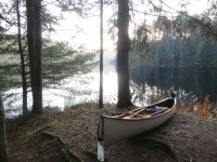
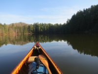
Iim9rPxkTGeYP+MBxOzMFw.jpg IMG_9911.JPG I am a firm believer in signing in to a trailhead, and of course signing out, so the local rangers can monitor use of the area. I managed to get organized and carry my lovely wood/canvas canoe and minimal gear (70 liter Sealline dry pack) the 1/4 mile carry to the launch point on Long Pond by 2:00PM. Long Pond and it's surroundings were lovely, and I saw only one party already camped on a pleasant site on the north shore of the lower pond, and one lone kayaker in the distance apparently making for the carry to the St. Regis Outfitters outpost location. For the rest of the trip I had the area to myself! Not another soul in sight.
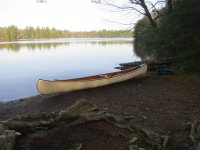
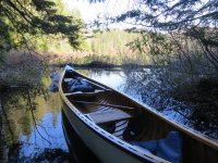
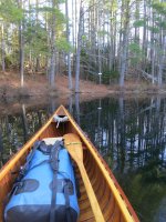
IMG_9913.JPG IMG_9915.JPG IMG_9917.JPG It seems that by dumb luck, I chose the most benign weather as well as having the area to myself. I ditched most of the cold weather clothing; keeping only my long johns for sleeping. After a most pleasant paddle the length of Long Pond, I arrived at the carry to Bessie & Nellie Ponds. Truthfully, I probably missed some of the joy of paddling Long Pond, as I was anxious to make it to the carry and get settled into the campsite at Bessie Pond. In retrospect I would make sure to have more time to enjoy the area and not hurry so much. This would become a theme for me as I only had two days open for this first taste of ADK paddling.

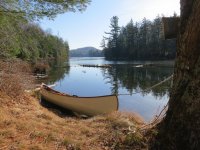
IMG_9925.JPG The landing for the carry to Nellie & Bessie Ponds.

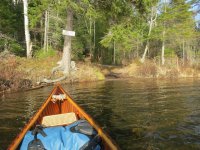
Afternoon temperatures were quite pleasant and the forest without it's deciduous leaf cover was open and inviting. With the time element weighing on my mind, I opted to single carry canoe & gear for the 1.6 mile carry- in spite of 8 hrs in my truck this day, I was feeling fresh. Also, I didn't want to have to double carry with triple the length of walking! I figured I could suck it up and suffer. In the end, it wasn't really bad... I probably rested twice and there was the diversion of having to cross the beaver pond early in the carry... IMG_9929.JPG Observant readers may notice the skim of ice on the beaver pond. Apparently the sun doesn't reach this little spot, and while the air temperature was pleasant, the little bit of ice remained as well as some bits of early snow in the shadows. I didn't know it then, but this little beaver pond (the dam is just to the left of the canoe in this picture) was barely 1/5 of the way along the carry. I had "hoped" that I might be halfway, but sadly no... there was a lot more to go!

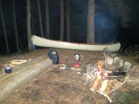
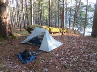
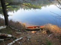
After a pretty tiring and muddy/wet carry I finally arrived at the junction in the carry trail where the trail to the Bessie Pond campsite branches right, and through the pine forest I could see both little Bessie Pond and the campfire ring on a promontory above the pond. I can't honestly say it was the nicest site, but it was nonetheless welcome. I fairly skipped the final 50 yards down to the site and began preparing for the night. I processed some firewood, filtered some water, located a tent site uphill from the fire ring, and proceeded to make some dinner before the light faded. I had purchased a 180 Stove, a so-called "stick stove", but as it was getting dark quickly I opted not to try it out. Maybe I'll do a stove review as a separate post once I've had a chance to test it under real conditions. IMG_9946.JPG IMG_9948.JPG IMG_9957.JPG This last picture of my tent was actually taken the following morning. It was my first time using this tent. It's a Dan Durston X-mid 1person. Meant for ultralight hikers, it is normally pitched using adjustable trekking poles in place of dedicated poles. Prior to leaving I had made poles for the tent using some old fiberglass segmented poles which I cut down into (4) short sections resulting in the 45" height required. The tent was great! Packed size is about the size of an football, and ridiculously light. It's basically a shaped tarp with a mosquito net/floor inner tent hung from the two high points and connected to the four corners as well. The 'tarp' leaves truly generous areas for storing gear out of the weather, and the inner tent has entry zippers on both sides. I slept well under a 20 degree down quilt on a Thermarest XTherm mattress & NEMO Fillo pillow. I resolved years ago to get a truly comfortable pillow which I feel is essential to a good nights sleep, and the Fillo fits the bill.

Part Two to follow...
 
Patrick,

your pictures are terrific. Great story so far ... 1.6 mile single carry ... you got some real grit buddy, good on ya. I look forward to reading part 2. I really like your canoe, it is good to read stories about people who still trip with wood canvas canoes, makes me feel good reading about trips like this.

Bob. :cool:
 
Hard to beat great weather and few people in the SRCA. Looking forward to part 2.
 
Great pics, and thanks for the DD xmid 1 review. I have one, but haven't done anything more than pitch it in the backyard yet so its nice to get a real world review.
 
Part Two: Bessie Pond to Fish Pond:

Sunday morning, day two dawned clear and pleasant save for a bit of mist over Bessie Pond. I'm not a religious person, but this is my cathedral!

A simple breakfast of instant oatmeal and coffee (i cheated and used Alpine Start instant coffee- not bad at all though I'm no coffee connoisseur) was followed by some cleanup and I organized the remaining firewood for the next resident. I packed my gear and by 8:30 had hoisted canoe and pack for the short carry to Nellie Pond. Click image for larger version  Name:	IMG_9955.JPG Views:	0 Size:	348.5 KB ID:	119219 Morning mist on Nellie Pond.

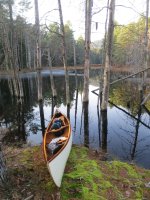
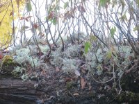
Click image for larger version  Name:	IMG_9962.JPG Views:	0 Size:	664.7 KB ID:	119220 Nellie Pond landing. Guarded by an old sunken log, there is a virtual garden of flora growing on top of the log- must have been here for many years! Click image for larger version  Name:	IMG_9964.JPG Views:	0 Size:	519.0 KB ID:	119221 Polytrichum moss, Reindeer moss (Cladonia Rangiferina), and a woody shrub I don't know.

Nellie Pond, and Kit Fox Pond beyond it are tiny. I was across both ponds and carries in minutes each, and though they are short, the paddling is quite enjoyable. The mirror like surface was a joy to glide across and made up for the brevity of the time in the canoe. I would come to realize that in the SRCA, one benefits from having well organized gear and a portage routine since they come quickly one after the other!

Click image for larger version  Name:	IMG_9970.JPG Views:	0 Size:	239.6 KB ID:	119222 Kit Fox Pond
Click image for larger version  Name:	IMG_9987.JPG Views:	0 Size:	584.7 KB ID:	119223 The landing, and steep uphill to the esker seperating Nellie Pond from Kit Fox Pond.

Carrying from Kit Fox Pond, one reaches a junction allowing either a direct carry to Fish Pond, or as I did, a carry to Little Long Pond. I found Little Long Pond to be sublime. The water continued to be like glass, and paddling into the warm morning sun was most pleasant. I decided to explore the entire pond paddling on to further explore Lydia Pond, lying at the northwest corner of Little Long Pond. Click image for larger version  Name:	IMG_9997.JPG Views:	0 Size:	558.6 KB ID:	119224 The landing for the carry to Lydia Pond. In this picture we're looking southeast, back into Little Long Pond. The carry to Fish Pond, the next objective, is at the far end of the lake- around the point on the left shore. With the unknown of how long my day might be I chose to simply hike the carry over to Lydia Pond, which was very short and easy. There is only one campsite on Lydia, and a somewhat small one at that though it sported a complete outhouse and a fire pit assembled with local stone, carried-in brick, and mortar. Someone went to a lot of effort to upgrade this site. Lydia Pond is designated as a "Special Trout water, with bait fish of any kind prohibited". It must be a cherished fishing spot for some!

Paddling back across Little Long Pond I quickly arrived at the carry to Fish Pond. It is a steep landing and an immediate ascent up and over an esker to Fish Pond.
Click image for larger version  Name:	IMG_0002.JPG Views:	0 Size:	506.1 KB ID:	119225 Looking down at the Fish Pond carry landing on Little Long Pond after having carried my pack across. In spite of single carrying on the long Bessie Pond carry, I chose to double carry or leap-frog the subsequent carries. After all, this is supposed to be fun, right?
Click image for larger version  Name:	IMG_0003.JPG Views:	0 Size:	292.6 KB ID:	119226 Fish Pond cliffs.

Fish Pond quickly made itself apparent once I left the small bay into which I launched. The water remained calm, the sun was out, the terrain was varied with cliffs to the northwest, a pleasant point of land on my left before the main pond opened up, and.... it was all mine! This was what I had come for. The next time, I'll plan to camp on this pond and more fully enjoy the surroundings. I just loved it. There are apparently two leanto sites on Fish Pond, and although I couldn't find them from the water these would be pleasant camp sites. For those unfamiliar with Adirondack shelters (leantos), they are the essential Adirondack camp experience. I couldn't help thinking that these ponds frozen in winter along with the carry trails would make for excellent backcountry skiing. Maybe this winter?

Next installment: Mud Pond, Ochre Pond, St. Regis Pond, Little Clear Pond and out.
 
Last edited:
Really nice pics, you sure got lucky with the weather! Too bad you didn't have time to scramble up the Fish Pond cliffs, they're pretty cool.
MDB and I spent a weekend at Fish Pond for our 1st anniversary...I try to get back every decade or so.
Looking forward to the next installment.
 
Part 3; Mud Pond to Little Clear Pond:

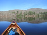
After a pleasant paddle on Fish Pond I arrived at the landing for the carry to Mud Pond.
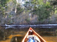
Click image for larger version  Name:	IMG_0005.JPG Views:	0 Size:	692.1 KB ID:	119326

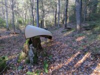
I anticipated that the next carry to Mud Pond, and the pond itself might be nasty... just the name Mud Pond suggested that it might be muddy colored- or shallow- or just generally not nice! The carry itself was pretty difficult, at least the first 1/3. From the relatively benign landing it was a pretty steep uphill to the top of the esker and at the high point I was happy to put the canoe down and go back for my pack. I found that leapfrogging the longer, or more arduous, portages was best for me. Here, I'm having a short rest at the high point of the carry enjoying the pleasant day, air temps, and my open surroundings.
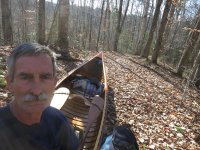
Click image for larger version  Name:	IMG_0019.JPG Views:	0 Size:	682.6 KB ID:	119327

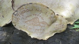
Along the way I noticed a shelf fungus, or bracket fungus (Ganoderma Applanatum- also known as Artists Conk, I think. http://mushroom-collecting.com/mushroomartist.html)
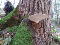
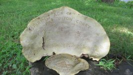
Click image for larger version  Name:	IMG_0016.JPG Views:	0 Size:	584.5 KB ID:	119328 This specimen was particularly nice though they are usually more moist on the underside in Spring. As a boy, my Scoutmaster decorated a large shelf fungus I had collected on the trail to Mts. Street and Nye in the Adirondack High Peaks. Sharpening a small stick to a point, he decorated and wrote on the delicate white underside and once dried - I had to very carefully pack the fungus out attached to the outside of my pack- it has remained clear for more than 50 years! Since those days, I've realized that the taking of natural items like this is discouraged. If everybody did it, there would be nothing left for others to enjoy. I suppose that removing a sample from private land or truly wild settings may be more appropriate, but frankly I treasure the memento of an earlier time. Here are a couple from those days. Click image for larger version  Name:	ADK shelf fungus.JPG Views:	0 Size:	345.7 KB ID:	119330
Moving along, my arrival at Mud Pond was a revelation. While not a large pond, it was nonetheless very pretty and though it took only minutes to transit I enjoyed myself thoroughly. It's an intimate setting, and the only drawback was the anticipation of having to yet again hoist my gear and carry to Ochre Pond, another tiny pond along the way. Unfortunately, I was about to perform a clownish maneuver at the next landing! Having successfully managed all the previous lifts of my canoe, this time I decided to try a different arrangement of my paddles. I had been lashing my paddles with the blades forward and the grips lashed to the deeply sculpted yoke. This had served me well as I like being able to grip the shafts with my hands during the carry rather than holding onto the canoe gunwales. Nearly 50 years in residential construction, carrying ladders and scaffolding on my shoulders, has apparently damaged my shoulders. I can't have my arms/hands above my shoulders for a long period anymore, so holding the paddle shafts in this manner allows me to keep my hands low and my elbows down and close to my chest- it's more comfortable for me. This time I decided to try lashing the blades to the yoke thinking that the broad flat surface would feel better on my shoulders. This is the way I always carried in the old days when I used the 'horse collar' type of PFD. It worked well then. This time not so much. This time I opted to also try lifting one end of the canoe, then walking my down to the yoke. Well, at the critical moment of balance one of the paddles shifted and came loose from the lashing and I forcefully pulled the edge of the blade right into the side of my forehead!
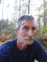
Click image for larger version  Name:	IMG_0028.JPG Views:	0 Size:	362.0 KB ID:	119331 Felt like a golf ball on the side of my head!! One of the downsides to solo tripping is that you can't share the glories (or miseries) of the trip with others, so you folks will have to be my virtual companions to enjoy this idiot move!


The landing at Ochre Pond was lovely. I was glad it was relatively dry though, as I bet in wet conditions the old walkway I found might be tough. The carry from Mud Pond had been delightful walking along the esker ridge most of the way. There was one stream crossing draining from a couple of smaller ponds/bogs which might be tougher in Spring or wetter conditions. Along the way while leapfrogging canoe and gear, I took advantage of natural rests when possible. Click image for larger version  Name:	IMG_0037.JPG Views:	0 Size:	801.6 KB ID:	119332
After the all-to-brief paddle across Ochre Pond, I arrived at the landing for the carry to St. Regis Pond.
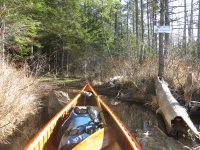
Click image for larger version  Name:	IMG_0033.JPG Views:	0 Size:	827.9 KB ID:	119333
I had been anxiously anticipating my arrival at St. Regis Pond, as it's apparently the largest pond in the canoe area.

Click image for larger version  Name:	JHjdrUNpS66zkjIUahwVgA.jpg Views:	0 Size:	457.7 KB ID:	119334 At the end of the carry from Ochre Pond, looking roughly ESE (110 degrees) at what I think is the Sentinel range in the middle distance.

I was looking forward to paddling a larger lake, and it was truly beautiful. There are lots of bays, points, and islands to explore, but that would be for another time. It was getting late in the day, and I anticipated sunset at about 4:30/5:00 pm and I had St. Regis Pond, the carry to Little Clear Pond, and Little Clear itself to travel to complete my brief trip, so I got busy paddling. Having paddled roughly to the middle of the pond, I spied the point which separates the access to Green Pond from the entry to the inlet leading to the carry to Little Clear Pond. Arriving at the inlet one paddles past a significant beaver lodge, in front of which floated a massive pile of freshly cut sticks. This puzzled me a bit until I decided that it was a supply of winter food for the beavers to access once the pond froze and snow piled up. I'm guessing most of the vegetation is suspended below waterline and therefore accessible to the beavers from their underwater lodge entrance. I was greeted by three beavers swimming deeper into the marsh and they were 'chuckling' at me and looking back at me as if to say, "hey, you dumb human, don't you know the tripping season is over? What are you doing here?"

The landing for the carry to Little Clear was the most sophisticated yet, and one which I had seen pictures of but didn't really appreciate until my arrival. It's quite convenient, though it kind of spoils any notion of 'wilderness'. I guess that lots of people enter the Canoe Area from Little Clear Pond which affords access to the largest pond and many campsites with only one relatively benign portage.
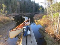
Click image for larger version  Name:	IMG_0058.JPG Views:	0 Size:	622.1 KB ID:	119335

Finally arriving at Little Clear Pond I picked up the pace, as the sun was nearly at the horizon and I had a long way to go. Not only the final bit of paddling, but I then had to look forward to the 8.5 mile hike back to my truck parked at the Long Pond access on Floodwood Rd.
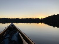
Click image for larger version  Name:	8wbai1uxRNOyY+4K+UxxLA.jpg Views:	0 Size:	141.9 KB ID:	119336

Aside from my haste, Little Clear was also lovely and i saw no fewer than 10 Osprey circling the pond presumably looking for dinner. The state of New York maintains a land-locked salmon hatchery in the lake and both fishing and shoreside camping is prohibited. Again, more time in the future should be devoted to exploration.

I landed at the Fish Hatchery access and quickly set my canoe and gear aside at the landing, switched to dry socks and sneakers, and commenced my hike to Floodwood Rd. I fast walked as much as I could, and after 2.5 hours gladly spied my truck where I left it. I hoped it would start (no reason it wouldn't, but its what I thought about the whole way on my dark walk!). I signed out of the Long Pond entry register, and quickly drove back to the Fish Hatchery lot hoping no one had disturbed my canoe and gear- it was untouched and I quickly loaded up and started my drive to my son's house in Vermont... another 2.5 hrs until I could finally put my head down and sleep!

Final thoughts, in no order of importance:

Next time I'll bring an old bicycle to drop off at my ending point if the trip isn't a loop! The long walk in the dark at the end of a long day was not fun and a bike ride would have been faster and more enjoyable!

Spend more time. Granted, this was all the time I had, but allowing more time for exploration would have been great. Next time I'll include hikes to Long Pond Mountain & St. Regis Mountain.

Going solo? This was my first solo canoe trip, and I missed being able to share both the wonderful parts as well as the comical/painful whack in the head!

And last... do this more often!!
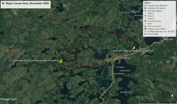
Click image for larger version  Name:	St. Regis Canoe Area map, November 7:8, 2020.jpg Views:	0 Size:	312.3 KB ID:	119337

Thank you all for following and commenting on my trip report. Let's hope there are more to come when the weather permits.

Pat
 

Attachments

  • Adirondacks shelf fungus.JPG
    Adirondacks shelf fungus.JPG
    297.8 KB · Views: 0
Last edited:
Boy howdy that is a great report ... and excellent pictures too. That was a series egg on your noggin you got there, glad it was not serious. That last port sounds pretty rigorous, you have grit buddy. We are getting wet sloppy snow tomorrow - followed by rain - yuk! When making my deliveries in that crappy weather I will be thinking of those awesome sunny pics you posted.

Nice write up.

Bob.
 
Patrick, great stuff thanks for posting, almost like being there!
When you go back Long Pond Mt is a must, although I liked better before it was a marked and maintained trail. St Regis Mt can be bushwhacked directly from St Regis Pond avoiding the circuitous paddle to get to the trailhead.
And you may want to include a visit to Ledge Pond, it’s rarely visited and a gem.
As far as the goose egg, at least you didn’t split it open, blows to the head often result in a black eye, which could be a cool temporary tattoo!
once again, great trip report and pics.
 
Back
Top